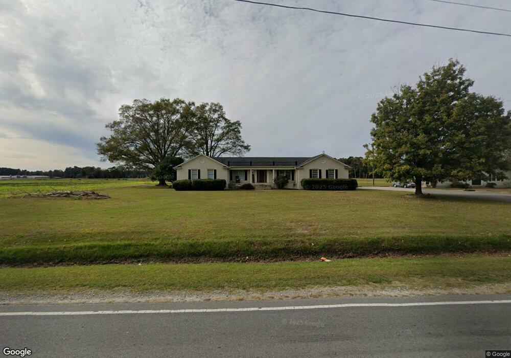
4556 Garland Hwy Clinton, NC 28328
Estimated Value: $253,000 - $389,000
3
Beds
3
Baths
3,144
Sq Ft
$104/Sq Ft
Est. Value
About This Home
This home is located at 4556 Garland Hwy, Clinton, NC 28328 and is currently estimated at $328,535, approximately $104 per square foot. 4556 Garland Hwy is a home located in Sampson County with nearby schools including Union Elementary School, Union Intermediate School, and Union Middle School.
Ownership History
Date
Name
Owned For
Owner Type
Purchase Details
Closed on
Sep 13, 2010
Sold by
Us Bank Na
Bought by
Sloan Leon
Current Estimated Value
Home Financials for this Owner
Home Financials are based on the most recent Mortgage that was taken out on this home.
Original Mortgage
$117,893
Interest Rate
4.87%
Mortgage Type
FHA
Purchase Details
Closed on
May 13, 2010
Sold by
Stewart Mary Louise
Bought by
Pettit William Walt
Create a Home Valuation Report for This Property
The Home Valuation Report is an in-depth analysis detailing your home's value as well as a comparison with similar homes in the area
Home Values in the Area
Average Home Value in this Area
Purchase History
| Date | Buyer | Sale Price | Title Company |
|---|---|---|---|
| Sloan Leon | $97,000 | None Available | |
| Pettit William Walt | $126,185 | -- |
Source: Public Records
Mortgage History
| Date | Status | Borrower | Loan Amount |
|---|---|---|---|
| Previous Owner | Sloan Leon | $117,893 |
Source: Public Records
Tax History Compared to Growth
Tax History
| Year | Tax Paid | Tax Assessment Tax Assessment Total Assessment is a certain percentage of the fair market value that is determined by local assessors to be the total taxable value of land and additions on the property. | Land | Improvement |
|---|---|---|---|---|
| 2025 | $1,953 | $248,784 | $19,375 | $229,409 |
| 2024 | $1,754 | $248,784 | $19,375 | $229,409 |
| 2023 | $1,449 | $156,647 | $16,848 | $139,799 |
| 2022 | $1,449 | $156,647 | $16,848 | $139,799 |
| 2021 | $1,449 | $156,647 | $16,848 | $139,799 |
| 2020 | $1,449 | $156,647 | $16,848 | $139,799 |
| 2019 | $1,449 | $156,647 | $0 | $0 |
| 2018 | $1,350 | $145,954 | $0 | $0 |
| 2017 | $1,350 | $145,954 | $0 | $0 |
| 2016 | $1,357 | $145,954 | $0 | $0 |
| 2015 | $1,357 | $145,954 | $0 | $0 |
| 2014 | $1,350 | $145,954 | $0 | $0 |
Source: Public Records
Map
Nearby Homes
- 471 John Mark Rd
- 0 Boykin Bridge Rd
- 1 Boykin Bridge Rd
- 000 Sandy Ln
- 335 Sprunt Dr
- 90 Alexander Ln
- 113 Jefferson St Unit A
- 111 Colonial Dr
- 865 Cecil Odie Rd
- 500 Rowan Rd
- 1181 Reedsford Rd
- 124 Kimberly Dr
- 1116 Phillips St
- 107 Miami St
- 382 Pig Cradle Ln
- 0 Hillside Ln
- 300 Devane St
- 101 Oakland Blvd
- 405 Sunset Ave
- 2153 Rowan Rd
- 4401 Garland Hwy
- 47 Moseley Ave
- 83 Moseley Ave
- 4725 Garland Hwy
- 4667 Garland Hwy
- 4376 Garland Hwy
- 4759 Garland Hwy
- 171 Moseley Ave
- 264 Moseley Ave
- 4799 Garland Hwy
- 4870 Garland Hwy
- 4900 Garland Hwy
- 404 Moseley Ave
- 4963 Garland Hwy
- 4974 Garland Hwy
- 205 Moseley Ave
- 4164 Garland Hwy
- 4164 Garland Hwy
- 5004 Garland Hwy
- 5005 Garland Hwy