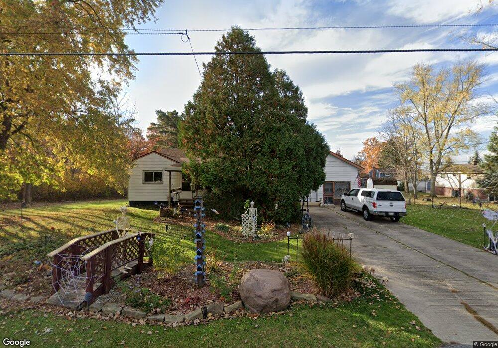
4556 Harding St Brunswick, OH 44212
Estimated Value: $188,000 - $221,000
3
Beds
6
Baths
1,188
Sq Ft
$174/Sq Ft
Est. Value
About This Home
This home is located at 4556 Harding St, Brunswick, OH 44212 and is currently estimated at $206,866, approximately $174 per square foot. 4556 Harding St is a home located in Medina County with nearby schools including Huntington Elementary School, Willets Middle School, and Brunswick High School.
Ownership History
Date
Name
Owned For
Owner Type
Purchase Details
Closed on
Jul 29, 1999
Sold by
Myers Oscar E and Myers Evelyn A
Bought by
Feeney Joseph E and Tompkins Kimberly J
Current Estimated Value
Home Financials for this Owner
Home Financials are based on the most recent Mortgage that was taken out on this home.
Original Mortgage
$76,000
Interest Rate
7.69%
Create a Home Valuation Report for This Property
The Home Valuation Report is an in-depth analysis detailing your home's value as well as a comparison with similar homes in the area
Home Values in the Area
Average Home Value in this Area
Purchase History
| Date | Buyer | Sale Price | Title Company |
|---|---|---|---|
| Feeney Joseph E | $95,000 | Transcounty Title Agency Inc |
Source: Public Records
Mortgage History
| Date | Status | Borrower | Loan Amount |
|---|---|---|---|
| Closed | Feeney Joseph E | $76,000 |
Source: Public Records
Tax History Compared to Growth
Tax History
| Year | Tax Paid | Tax Assessment Tax Assessment Total Assessment is a certain percentage of the fair market value that is determined by local assessors to be the total taxable value of land and additions on the property. | Land | Improvement |
|---|---|---|---|---|
| 2024 | $2,216 | $44,800 | $19,400 | $25,400 |
| 2023 | $2,216 | $44,800 | $19,400 | $25,400 |
| 2022 | $2,096 | $44,800 | $19,400 | $25,400 |
| 2021 | $1,903 | $36,470 | $15,400 | $21,070 |
| 2020 | $1,713 | $36,470 | $15,400 | $21,070 |
| 2019 | $1,713 | $36,470 | $15,400 | $21,070 |
| 2018 | $1,603 | $32,370 | $12,490 | $19,880 |
| 2017 | $1,605 | $32,370 | $12,490 | $19,880 |
| 2016 | $1,603 | $32,370 | $12,490 | $19,880 |
| 2015 | $1,535 | $29,980 | $11,570 | $18,410 |
| 2014 | $1,530 | $29,980 | $11,570 | $18,410 |
| 2013 | $1,496 | $29,980 | $11,570 | $18,410 |
Source: Public Records
Map
Nearby Homes
- 1536 Jefferson Ave
- 1431 Roosevelt Ave
- 1389 Mussel Shoals Dr
- 4408 Center Rd
- 1591 Pearl Rd
- 4464 Newcastle Cove
- 0 Pearl Rd Unit 4173749
- V/L Pearl Rd
- 1200 Mulberry Ln
- 4385 Inner Circle Dr Unit B-18
- 4383 Inner Circle Dr Unit C24
- VL Laurel & Substation Rd
- 4349 Inner Circle Dr Unit A-5
- 1821 Stone Manor Cir
- 0 Center Rd Unit 4467135
- 4224 Maiden Ct
- 1202 Substation Rd
- 1139 Glencove Commons
- 1044-1070 Pearl Rd
- 4200 Raymond Dr
- 1545 Mckinley Ave
- 1555 Mckinley Ave
- 4544 Harding St
- 1524 Garfield Ave
- 1525 Mckinley Ave
- 4536 Harding St
- 1565 Mckinley Ave
- 1542 Mckinley Ave Unit 1544
- 1542 Mc Kinley Ave
- 1513 Mckinley Ave
- 1510 Garfield Ave
- 4528 Harding St
- 1526 Mckinley Ave
- 1511 Garfield Ave
- 1575 Mckinley Ave
- 1522 Roosevelt Ave
- 1564 Mckinley Ave
- 1505 Mckinley Ave
- 1510 Roosevelt Ave
- 1510 Mckinley Ave