Estimated Value: $236,000 - $379,000
3
Beds
1
Bath
2,000
Sq Ft
$152/Sq Ft
Est. Value
About This Home
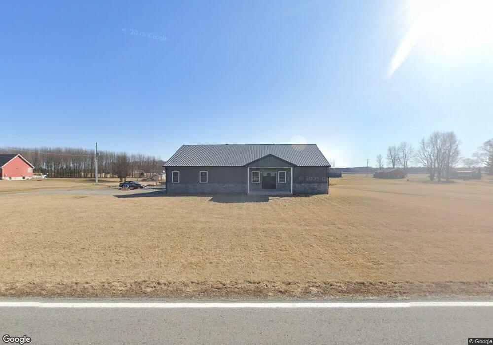
This home is located at 4556 State Route 701, Ada, OH 45810 and is currently estimated at $303,937, approximately $151 per square foot. 4556 State Route 701 is a home with nearby schools including Upper Scioto Valley Elementary School, Upper Scioto Valley Middle School, and Upper Scioto Valley High School.
Ownership History
Date
Name
Owned For
Owner Type
Purchase Details
Closed on
Dec 27, 2024
Sold by
Castle Amber Christine
Bought by
Castle Cory Lee
Current Estimated Value
Purchase Details
Closed on
Aug 10, 2017
Sold by
Castle Roger and Castle Donna
Bought by
Castle Cory Lee and Castle Amber Christine
Create a Home Valuation Report for This Property
The Home Valuation Report is an in-depth analysis detailing your home's value as well as a comparison with similar homes in the area
Home Values in the Area
Average Home Value in this Area
Purchase History
| Date | Buyer | Sale Price | Title Company |
|---|---|---|---|
| Castle Cory Lee | -- | None Listed On Document | |
| Castle Cory Lee | -- | None Available |
Source: Public Records
Tax History Compared to Growth
Tax History
| Year | Tax Paid | Tax Assessment Tax Assessment Total Assessment is a certain percentage of the fair market value that is determined by local assessors to be the total taxable value of land and additions on the property. | Land | Improvement |
|---|---|---|---|---|
| 2024 | $2,896 | $83,590 | $5,990 | $77,600 |
| 2023 | $2,896 | $83,590 | $5,990 | $77,600 |
| 2022 | $44 | $980 | $980 | $0 |
| 2021 | $48 | $980 | $980 | $0 |
| 2020 | $47 | $980 | $980 | $0 |
| 2019 | $44 | $980 | $980 | $0 |
| 2018 | $372 | $9,430 | $3,990 | $5,440 |
| 2017 | $230 | $9,430 | $3,990 | $5,440 |
| 2016 | $78 | $1,490 | $980 | $510 |
| 2015 | $51 | $1,490 | $980 | $510 |
| 2014 | $33 | $1,490 | $980 | $510 |
| 2013 | $35 | $1,490 | $980 | $510 |
Source: Public Records
Map
Nearby Homes
- 3931 County Road 80
- 2864 Ohio 309
- 710 S Main St
- 314 E University Ave
- 501 Elm St
- 900 N Front St
- 308-310 S Simon St
- 301 S Main St
- 212 N Simon St
- 203 Belmont St
- 211 S Main St
- 211 W Buckeye Ave Unit 211 1/2
- 210 N Gilbert St
- 4071 Township Road 35
- 442 Edwards St
- 444 Edwards St Unit A, B
- 444 Edwards St Unit 2
- 128 W North Ave
- 629 N Main St
- 6782 County Road 15
- 4604 State Route 701
- 4497 State Route 309
- 4437 State Route 309
- 4654 Ohio 701
- 4654 State Route 701
- 4654 Sr
- 4654 State Route
- 4559 State Route 309
- 4597 State Route 701
- 4494 State Route 309
- 0 Ohio 701
- 4646 State Route 309
- 4546 State Route 309
- 4750 Sr
- 4544 State Route 309
- 4736 State Route 309
- 4750 State Route 309
- 4218 State Route 309
- 4191 State Route 309