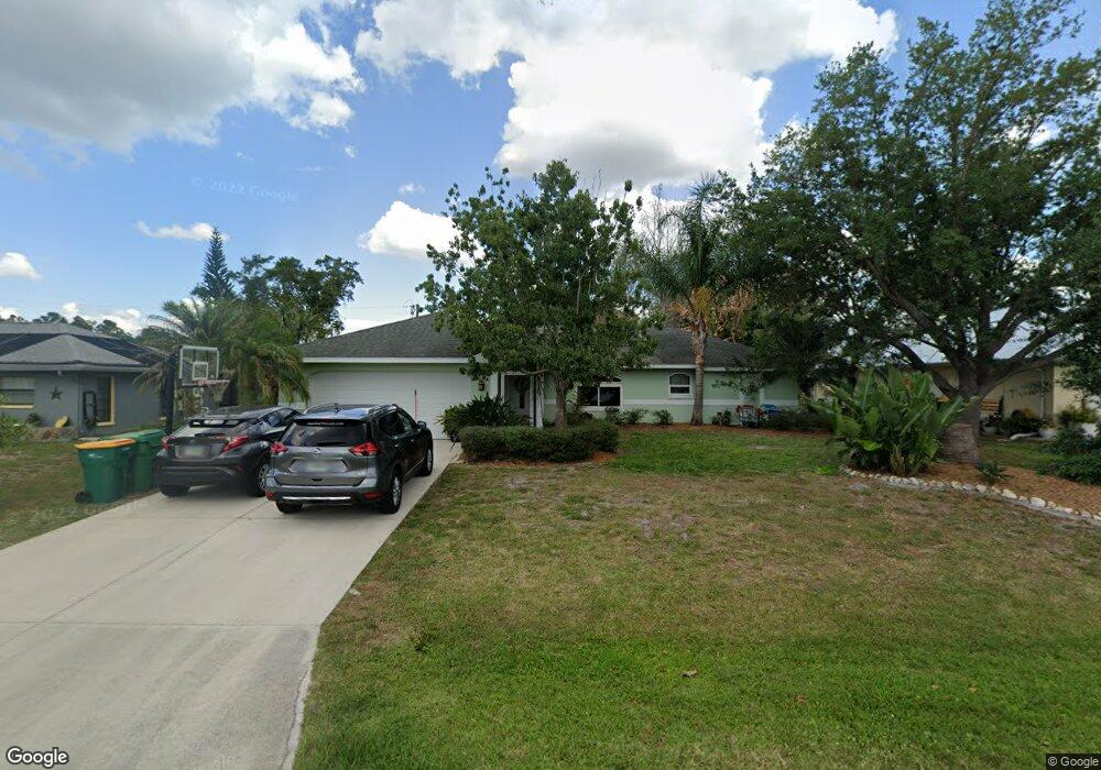
456 Delaney St Port Charlotte, FL 33954
Estimated Value: $269,246 - $322,000
3
Beds
2
Baths
1,449
Sq Ft
$207/Sq Ft
Est. Value
About This Home
This home is located at 456 Delaney St, Port Charlotte, FL 33954 and is currently estimated at $300,062, approximately $207 per square foot. 456 Delaney St is a home located in Charlotte County with nearby schools including Kingsway Elementary School, Port Charlotte Middle School, and Port Charlotte High School.
Ownership History
Date
Name
Owned For
Owner Type
Purchase Details
Closed on
May 18, 2001
Sold by
Barone Paul A and Barone Gina M
Bought by
Moore Kimberly K and Moore Keith L
Current Estimated Value
Home Financials for this Owner
Home Financials are based on the most recent Mortgage that was taken out on this home.
Original Mortgage
$91,800
Outstanding Balance
$34,151
Interest Rate
6.98%
Estimated Equity
$265,911
Purchase Details
Closed on
Jan 11, 1995
Sold by
Nopper Carl and Nopper Betty
Bought by
Barone Paul A and Barone Gina M
Create a Home Valuation Report for This Property
The Home Valuation Report is an in-depth analysis detailing your home's value as well as a comparison with similar homes in the area
Home Values in the Area
Average Home Value in this Area
Purchase History
| Date | Buyer | Sale Price | Title Company |
|---|---|---|---|
| Moore Kimberly K | $108,000 | -- | |
| Barone Paul A | -- | -- |
Source: Public Records
Mortgage History
| Date | Status | Borrower | Loan Amount |
|---|---|---|---|
| Open | Moore Kimberly K | $91,800 |
Source: Public Records
Tax History Compared to Growth
Tax History
| Year | Tax Paid | Tax Assessment Tax Assessment Total Assessment is a certain percentage of the fair market value that is determined by local assessors to be the total taxable value of land and additions on the property. | Land | Improvement |
|---|---|---|---|---|
| 2023 | $1,951 | $117,379 | $0 | $0 |
| 2022 | $1,864 | $113,960 | $0 | $0 |
| 2021 | $1,848 | $110,641 | $0 | $0 |
| 2020 | $1,800 | $109,113 | $0 | $0 |
| 2019 | $1,713 | $106,660 | $0 | $0 |
| 2018 | $1,567 | $104,671 | $0 | $0 |
| 2017 | $1,546 | $102,518 | $0 | $0 |
| 2016 | $1,531 | $100,409 | $0 | $0 |
| 2015 | $1,517 | $99,711 | $0 | $0 |
| 2014 | $1,491 | $98,920 | $0 | $0 |
Source: Public Records
Map
Nearby Homes
- 439 Perl St
- 405 Delaney St
- 408 Delaney St
- 22350 Priscilla Ave
- 22451 Priscilla Ave
- 376 Macarthur Dr
- 22270 Esplanade Ave
- 22349 Columbus Ave
- 22394 Peachland Blvd
- 1141 Cazenovia St
- 22285 Columbus Ave
- 22452 Donalda Ave
- 22484 Bradford Ave
- 22342 Bradford Ave
- 22442 Peachland Blvd
- 346 Macarthur Dr
- 341 Wyler St
- 1117 Marcus St
- 22190 Esplanade Ave
- 22412 Cezane Ave
- 448 Delaney St
- 464 Delaney St
- 463 Macarthur Dr
- 447 Macarthur Dr
- 440 Delaney St
- 453 Delaney St
- 445 Delaney St
- 439 Macarthur Dr
- 22394 Tennyson Ave
- 432 Delaney St
- 448 Macarthur Dr
- 437 Delaney St
- 431 Macarthur Dr
- 464 Macarthur Dr
- 22354 Tennyson Ave
- 456 Macarthur Dr
- 456 Drive
- 429 Delaney St
- 474 Macarthur Dr
- 22410 Tennyson Ave