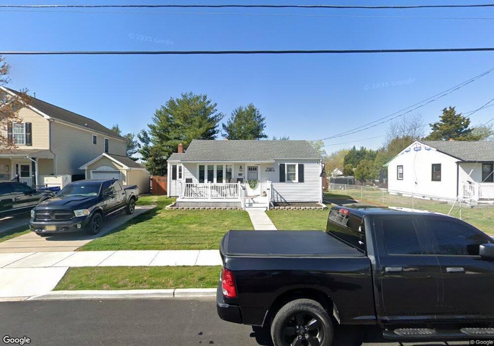
456 N Coles Ave Maple Shade, NJ 08052
Estimated Value: $256,989 - $343,000
--
Bed
--
Bath
1,386
Sq Ft
$214/Sq Ft
Est. Value
About This Home
This home is located at 456 N Coles Ave, Maple Shade, NJ 08052 and is currently estimated at $296,247, approximately $213 per square foot. 456 N Coles Ave is a home located in Burlington County with nearby schools including Ralph J Steinhauer Elementary School, Maude M. Wilkins Elementary School, and Howard R Yocum School.
Ownership History
Date
Name
Owned For
Owner Type
Purchase Details
Closed on
Jul 27, 2015
Sold by
Craven Richard Giles
Bought by
Howe Nathan and Howe Deirdre
Current Estimated Value
Home Financials for this Owner
Home Financials are based on the most recent Mortgage that was taken out on this home.
Original Mortgage
$133,000
Outstanding Balance
$104,390
Interest Rate
3.97%
Mortgage Type
New Conventional
Estimated Equity
$191,857
Purchase Details
Closed on
Jan 25, 1952
Bought by
Craven Doris M
Create a Home Valuation Report for This Property
The Home Valuation Report is an in-depth analysis detailing your home's value as well as a comparison with similar homes in the area
Home Values in the Area
Average Home Value in this Area
Purchase History
| Date | Buyer | Sale Price | Title Company |
|---|---|---|---|
| Howe Nathan | $140,000 | Old Republic Natl Title Ins | |
| Craven Doris M | -- | -- |
Source: Public Records
Mortgage History
| Date | Status | Borrower | Loan Amount |
|---|---|---|---|
| Open | Howe Nathan | $133,000 |
Source: Public Records
Tax History Compared to Growth
Tax History
| Year | Tax Paid | Tax Assessment Tax Assessment Total Assessment is a certain percentage of the fair market value that is determined by local assessors to be the total taxable value of land and additions on the property. | Land | Improvement |
|---|---|---|---|---|
| 2025 | $5,550 | $146,200 | $43,900 | $102,300 |
| 2024 | $5,389 | $146,200 | $43,900 | $102,300 |
| 2023 | $5,389 | $146,200 | $43,900 | $102,300 |
| 2022 | $5,306 | $146,200 | $43,900 | $102,300 |
| 2021 | $5,254 | $146,200 | $43,900 | $102,300 |
| 2020 | $5,269 | $146,200 | $43,900 | $102,300 |
| 2019 | $5,076 | $146,200 | $43,900 | $102,300 |
| 2018 | $4,988 | $146,200 | $43,900 | $102,300 |
| 2017 | $4,930 | $146,200 | $43,900 | $102,300 |
| 2016 | $4,857 | $146,200 | $43,900 | $102,300 |
| 2015 | $4,752 | $146,200 | $43,900 | $102,300 |
| 2014 | $4,107 | $146,200 | $43,900 | $102,300 |
Source: Public Records
Map
Nearby Homes
- 432 N Coles Ave
- 12 Collins Ln
- 4 W Germantown Ave
- 301 N Coles Ave
- 41 Orchard Ave
- 480 W Front St
- 29 W Broadway
- 48 N Terrace Ave
- 218 E Germantown Ave
- 505 Greenwood Ave
- 8534 Orchard Ave
- 524 W Main St
- 3422 Palace Ct
- 8515 Bryn Mawr Ave
- 8337 Herbert Ave
- 8704 Park Ave
- 3423 New Jersey Ct
- 22 Theodore Ave
- 19 Farnsworth Ave
- 8331 Stockton Ave
- 452 N Coles Ave
- 460 N Coles Ave
- 448 N Coles Ave
- 464 N Coles Ave
- 216 W Germantown Ave
- 308 B Collins Lane B
- 308 Collins Ln
- 444 N Coles Ave
- 216 E Germantown Ave
- 468 N Coles Ave
- 451 N Coles Ave
- 219 W Germantown Ave
- 440 N Coles Ave
- 212 W Germantown Ave
- 447 N Coles Ave
- 472 N Coles Ave
- 308A Collins Ln
- 215 W Germantown Ave
- 443 N Coles Ave
- 208 W Germantown Ave