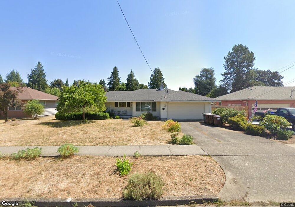
456 NE 6th Ave Hillsboro, OR 97124
Central Hillsboro NeighborhoodEstimated Value: $458,000 - $536,000
3
Beds
2
Baths
1,348
Sq Ft
$365/Sq Ft
Est. Value
About This Home
This home is located at 456 NE 6th Ave, Hillsboro, OR 97124 and is currently estimated at $492,400, approximately $365 per square foot. 456 NE 6th Ave is a home located in Washington County with nearby schools including Lincoln Street Elementary School, Evergreen Jr High School, and Glencoe High School.
Ownership History
Date
Name
Owned For
Owner Type
Purchase Details
Closed on
Dec 28, 2021
Sold by
Thompson Barbara L and Thomspon Survivors Trust
Bought by
Carter Marlys J and Thomspon Survivors Trust
Current Estimated Value
Purchase Details
Closed on
Feb 18, 2010
Sold by
Thompson Mary M
Bought by
Thompson Mary M and Thompson Survivors Trust
Purchase Details
Closed on
Apr 9, 2003
Sold by
Thompson Harold B and Thompson Mary
Bought by
Thompson Harold B and Thompson Mary M
Purchase Details
Closed on
Aug 21, 2000
Sold by
Thompson Barbara L
Bought by
Thompson Harold B and Thompson Mary
Home Financials for this Owner
Home Financials are based on the most recent Mortgage that was taken out on this home.
Original Mortgage
$128,441
Interest Rate
8.15%
Mortgage Type
FHA
Create a Home Valuation Report for This Property
The Home Valuation Report is an in-depth analysis detailing your home's value as well as a comparison with similar homes in the area
Home Values in the Area
Average Home Value in this Area
Purchase History
| Date | Buyer | Sale Price | Title Company |
|---|---|---|---|
| Carter Marlys J | -- | None Available | |
| Thompson Mary M | -- | None Available | |
| Thompson Harold B | -- | -- | |
| Thompson Harold B | $129,500 | Oregon Title Insurance Co |
Source: Public Records
Mortgage History
| Date | Status | Borrower | Loan Amount |
|---|---|---|---|
| Closed | Thompson Harold B | $128,441 |
Source: Public Records
Tax History Compared to Growth
Tax History
| Year | Tax Paid | Tax Assessment Tax Assessment Total Assessment is a certain percentage of the fair market value that is determined by local assessors to be the total taxable value of land and additions on the property. | Land | Improvement |
|---|---|---|---|---|
| 2025 | $3,681 | $225,170 | -- | -- |
| 2024 | $3,576 | $218,620 | -- | -- |
| 2023 | $3,576 | $212,260 | $0 | $0 |
| 2022 | $3,479 | $212,260 | $0 | $0 |
| 2021 | $3,409 | $200,080 | $0 | $0 |
| 2020 | $3,336 | $194,260 | $0 | $0 |
| 2019 | $3,240 | $188,610 | $0 | $0 |
| 2018 | $3,101 | $183,120 | $0 | $0 |
| 2017 | $2,989 | $177,790 | $0 | $0 |
| 2016 | $2,907 | $172,620 | $0 | $0 |
| 2015 | $2,790 | $167,600 | $0 | $0 |
| 2014 | $2,774 | $162,720 | $0 | $0 |
Source: Public Records
Map
Nearby Homes
- 624 NE Edison St
- 511 NE Lincoln St
- 420 NE Jackson St
- 354 NE Jackson St
- 245 NE 4th Ave
- 341 NE 3rd Ave
- 665 NE 3rd Ave
- 553 NE Buena Vista St
- 1043 NE Sturgess Ave
- 960 E Main St
- 1184 NE Turner Dr
- 154 NW Garibaldi St
- 1269 NE Grant St
- 1 NE 3rd Ave
- 1303 NE Cornell Rd
- 1242 NE Parkside Dr
- 1112 E Main St
- 856 NW Val Ct
- 635 SE Walnut St
- 1425 NE Glen Ellen Dr
- 436 NE 6th Ave
- 474 NE 6th Ave
- 457 NE Birchwood Dr
- 457 NE Birchwood Dr
- 441 NE Birchwood Dr
- 422 NE 6th Ave
- 512 NE 6th Ave
- 427 NE Birchwood Dr
- 511 NE Birchwood Dr
- 451 NE 6th Ave
- 471 NE 6th Ave
- 437 NE 6th Ave
- 605 NE Edison St
- 540 NE 6th Ave
- 513 NE 6th Ave
- 415 NE 6th Ave
- 625 NE Edison St
- 470 NE Birchwood Dr
- 448 NE Birchwood Dr
- 546 NE 6th Ave