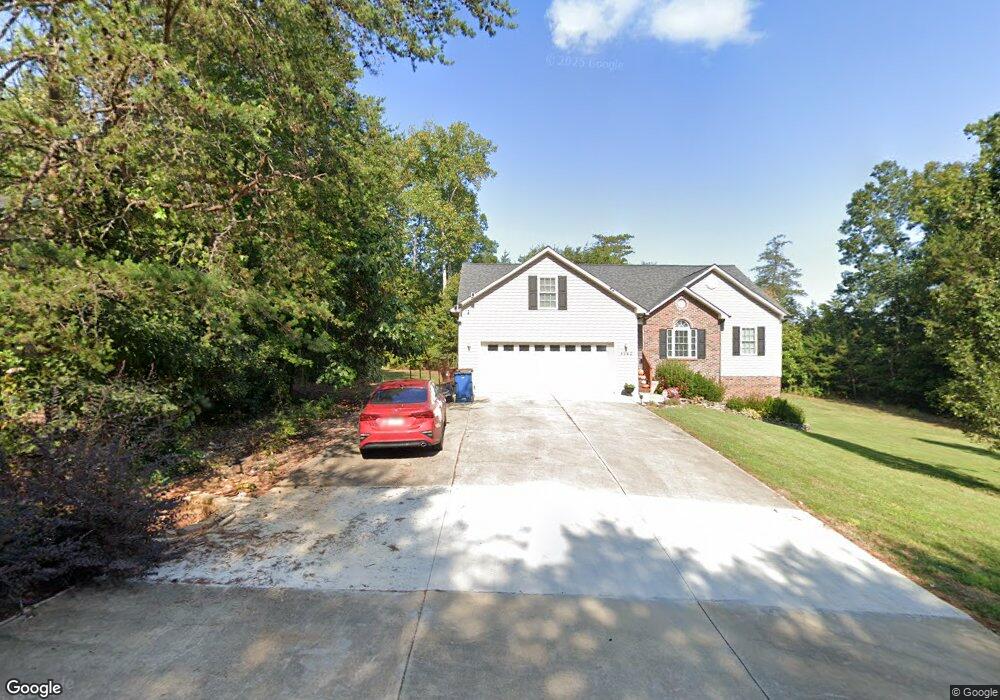
4562 River Run Cir Hickory, NC 28602
South Hickory NeighborhoodEstimated Value: $347,357 - $423,000
3
Beds
2
Baths
1,756
Sq Ft
$219/Sq Ft
Est. Value
About This Home
This home is located at 4562 River Run Cir, Hickory, NC 28602 and is currently estimated at $384,089, approximately $218 per square foot. 4562 River Run Cir is a home located in Catawba County with nearby schools including Fred T. Foard High School, Blackburn Elementary School, and Jacobs Fork Middle School.
Ownership History
Date
Name
Owned For
Owner Type
Purchase Details
Closed on
Dec 10, 2009
Sold by
Carter Edward Scott and Carter Katherine Parker
Bought by
Barnhardt Rodney Lee and Smith Donna M
Current Estimated Value
Home Financials for this Owner
Home Financials are based on the most recent Mortgage that was taken out on this home.
Original Mortgage
$194,275
Outstanding Balance
$127,431
Interest Rate
5.01%
Mortgage Type
New Conventional
Estimated Equity
$256,658
Purchase Details
Closed on
Jun 10, 2008
Sold by
Highway 10 Llc
Bought by
Carter Edward Scott
Home Financials for this Owner
Home Financials are based on the most recent Mortgage that was taken out on this home.
Original Mortgage
$7,850
Interest Rate
6.02%
Mortgage Type
Purchase Money Mortgage
Create a Home Valuation Report for This Property
The Home Valuation Report is an in-depth analysis detailing your home's value as well as a comparison with similar homes in the area
Home Values in the Area
Average Home Value in this Area
Purchase History
| Date | Buyer | Sale Price | Title Company |
|---|---|---|---|
| Barnhardt Rodney Lee | $204,500 | Chicago Title Insurance Co | |
| Carter Edward Scott | $19,500 | Chicago Title Insurance Co |
Source: Public Records
Mortgage History
| Date | Status | Borrower | Loan Amount |
|---|---|---|---|
| Open | Barnhardt Rodney Lee | $194,275 | |
| Previous Owner | Carter Edward Scott | $7,850 | |
| Previous Owner | Carter Edward Scott | $172,000 |
Source: Public Records
Tax History Compared to Growth
Tax History
| Year | Tax Paid | Tax Assessment Tax Assessment Total Assessment is a certain percentage of the fair market value that is determined by local assessors to be the total taxable value of land and additions on the property. | Land | Improvement |
|---|---|---|---|---|
| 2025 | $1,437 | $314,100 | $21,400 | $292,700 |
| 2024 | $1,437 | $314,100 | $21,400 | $292,700 |
| 2023 | $1,437 | $207,100 | $16,700 | $190,400 |
| 2022 | $1,350 | $207,100 | $16,700 | $190,400 |
| 2021 | $1,319 | $207,100 | $16,700 | $190,400 |
| 2020 | $1,319 | $207,100 | $16,700 | $190,400 |
| 2019 | $1,319 | $207,100 | $0 | $0 |
| 2018 | $1,185 | $186,100 | $16,600 | $169,500 |
| 2017 | $1,185 | $0 | $0 | $0 |
| 2016 | $1,185 | $0 | $0 | $0 |
| 2015 | $1,086 | $186,100 | $16,600 | $169,500 |
| 2014 | $1,086 | $183,600 | $22,600 | $161,000 |
Source: Public Records
Map
Nearby Homes
- 4149 River Run Cir
- 4176 River Run Cir
- 4175 River Run Cir
- 2114 Finger Bridge Rd
- 3425 Zion Church Rd
- 1 ACRE Jacobs Fork None
- 4339 Angel Hill Dr
- 1263 Waterford Dr
- 4146 Old State Rd
- 2540 N Carolina 10 Hwy
- 4063 Rainbow Hills Dr
- 1158 Waterford Dr
- 1160 Mulberry Ln
- 1434 Mammoth Rd
- 1443 Mammoth Rd
- 3368 Plateau Rd
- 3651 W Nc 10 Hwy
- 0 Pittstown Rd
- 3884 Snider Cir
- 5780 W Nc 10 Hwy
- 4574 River Run Cir
- 4574 River Run Cir Unit 41
- 4584 River Run Cir
- 1949 Elk Track None
- 1930 Sliding Rock
- 1925 Bear Paw None
- 4587 River Run Cir Unit 7
- 1956 Elk Track None
- 1965 Elk Track None
- 1937 Bear Paw None
- 1965 Elk Track
- 4597 River Run Cir
- 1934 Finger Bridge Rd
- 1920 Sliding Rock
- 00 Bear Paw Views
- 1940 Sliding Rock None Unit 44
- 4609 River Run Cir
- 1932 Bear Paw
- 4280 River Run Cir
- 4419 River Run Cir