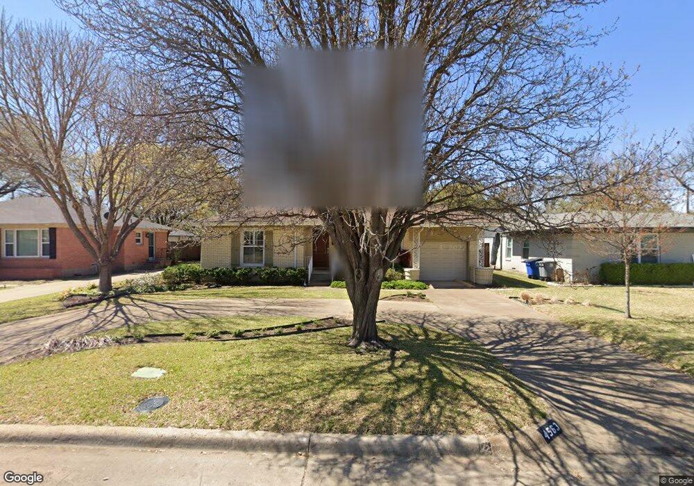
4563 Surf Dr Dallas, TX 75214
Northeast Dallas NeighborhoodEstimated Value: $554,000 - $688,000
3
Beds
2
Baths
1,342
Sq Ft
$449/Sq Ft
Est. Value
About This Home
This home is located at 4563 Surf Dr, Dallas, TX 75214 and is currently estimated at $602,878, approximately $449 per square foot. 4563 Surf Dr is a home located in Dallas County with nearby schools including Lakewood Elementary School, J L Long Middle School, and Woodrow Wilson High School.
Ownership History
Date
Name
Owned For
Owner Type
Purchase Details
Closed on
Apr 17, 2018
Sold by
Flint Shirley
Bought by
Morr David
Current Estimated Value
Purchase Details
Closed on
Jul 28, 2003
Sold by
Hudson Charles D and Hudson Joan T
Bought by
Flint Shirley
Home Financials for this Owner
Home Financials are based on the most recent Mortgage that was taken out on this home.
Original Mortgage
$140,000
Interest Rate
5.24%
Mortgage Type
Purchase Money Mortgage
Purchase Details
Closed on
Apr 24, 2003
Sold by
Mcdaniel Mary Jane
Bought by
Hudson Charles D and Hudson Joan T
Purchase Details
Closed on
Aug 20, 1996
Sold by
Mcdaniel Mary Jane Brown
Bought by
Brown Edward Sylvester
Create a Home Valuation Report for This Property
The Home Valuation Report is an in-depth analysis detailing your home's value as well as a comparison with similar homes in the area
Home Values in the Area
Average Home Value in this Area
Purchase History
| Date | Buyer | Sale Price | Title Company |
|---|---|---|---|
| Morr David | -- | None Available | |
| Flint Shirley | -- | -- | |
| Hudson Charles D | -- | -- | |
| Brown Edward Sylvester | -- | -- |
Source: Public Records
Mortgage History
| Date | Status | Borrower | Loan Amount |
|---|---|---|---|
| Previous Owner | Flint Shirley | $140,000 |
Source: Public Records
Tax History Compared to Growth
Tax History
| Year | Tax Paid | Tax Assessment Tax Assessment Total Assessment is a certain percentage of the fair market value that is determined by local assessors to be the total taxable value of land and additions on the property. | Land | Improvement |
|---|---|---|---|---|
| 2025 | $4,796 | $618,040 | $406,850 | $211,190 |
| 2024 | $4,796 | $517,300 | $300,000 | $217,300 |
| 2023 | $4,796 | $505,240 | $300,000 | $205,240 |
| 2022 | $12,633 | $505,240 | $300,000 | $205,240 |
| 2021 | $9,569 | $362,720 | $200,000 | $162,720 |
| 2020 | $9,840 | $362,720 | $200,000 | $162,720 |
| 2019 | $9,755 | $342,840 | $200,000 | $142,840 |
| 2018 | $9,323 | $342,840 | $200,000 | $142,840 |
| 2017 | $8,133 | $299,100 | $200,000 | $99,100 |
| 2016 | $8,133 | $299,100 | $200,000 | $99,100 |
| 2015 | $3,325 | $229,170 | $100,000 | $129,170 |
| 2014 | $3,325 | $223,020 | $100,000 | $123,020 |
Source: Public Records
Map
Nearby Homes
- 6711 Vada Dr
- 6537 Patrick Dr
- 6802 Vada Dr
- 6746 Braeburn Dr
- 6720 Braeburn Dr
- 6529 Trammel Dr
- 4323 Ashford Dr
- 6446 Lange Cir
- 6459 Trammel Dr
- 6527 Axton Cir
- 6644 Santa Anita Dr
- 6811 Patrick Dr
- 6474 Sudbury Dr
- 6660 Santa Anita Dr
- 6923 Inverness Ln
- 6665 Santa Anita Dr
- 6984 Santa Barbara Dr
- 6529 Saint Moritz Ave
- 6804 Santa Maria Ln
- 6415 Axton Ln
- 4557 Surf Dr
- 4603 Surf Dr
- 4607 Surf Dr
- 4551 Surf Dr
- 4530 Saint Landry Dr
- 4534 Saint Landry Dr
- 4524 Saint Landry Dr
- 6605 Vada Dr
- 6604 Vada Dr
- 4540 Saint Landry Dr
- 4611 Surf Dr
- 4518 Saint Landry Dr
- 4547 Surf Dr
- 6609 Vada Dr
- 4544 Saint Landry Dr
- 6608 Vada Dr
- 4610 Surf Dr
- 4617 Surf Dr
- 4543 Surf Dr
- 6737 Ravendale Ln