Estimated Value: $264,000 - $276,000
3
Beds
3
Baths
2,185
Sq Ft
$124/Sq Ft
Est. Value
About This Home
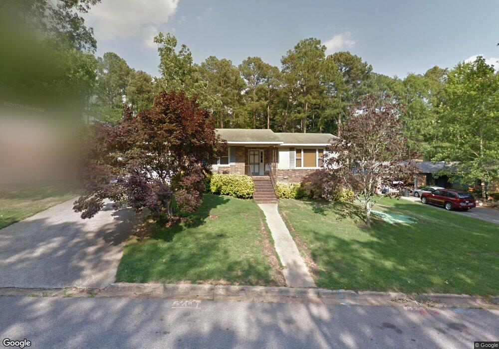
This home is located at 4564 Carol Ct, Evans, GA 30809 and is currently estimated at $271,497, approximately $124 per square foot. 4564 Carol Ct is a home with nearby schools including Westmont Elementary School, Evans Elementary School, and Evans Middle School.
Ownership History
Date
Name
Owned For
Owner Type
Purchase Details
Closed on
Nov 1, 2022
Sold by
Knight Bobby P
Bought by
Bobby Pascal Knight and Sun Hui
Current Estimated Value
Create a Home Valuation Report for This Property
The Home Valuation Report is an in-depth analysis detailing your home's value as well as a comparison with similar homes in the area
Home Values in the Area
Average Home Value in this Area
Purchase History
| Date | Buyer | Sale Price | Title Company |
|---|---|---|---|
| Bobby Pascal Knight | -- | -- |
Source: Public Records
Tax History Compared to Growth
Tax History
| Year | Tax Paid | Tax Assessment Tax Assessment Total Assessment is a certain percentage of the fair market value that is determined by local assessors to be the total taxable value of land and additions on the property. | Land | Improvement |
|---|---|---|---|---|
| 2025 | $2,626 | $107,665 | $21,604 | $86,061 |
| 2024 | $2,752 | $107,800 | $19,304 | $88,496 |
| 2023 | $2,752 | $100,081 | $19,304 | $80,777 |
| 2022 | $2,232 | $83,638 | $16,404 | $67,234 |
| 2021 | $2,372 | $85,090 | $16,404 | $68,686 |
| 2020 | $2,089 | $73,107 | $13,204 | $59,903 |
| 2019 | $1,930 | $67,390 | $13,104 | $54,286 |
| 2018 | $1,752 | $60,786 | $11,204 | $49,582 |
| 2017 | $1,740 | $62,032 | $11,104 | $50,928 |
| 2016 | $1,596 | $59,010 | $11,180 | $47,830 |
| 2015 | $1,501 | $55,392 | $10,680 | $44,712 |
| 2014 | $1,444 | $52,636 | $10,680 | $41,956 |
Source: Public Records
Map
Nearby Homes
- 4558 Glenda Ln
- 4521 Zola Dr
- 4517 Glennwood Dr
- 217 Dry Creek Rd
- 231 Dry Creek Rd
- 245 Belair Rd N
- 213 N Belair Rd
- 4442 Roxbury Dr
- 4569 Gray Ln
- 4597 Gray Ln
- 4621 Durbin Dr
- 4425 Branchwood Dr
- 4403 Owens Rd
- 126 Moss Creek Dr
- 4586 Oxford Ct
- 5068 Hereford Farm Rd
- 4009 Waccamaw Dr
- 489 Connemara Trail
- 174 Creek View Ct
- 104 Moss Creek Dr
- 4566 Carol Ct
- 4576 Carol Ct
- 4560 Glenda Ln
- 4547 Wilma Ct
- 4568 Carol Ct
- 4553 Carol Ct
- 4570 Carol Ct
- 4556 Wilma Ct
- 4549 Wilma Ct
- 4551 Glenda Ln
- 4558 Glennwood Dr
- 4549 Glenda Ln
- 4556 Glennwood Dr
- 4593 Calloway Dr
- 4547 Glenda Ln
- 4551 Wilma Ct
- 4554 Glennwood Dr
- 4548 Wilma Ct
- 4559 Glennwood Dr
- 266 Calloway Dr