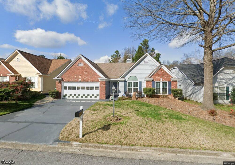
4565 Brook Farms Ct Unit AP2 Duluth, GA 30096
Estimated Value: $419,165 - $477,000
3
Beds
2
Baths
2,086
Sq Ft
$217/Sq Ft
Est. Value
About This Home
This home is located at 4565 Brook Farms Ct Unit AP2, Duluth, GA 30096 and is currently estimated at $452,791, approximately $217 per square foot. 4565 Brook Farms Ct Unit AP2 is a home located in Gwinnett County with nearby schools including Berkeley Lake Elementary School, Duluth Middle School, and Duluth High School.
Ownership History
Date
Name
Owned For
Owner Type
Purchase Details
Closed on
Dec 8, 2014
Sold by
Guy Milton
Bought by
Guy Milton and Felton-Guy Myrtle
Current Estimated Value
Home Financials for this Owner
Home Financials are based on the most recent Mortgage that was taken out on this home.
Original Mortgage
$148,000
Outstanding Balance
$113,422
Interest Rate
4.09%
Mortgage Type
New Conventional
Estimated Equity
$339,369
Purchase Details
Closed on
May 17, 1995
Sold by
Old Norcross In Vestments
Bought by
Smith Mavis W
Create a Home Valuation Report for This Property
The Home Valuation Report is an in-depth analysis detailing your home's value as well as a comparison with similar homes in the area
Home Values in the Area
Average Home Value in this Area
Purchase History
| Date | Buyer | Sale Price | Title Company |
|---|---|---|---|
| Guy Milton | $185,000 | -- | |
| Guy Milton | $185,000 | -- | |
| Smith Mavis W | $140,900 | -- |
Source: Public Records
Mortgage History
| Date | Status | Borrower | Loan Amount |
|---|---|---|---|
| Open | Guy Milton | $148,000 | |
| Closed | Guy Milton | $148,000 | |
| Closed | Smith Mavis W | $0 |
Source: Public Records
Tax History Compared to Growth
Tax History
| Year | Tax Paid | Tax Assessment Tax Assessment Total Assessment is a certain percentage of the fair market value that is determined by local assessors to be the total taxable value of land and additions on the property. | Land | Improvement |
|---|---|---|---|---|
| 2025 | $1,450 | $174,480 | $29,920 | $144,560 |
| 2024 | $1,447 | $165,680 | $33,200 | $132,480 |
| 2023 | $1,447 | $152,880 | $33,200 | $119,680 |
| 2022 | $1,413 | $126,480 | $24,000 | $102,480 |
| 2021 | $1,406 | $115,000 | $20,000 | $95,000 |
| 2020 | $3,761 | $110,400 | $20,000 | $90,400 |
| 2019 | $3,391 | $98,440 | $18,000 | $80,440 |
| 2018 | $3,376 | $97,640 | $18,000 | $79,640 |
| 2016 | $3,408 | $88,680 | $16,000 | $72,680 |
| 2015 | $2,924 | $74,000 | $16,000 | $58,000 |
| 2014 | -- | $67,040 | $12,800 | $54,240 |
Source: Public Records
Map
Nearby Homes
- 3991 Centennial Trail
- 4569 Iroquois Trail
- 2385 Muirfield Way
- 4786 Masters Ct Unit 4
- 4777 Overlook View Ct
- 4328 Buckingham Place
- 4368 Buckingham Place
- 4302 Inverness Rd
- 4300 Wildridge Dr
- 4767 Glenwhite Dr
- 2055 Lake Ford Cir
- 2605 Silver Cliff Dr Unit I
- 4880 Racquet Ct
- 2318 Ingram Rd
- 2865 Landington Way
- 2250 Berkeley Creek Ct Unit 2
- 2688 Shetland Ln
- 2606 Gravitt Rd Unit 2
- 4565 Brook Farms Ct
- 4575 Brook Farms Ct
- 2560 Millerbrook Dr
- 2580 Millerbrook Dr
- 2650 Millerbrook Dr
- 4585 Brook Farms Ct
- 4560 Brook Farms Ct
- 2660 Millerbrook Dr
- 2630 Millerbrook Dr
- 4570 Brook Farms Ct
- 4550 Brook Farms Ct
- 4580 Brook Farms Ct
- 2565 Millerbrook Dr
- 4391 Claiborne Ct
- 2575 Millerbrook Dr Unit 21
- 2575 Millerbrook Dr
- 2555 Millerbrook Dr
- 4381 Claiborne Ct
- 4401 Claiborne Ct
- 2585 Millerbrook Dr