Estimated Value: $223,000 - $243,000
Studio
--
Bath
1,902
Sq Ft
$122/Sq Ft
Est. Value
About This Home
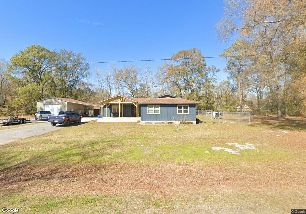
This home is located at 4565 Eaves Rd, Vidor, TX 77662 and is currently estimated at $232,613, approximately $122 per square foot. 4565 Eaves Rd is a home located in Orange County.
Ownership History
Date
Name
Owned For
Owner Type
Purchase Details
Closed on
Nov 1, 2013
Sold by
Turner John Alan
Bought by
Bloss William and Bloss Gina
Current Estimated Value
Home Financials for this Owner
Home Financials are based on the most recent Mortgage that was taken out on this home.
Original Mortgage
$70,000
Interest Rate
4.35%
Mortgage Type
Purchase Money Mortgage
Purchase Details
Closed on
Oct 7, 2013
Sold by
Turner Jason Alan
Bought by
Turner Jon Alan
Home Financials for this Owner
Home Financials are based on the most recent Mortgage that was taken out on this home.
Original Mortgage
$70,000
Interest Rate
4.35%
Mortgage Type
Purchase Money Mortgage
Create a Home Valuation Report for This Property
The Home Valuation Report is an in-depth analysis detailing your home's value as well as a comparison with similar homes in the area
Home Values in the Area
Average Home Value in this Area
Purchase History
| Date | Buyer | Sale Price | Title Company |
|---|---|---|---|
| Bloss William | -- | None Available | |
| Turner Jon Alan | -- | None Available | |
| Bloss William | -- | -- | |
| Turner Jon Alan | -- | None Available |
Source: Public Records
Mortgage History
| Date | Status | Borrower | Loan Amount |
|---|---|---|---|
| Previous Owner | Bloss William | $70,000 |
Source: Public Records
Tax History
| Year | Tax Paid | Tax Assessment Tax Assessment Total Assessment is a certain percentage of the fair market value that is determined by local assessors to be the total taxable value of land and additions on the property. | Land | Improvement |
|---|---|---|---|---|
| 2025 | $2,830 | $189,522 | $9,450 | $180,072 |
| 2024 | $1,142 | $181,090 | $9,450 | $171,640 |
| 2023 | $2,123 | $151,337 | $9,450 | $141,887 |
| 2022 | $1,445 | $125,130 | $9,450 | $115,680 |
| 2021 | $2,089 | $112,321 | $9,450 | $108,930 |
| 2020 | $1,957 | $102,110 | $9,450 | $92,660 |
| 2019 | $1,919 | $99,300 | $9,450 | $89,850 |
| 2018 | $998 | $52,270 | $9,450 | $42,820 |
| 2017 | $1,884 | $95,100 | $9,450 | $85,650 |
| 2016 | $1,697 | $88,870 | $9,450 | $79,420 |
| 2015 | $1,234 | $86,557 | $9,450 | $77,107 |
| 2014 | $1,234 | $85,398 | $9,450 | $75,948 |
Source: Public Records
Map
Nearby Homes
- 4585 Eaves Rd
- 4595 Eaves Rd
- 4560 Townsend Dr
- 160 S Linscomb Rd
- 0 Texas 12
- 0 Highway 12 Linscomb Rd Unit 24059808
- 6165 N Linscomb Rd
- 975 Roberts Rd
- 1080 Scott Dr
- 3665 E Railroad St
- 0 Fm 1132 Unit 93970706
- 4520 Lamont
- 260 Lawrence Ln
- 1275 Evangeline Ln
- 425 Lawrence Ln
- 410 Lee Ln
- 3118 Flora St
- 1635 Stagg Dr
- 410 Creekwood St
- 1615 Stagg St
- 4570 Eaves Rd
- 4580 Eaves Rd
- 1295 N Pecan Dr
- 1315 Doty Rd
- 1350 N Pecan Dr
- 1275 N Pecan Dr
- 1325 Doty Rd
- 1330 Doty Rd
- 1290 Doty Rd
- 4190 E Railroad St
- 4705 Singleton Rd
- 4565 E Railroad St
- 4575 E Railroad St
- 4725 Singleton Rd
- 1065 Doty Rd
- 4745 Singleton Rd
- 4595 E Railroad St
- 4755 Singleton Rd
- 4185 E Railroad St
- 1030 Doty Rd
Your Personal Tour Guide
Ask me questions while you tour the home.