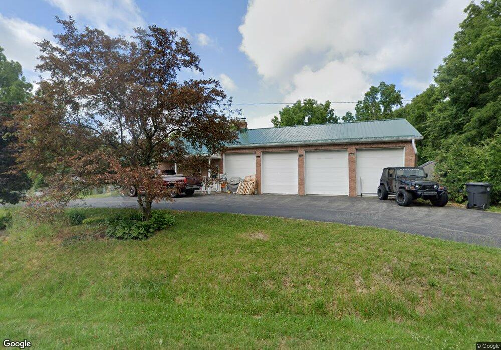
4565 State Road 252 Martinsville, IN 46151
Estimated Value: $331,000 - $539,218
2
Beds
2
Baths
1,534
Sq Ft
$281/Sq Ft
Est. Value
About This Home
This home is located at 4565 State Road 252, Martinsville, IN 46151 and is currently estimated at $431,805, approximately $281 per square foot. 4565 State Road 252 is a home located in Morgan County with nearby schools including Indian Creek Elementary School, Indian Creek Intermediate School, and Indian Creek Middle School.
Ownership History
Date
Name
Owned For
Owner Type
Purchase Details
Closed on
Feb 13, 2020
Sold by
Modesitt Jared and Jerry R Mcdonald Living Trust
Bought by
Ferrell Matthew Aaron and Ferrell Amanda Sue
Current Estimated Value
Home Financials for this Owner
Home Financials are based on the most recent Mortgage that was taken out on this home.
Original Mortgage
$208,000
Outstanding Balance
$184,588
Interest Rate
3.72%
Mortgage Type
New Conventional
Estimated Equity
$247,217
Create a Home Valuation Report for This Property
The Home Valuation Report is an in-depth analysis detailing your home's value as well as a comparison with similar homes in the area
Home Values in the Area
Average Home Value in this Area
Purchase History
| Date | Buyer | Sale Price | Title Company |
|---|---|---|---|
| Ferrell Matthew Aaron | -- | Chicago Title Company Llc |
Source: Public Records
Mortgage History
| Date | Status | Borrower | Loan Amount |
|---|---|---|---|
| Open | Ferrell Matthew Aaron | $208,000 |
Source: Public Records
Tax History Compared to Growth
Tax History
| Year | Tax Paid | Tax Assessment Tax Assessment Total Assessment is a certain percentage of the fair market value that is determined by local assessors to be the total taxable value of land and additions on the property. | Land | Improvement |
|---|---|---|---|---|
| 2024 | $3,331 | $432,600 | $152,200 | $280,400 |
| 2023 | $2,681 | $418,100 | $152,200 | $265,900 |
| 2022 | $2,557 | $384,100 | $152,200 | $231,900 |
| 2021 | $1,758 | $288,600 | $95,000 | $193,600 |
| 2020 | $1,586 | $281,200 | $95,000 | $186,200 |
| 2019 | $2,452 | $267,600 | $95,000 | $172,600 |
| 2018 | $2,274 | $256,400 | $94,000 | $162,400 |
| 2017 | $2,324 | $254,000 | $94,000 | $160,000 |
| 2016 | $2,162 | $231,800 | $91,000 | $140,800 |
| 2014 | $1,680 | $232,400 | $91,000 | $141,400 |
| 2013 | $1,680 | $243,700 | $91,000 | $152,700 |
Source: Public Records
Map
Nearby Homes
- 0 E Parkwood Dr Unit MBR22044924
- 4523 E Parkwood Dr
- 0 Dynasty Ridge Rd
- 0 E Sunnyslope Unit MBR22044789
- 0 S Cove Rd
- 0 S Cove Rd Unit MBR22048618
- 4320 C S R 252
- 4194 E West Point Ct
- 2076 Dynasty Ridge Rd
- 0 Rembrandt East Dr Unit MBR22067693
- 0 E Lakeview Dr Unit MBR22050469
- 0 E Lakeview Dr Unit MBR21952404
- 4379 E Rembrandt Dr
- 2050 S Hill Valley Rd
- 4312 E Rembrandt Dr
- 1992 S Painted Hills Ct
- 2013 S Austin Ct
- 2500 S Edgewood Cove
- 3876 E Glenwood Dr
- 0 Cherry Ct
- 1601 S Broadacres Cir
- 4565 Sr 252
- 4560 State Road 252
- 0 S Broadacres Unit 21043842
- 0 S Broadacres Unit 21173989
- 0 S Broadacres Unit MBR21816972
- LOT707 S Broadacres Cir
- 698 S Broadacres Cir
- 0 S Broadacres Unit MBR2412260
- 700 S Broadacres Cir
- 0 S Broadacres Unit 21737367
- 4632 E Parkwood Dr
- 4435 Indiana 252
- 1761 S Sunnyslope Ct
- 1651 S Broadacres Cir
- 1646 S Broadacres Cir
- 1659 S Broadacres Cir
- 0 Sunny Slope Ct
- 4550 E Ridge Rd
- 1771 S Sunnyslope Ct