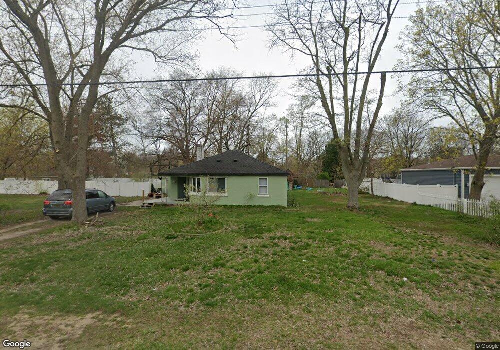
4565 Thompson St Norton Shores, MI 49441
Estimated Value: $229,724 - $258,000
4
Beds
2
Baths
1,502
Sq Ft
$163/Sq Ft
Est. Value
About This Home
This home is located at 4565 Thompson St, Norton Shores, MI 49441 and is currently estimated at $244,431, approximately $162 per square foot. 4565 Thompson St is a home located in Muskegon County with nearby schools including Mona Shores High School, Edgewood Elementary Academy, and Dr. Martin Luther King Academy.
Ownership History
Date
Name
Owned For
Owner Type
Purchase Details
Closed on
Dec 8, 2016
Sold by
Gocha Lisa E
Bought by
Judithdavid I Llc
Current Estimated Value
Purchase Details
Closed on
Dec 12, 2014
Sold by
Rhinesmith Brian L and Rhinesmith Virginia
Bought by
Penoyer Kevin and Penoyer Elizabeth
Home Financials for this Owner
Home Financials are based on the most recent Mortgage that was taken out on this home.
Original Mortgage
$83,724
Interest Rate
3.99%
Mortgage Type
FHA
Create a Home Valuation Report for This Property
The Home Valuation Report is an in-depth analysis detailing your home's value as well as a comparison with similar homes in the area
Home Values in the Area
Average Home Value in this Area
Purchase History
| Date | Buyer | Sale Price | Title Company |
|---|---|---|---|
| Judithdavid I Llc | $7,400 | None Available | |
| Penoyer Kevin | $75,900 | Chicago Title |
Source: Public Records
Mortgage History
| Date | Status | Borrower | Loan Amount |
|---|---|---|---|
| Previous Owner | Penoyer Kevin | $83,724 |
Source: Public Records
Tax History Compared to Growth
Tax History
| Year | Tax Paid | Tax Assessment Tax Assessment Total Assessment is a certain percentage of the fair market value that is determined by local assessors to be the total taxable value of land and additions on the property. | Land | Improvement |
|---|---|---|---|---|
| 2025 | $2,013 | $101,400 | $0 | $0 |
| 2024 | $1,578 | $92,600 | $0 | $0 |
| 2023 | $1,507 | $81,800 | $0 | $0 |
| 2022 | $1,837 | $68,600 | $0 | $0 |
| 2021 | $1,785 | $62,000 | $0 | $0 |
| 2020 | $1,765 | $56,500 | $0 | $0 |
| 2019 | $1,733 | $51,300 | $0 | $0 |
| 2018 | $1,692 | $47,300 | $0 | $0 |
| 2017 | $1,653 | $47,000 | $0 | $0 |
| 2016 | $1,280 | $43,600 | $0 | $0 |
| 2015 | -- | $40,400 | $0 | $0 |
| 2014 | $2,185 | $41,100 | $0 | $0 |
| 2013 | -- | $39,500 | $0 | $0 |
Source: Public Records
Map
Nearby Homes
- 4535 Thompson Rd
- 4476 Cedar Ln Unit 54
- V/L 4535 Thompson Rd
- 1065 Wilson Ct
- 4468 Spruce Ct
- 1067 Aspen Dr
- 4677 Harvey St
- 4638 Lauren Dr
- 1130 Englewood Ave
- 1068 Englewood Ave
- 945 Petrie Ave
- 1404 E Ellis Rd
- 4769 Harvey St
- 1454 Airport Rd
- 4060 Buck St
- 1283 E Ellis Rd Unit 18
- 1283 E Ellis Rd Unit 20
- 1283 E Ellis Rd Unit 19
- 1283 E Ellis Rd Unit 21
- 1201 Shettler Rd
- 4565 Thompson St
- 4547 Thompson St
- 1232 E Hile Rd
- 1240 E Hile Rd
- 1214 E Hile Rd
- 1258 E Hile Rd
- 4529 Thompson St
- 4538 Thompson St
- 4556 Thompson St
- 4574 Mckinley Ct
- 4526 Thompson St
- 4548 Mckinley Ct
- 4509 Thompson St
- 1286 E Hile Rd
- 4512 Thompson Rd
- 4508 Mckinley Ct
- 4536 Mckinley Ct
- 1263 E Hile Rd
- 4512 Thompson St
- 4501 Thompson St