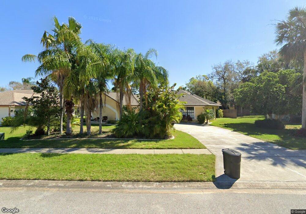
4569 Barnacle Dr Port Orange, FL 32127
South Port Orange NeighborhoodEstimated Value: $337,000 - $364,653
3
Beds
2
Baths
1,567
Sq Ft
$224/Sq Ft
Est. Value
About This Home
This home is located at 4569 Barnacle Dr, Port Orange, FL 32127 and is currently estimated at $350,913, approximately $223 per square foot. 4569 Barnacle Dr is a home located in Volusia County with nearby schools including Sugar Mill Elementary School, Silver Sands Middle School, and Spruce Creek High School.
Ownership History
Date
Name
Owned For
Owner Type
Purchase Details
Closed on
Jul 18, 2005
Sold by
Wright Diane
Bought by
Latorre Vincent
Current Estimated Value
Home Financials for this Owner
Home Financials are based on the most recent Mortgage that was taken out on this home.
Original Mortgage
$204,000
Outstanding Balance
$105,388
Interest Rate
5.5%
Mortgage Type
Purchase Money Mortgage
Estimated Equity
$245,525
Purchase Details
Closed on
Dec 15, 1991
Bought by
Latorre Vincent
Purchase Details
Closed on
Jul 15, 1989
Bought by
Latorre Vincent
Create a Home Valuation Report for This Property
The Home Valuation Report is an in-depth analysis detailing your home's value as well as a comparison with similar homes in the area
Home Values in the Area
Average Home Value in this Area
Purchase History
| Date | Buyer | Sale Price | Title Company |
|---|---|---|---|
| Latorre Vincent | $255,000 | Professional Title Agency In | |
| Latorre Vincent | $86,900 | -- | |
| Latorre Vincent | $100 | -- |
Source: Public Records
Mortgage History
| Date | Status | Borrower | Loan Amount |
|---|---|---|---|
| Open | Latorre Vincent | $204,000 |
Source: Public Records
Tax History Compared to Growth
Tax History
| Year | Tax Paid | Tax Assessment Tax Assessment Total Assessment is a certain percentage of the fair market value that is determined by local assessors to be the total taxable value of land and additions on the property. | Land | Improvement |
|---|---|---|---|---|
| 2025 | $1,905 | $152,257 | -- | -- |
| 2024 | $1,905 | $147,966 | -- | -- |
| 2023 | $1,905 | $143,657 | $0 | $0 |
| 2022 | $1,828 | $139,473 | $0 | $0 |
| 2021 | $1,857 | $135,411 | $0 | $0 |
| 2020 | $1,807 | $133,541 | $0 | $0 |
| 2019 | $1,743 | $130,539 | $0 | $0 |
| 2018 | $1,738 | $128,105 | $0 | $0 |
| 2017 | $1,738 | $125,470 | $0 | $0 |
| 2016 | $1,733 | $122,889 | $0 | $0 |
| 2015 | $1,782 | $122,035 | $0 | $0 |
| 2014 | $1,786 | $121,066 | $0 | $0 |
Source: Public Records
Map
Nearby Homes
- 823 Wooddusk Dr
- 4577 Miles Dr
- 772 Horseman Dr
- 722 Raven Rock Ct
- 4589 Alder Dr
- 811 Brimfield Ct
- 723 Raven Rock Ct
- 4508 Alder Dr
- 4590 Miles Dr
- 750 Horseman Dr
- 712 Kristina Ct
- 69 Tropical Ct
- 744 Horseman Dr
- 705 Kristina Ct
- 962 Stonybrook Cir
- 932 Sabalwood Ct
- 139 Royal Palm Cir
- 830 Lakeland Dr
- 701 Priscilla Ct
- 5402 Marshfield Dr
- 4567 Barnacle Dr
- 4571 Barnacle Dr
- 4572 Alder Dr
- 4570 Alder Dr
- 4574 Alder Dr
- 4568 Barnacle Dr
- 4565 Barnacle Dr
- 4566 Barnacle Dr
- 4570 Barnacle Dr
- 4576 Alder Dr
- 4568 Alder Dr
- 4564 Barnacle Dr
- 4572 Barnacle Dr
- 4563 Barnacle Dr
- 4575 Barnacle Dr
- 4569 Miles Dr
- 4571 Alder Dr
- 4567 Riverwood Dr
- 4567 Miles Dr
- 4569 Alder Dr