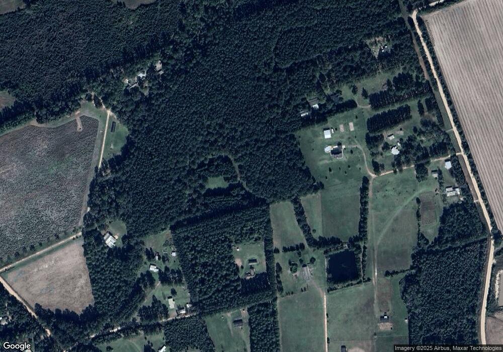
457 Akins Ln Brooklet, GA 30415
Estimated Value: $449,000 - $635,137
4
Beds
2
Baths
2,860
Sq Ft
$196/Sq Ft
Est. Value
About This Home
This home is located at 457 Akins Ln, Brooklet, GA 30415 and is currently estimated at $561,284, approximately $196 per square foot. 457 Akins Ln is a home with nearby schools including Stilson Elementary School, Southeast Bulloch High School, and Southeast Bulloch Middle School.
Ownership History
Date
Name
Owned For
Owner Type
Purchase Details
Closed on
Sep 15, 2015
Sold by
Hutchens Toby Christopher
Bought by
Hutchens Toby Christopher and Hutchens Tammie R
Current Estimated Value
Purchase Details
Closed on
Apr 7, 2014
Sold by
Black Robert K
Bought by
Hutchens Toby Christopher
Purchase Details
Closed on
Feb 1, 1993
Bought by
Black Robert K and Black Christine H
Create a Home Valuation Report for This Property
The Home Valuation Report is an in-depth analysis detailing your home's value as well as a comparison with similar homes in the area
Purchase History
| Date | Buyer | Sale Price | Title Company |
|---|---|---|---|
| Hutchens Toby Christopher | -- | -- | |
| Hutchens Toby Christopher | $34,500 | -- | |
| Black Robert K | -- | -- |
Source: Public Records
Tax History
| Year | Tax Paid | Tax Assessment Tax Assessment Total Assessment is a certain percentage of the fair market value that is determined by local assessors to be the total taxable value of land and additions on the property. | Land | Improvement |
|---|---|---|---|---|
| 2025 | $3,561 | $247,880 | $59,280 | $188,600 |
| 2024 | $3,561 | $197,480 | $44,160 | $153,320 |
| 2023 | $3,248 | $173,800 | $28,920 | $144,880 |
| 2022 | $2,788 | $149,570 | $24,118 | $125,452 |
| 2021 | $2,471 | $132,082 | $24,118 | $107,964 |
| 2020 | $2,368 | $121,262 | $20,098 | $101,164 |
| 2019 | $2,384 | $121,472 | $20,098 | $101,374 |
| 2018 | $2,256 | $115,482 | $16,745 | $98,737 |
| 2017 | $2,205 | $112,027 | $16,745 | $95,282 |
| 2016 | $2,314 | $102,036 | $9,708 | $92,328 |
| 2015 | $220 | $97,370 | $9,708 | $87,662 |
| 2014 | -- | $9,708 | $9,708 | $0 |
Source: Public Records
Map
Nearby Homes
- 925 Cleary Rd
- Lot 9 Arcola Rd
- Lot 3 Arcola Rd
- Lot 10 Arcola Rd
- Lot 1 Arcola Rd
- Lot 5 Arcola Rd
- Lot 4 Arcola Rd
- Lot 7 Arcola Rd
- Lot 2 Arcola Rd
- Lot 8 Arcola Rd
- Lot 11 Arcola Rd
- Lot 6 Arcola Rd
- 4031 Mud Rd
- LOT 11 Arcola Rd
- LOT 4 Arcola Rd
- LOT 1 Arcola Rd
- LOT 6 Arcola Rd
- LOT 10 Arcola Rd
- LOT 5 Arcola Rd
- LOT 3 Arcola Rd
- 615 Akins Ln
- 5787 Mud Rd
- 250 Mud Ln
- 433 Akins Ln
- 268 Cleary Rd
- 246 Cleary Rd
- 5959 Mud Rd
- 5889 Mud Rd
- 5927 Mud Rd
- 178 Mud Ln
- 99 Old Happy Ln Unit 268 ACRES
- 99 Old Happy Ln Unit 70.4 ACRES
- 99 Old Happy Ln
- 6089 Mud Rd
- 148 Cleary Rd
- 5818 Mud Rd
- 0 Mud Ln Unit 8256402
- 0 Mud Ln Unit 2939241
- 0 Mud Ln Unit 3285098
- 0 Mud Ln Unit 7219360
