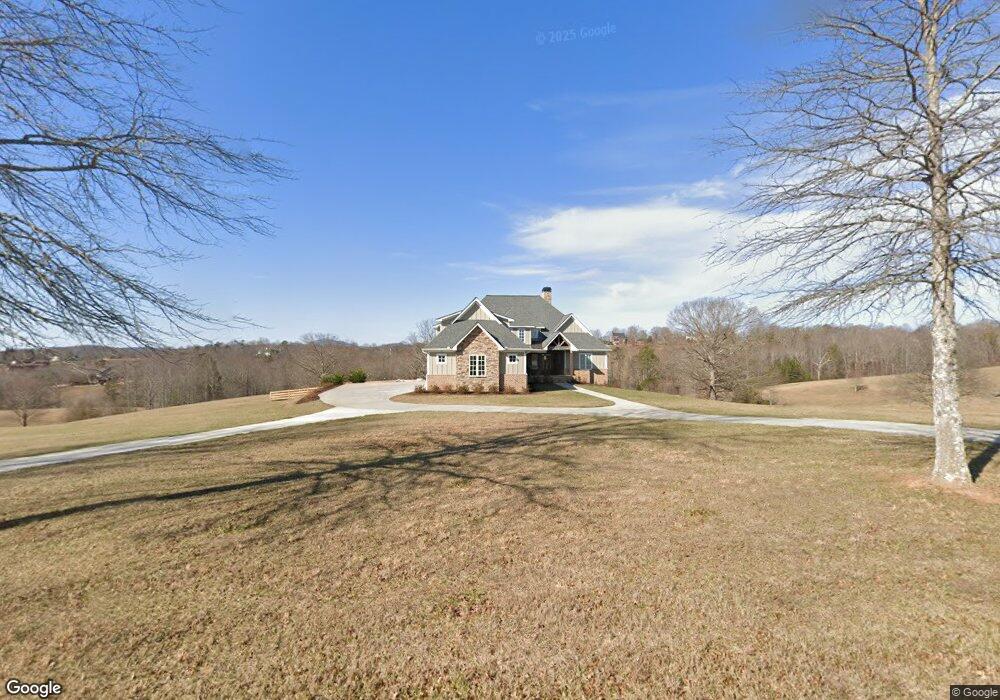
457 Annandale Dr Clarkesville, GA 30523
Estimated Value: $977,000 - $1,191,000
4
Beds
5
Baths
4,119
Sq Ft
$269/Sq Ft
Est. Value
About This Home
This home is located at 457 Annandale Dr, Clarkesville, GA 30523 and is currently estimated at $1,109,704, approximately $269 per square foot. 457 Annandale Dr is a home with nearby schools including Clarkesville Elementary School, North Habersham Middle School, and Habersham Success Academy.
Ownership History
Date
Name
Owned For
Owner Type
Purchase Details
Closed on
Feb 25, 2020
Sold by
Martin Sunshine B
Bought by
Wareham Stephen Donald and Wareham Cristin Leigh
Current Estimated Value
Home Financials for this Owner
Home Financials are based on the most recent Mortgage that was taken out on this home.
Original Mortgage
$629,000
Outstanding Balance
$562,788
Interest Rate
3.75%
Mortgage Type
New Conventional
Estimated Equity
$546,916
Create a Home Valuation Report for This Property
The Home Valuation Report is an in-depth analysis detailing your home's value as well as a comparison with similar homes in the area
Home Values in the Area
Average Home Value in this Area
Purchase History
| Date | Buyer | Sale Price | Title Company |
|---|---|---|---|
| Wareham Stephen Donald | $160,000 | -- |
Source: Public Records
Mortgage History
| Date | Status | Borrower | Loan Amount |
|---|---|---|---|
| Open | Wareham Stephen Donald | $629,000 |
Source: Public Records
Tax History Compared to Growth
Tax History
| Year | Tax Paid | Tax Assessment Tax Assessment Total Assessment is a certain percentage of the fair market value that is determined by local assessors to be the total taxable value of land and additions on the property. | Land | Improvement |
|---|---|---|---|---|
| 2025 | $9,203 | $432,406 | $80,546 | $351,860 |
| 2024 | -- | $425,744 | $58,516 | $367,228 |
| 2023 | $8,126 | $361,276 | $58,516 | $302,760 |
| 2022 | $7,937 | $314,888 | $58,516 | $256,372 |
| 2021 | $5,597 | $298,332 | $58,516 | $239,816 |
| 2020 | $1,183 | $43,972 | $43,972 | $0 |
| 2019 | $1,184 | $43,972 | $43,972 | $0 |
| 2018 | $1,175 | $43,972 | $43,972 | $0 |
| 2017 | $1,181 | $43,972 | $43,972 | $0 |
| 2016 | $1,147 | $109,930 | $43,972 | $0 |
| 2015 | $1,133 | $109,930 | $43,972 | $0 |
| 2014 | $1,154 | $109,930 | $43,972 | $0 |
| 2013 | -- | $54,964 | $54,964 | $0 |
Source: Public Records
Map
Nearby Homes
- 0 TRACT 4 Annandale Dr
- 0 TRACT 3 Annandale Dr
- 0 TRACT 1 Annandale Dr
- 0 TRACT 2 Annandale Dr
- 0 Mountain Ridge Dr Unit 7628449
- 4850 New Liberty Rd
- 1613 Duchess Ln
- 5265 New Liberty Rd
- 501 the Orchard Rd
- 274 Hardman Rd
- 182 Hardman Rd
- 101 Dove Ln
- 282 Wild Iris Ln
- 0 Ben Jones Rd Unit 10333027
- 0 Ben Jones Rd Unit 7377215
- 0 Ben Jones Rd Unit 20180428
- 0 Ben Jones Rd Unit 10021237
- 135 Mountain Ridge Dr
- LOT 36 Mountain Ridge Dr
- 0 Barney Field Rd Unit 110.9 AC 10472662
- 495 Annandale Dr Unit 28
- 495 Annandale Dr
- 427 Annandale Dr
- 0 Springbank Dr Unit E
- 0 Springbank Dr Unit E 7404560
- 0 Springbank Dr Unit 3286265
- 393 Annandale Dr
- 171 Victorian Terrace
- 281 Annandale Dr
- 281 Annandale Dr Unit 24
- 569 Annandale Dr
- 17 Southern Estates
- 15 Southern Estates
- 0 Holland Pippen Unit LOT 31 3191463
- 0 TRACT 20 Annandale Dr
- ANNANDALE TRACT Annandale Dr
- 1177 Annandale Dr
- 225 Victorian Terrace
- 615 Annandale Dr
- 1023 Annandale Dr