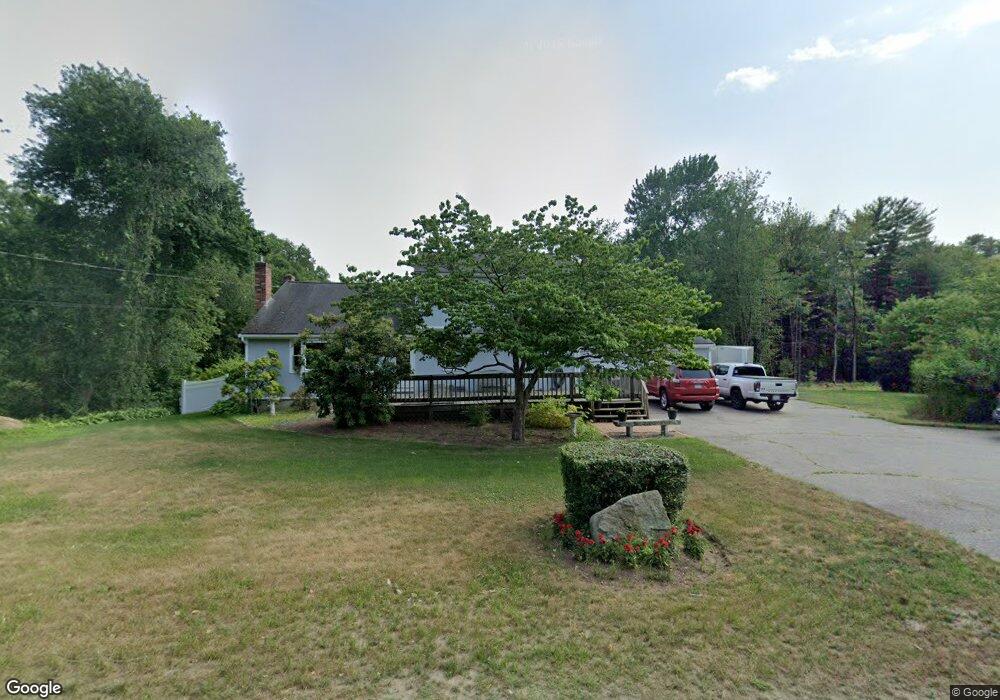
457 King Philip St Raynham, MA 02767
Estimated Value: $541,505 - $609,000
3
Beds
2
Baths
1,771
Sq Ft
$321/Sq Ft
Est. Value
About This Home
This home is located at 457 King Philip St, Raynham, MA 02767 and is currently estimated at $567,626, approximately $320 per square foot. 457 King Philip St is a home located in Bristol County with nearby schools including Merrill Elementary School, Williams Intermediate School, and Raynham Middle School.
Ownership History
Date
Name
Owned For
Owner Type
Purchase Details
Closed on
Mar 30, 2022
Sold by
Isenor Frederick R
Bought by
Isenor Gretchen E and Isenor Johanna C
Current Estimated Value
Home Financials for this Owner
Home Financials are based on the most recent Mortgage that was taken out on this home.
Original Mortgage
$352,000
Outstanding Balance
$328,292
Interest Rate
3.92%
Mortgage Type
Purchase Money Mortgage
Estimated Equity
$239,334
Purchase Details
Closed on
Jun 3, 2009
Sold by
Isenor Frederick R
Bought by
Isenor Frederick R
Home Financials for this Owner
Home Financials are based on the most recent Mortgage that was taken out on this home.
Original Mortgage
$175,000
Interest Rate
4.83%
Mortgage Type
Purchase Money Mortgage
Create a Home Valuation Report for This Property
The Home Valuation Report is an in-depth analysis detailing your home's value as well as a comparison with similar homes in the area
Home Values in the Area
Average Home Value in this Area
Purchase History
| Date | Buyer | Sale Price | Title Company |
|---|---|---|---|
| Isenor Gretchen E | $440,000 | None Available | |
| Isenor Frederick R | $50,000 | -- | |
| Isenor Frederick R | $50,000 | -- |
Source: Public Records
Mortgage History
| Date | Status | Borrower | Loan Amount |
|---|---|---|---|
| Open | Isenor Gretchen E | $352,000 | |
| Previous Owner | Isenor Frederick R | $15,008 | |
| Previous Owner | Isenor Frederick R | $175,000 | |
| Previous Owner | Isenor Frederick R | $105,000 | |
| Previous Owner | Isenor Frederick R | $58,276 |
Source: Public Records
Tax History Compared to Growth
Tax History
| Year | Tax Paid | Tax Assessment Tax Assessment Total Assessment is a certain percentage of the fair market value that is determined by local assessors to be the total taxable value of land and additions on the property. | Land | Improvement |
|---|---|---|---|---|
| 2025 | $5,211 | $430,700 | $204,100 | $226,600 |
| 2024 | $5,349 | $430,700 | $204,100 | $226,600 |
| 2023 | $5,489 | $403,600 | $183,500 | $220,100 |
| 2022 | $5,490 | $370,200 | $173,500 | $196,700 |
| 2021 | $5,190 | $353,300 | $163,500 | $189,800 |
| 2020 | $4,976 | $345,300 | $155,500 | $189,800 |
| 2019 | $4,548 | $319,600 | $135,500 | $184,100 |
| 2018 | $4,537 | $304,500 | $129,500 | $175,000 |
| 2017 | $4,294 | $285,700 | $123,500 | $162,200 |
| 2016 | $4,220 | $281,700 | $119,500 | $162,200 |
| 2015 | $4,479 | $293,900 | $118,800 | $175,100 |
Source: Public Records
Map
Nearby Homes
- 123 Center St
- 2 Maplewood Ln Unit 21-1
- 0 Maplewood Unit 21.3 73426136
- 0 Maplewood Unit 33-1 73420094
- 65 Lothrop St
- 46 Sylvain St
- 63 Vaillancourt St
- 17 Lisa Dr
- 9 Abbey Ln
- 47 Fairbanks Rd
- 84 Diniz Dr
- 13 Daisy Ave
- 18 Garfield St
- 12 Oxford St
- 5 New Carver St
- 43 Avon St
- 138 Carver St
- 658 Broadway
- 28 Madison St
- 73 Sherwood Ln
- Lot 1 King Philip St
- 445 King Philip St
- 461 King Philip St
- 461 King Philip St Unit 1
- 456 King Philip St
- 438 King Philip St
- 154 1st St
- 144 1st St
- 425 King Philip St
- 134 1st St
- 498 King Philip St
- 466 King Philip St
- 122 1st St
- 126 Chickering Rd
- 115 Chickering Rd
- 512 King Philip St
- 133 1st St
- 0 King Philip St (Rear) Unit 71557597
- 416 King St
- 416 King Philip St