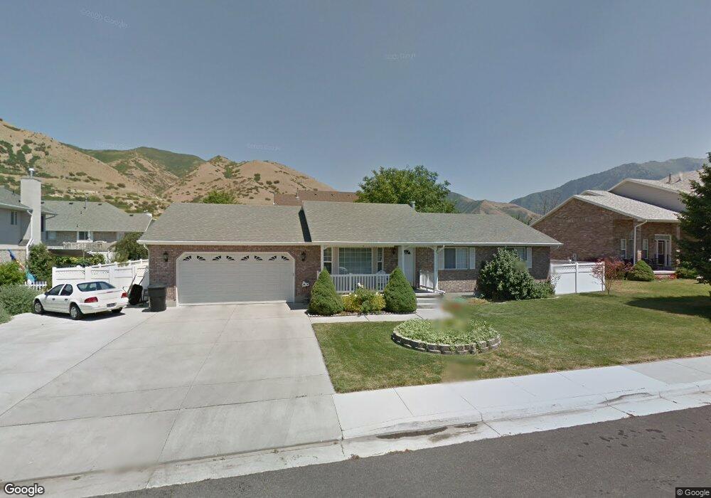
457 S 1680 E Springville, UT 84663
East Hobble Creek NeighborhoodEstimated Value: $523,000 - $710,000
5
Beds
4
Baths
3,039
Sq Ft
$196/Sq Ft
Est. Value
About This Home
This home is located at 457 S 1680 E, Springville, UT 84663 and is currently estimated at $596,239, approximately $196 per square foot. 457 S 1680 E is a home located in Utah County with nearby schools including Brookside School, Springville Junior High School, and Springville High School.
Ownership History
Date
Name
Owned For
Owner Type
Purchase Details
Closed on
May 1, 2023
Sold by
Kirschbaum Trudy S
Bought by
Morris Matthew Tyler and Morris Camilla P
Current Estimated Value
Home Financials for this Owner
Home Financials are based on the most recent Mortgage that was taken out on this home.
Original Mortgage
$522,025
Outstanding Balance
$504,230
Interest Rate
5.25%
Mortgage Type
Construction
Estimated Equity
$92,009
Purchase Details
Closed on
Dec 13, 2022
Sold by
Little Kirsch Trust
Bought by
Kirschbaum Trudy S
Purchase Details
Closed on
Feb 6, 2020
Sold by
Kirschbaum Edwin Scott and Kirschbaum Trudy
Bought by
Kirschbaum Edwin Scott and Kirschbaum Trudy
Create a Home Valuation Report for This Property
The Home Valuation Report is an in-depth analysis detailing your home's value as well as a comparison with similar homes in the area
Home Values in the Area
Average Home Value in this Area
Purchase History
| Date | Buyer | Sale Price | Title Company |
|---|---|---|---|
| Morris Matthew Tyler | -- | Wasatch Land & Title | |
| Kirschbaum Trudy S | -- | Wasatch Land & Title | |
| Kirschbaum Edwin Scott | -- | None Available |
Source: Public Records
Mortgage History
| Date | Status | Borrower | Loan Amount |
|---|---|---|---|
| Open | Morris Matthew Tyler | $522,025 |
Source: Public Records
Tax History
| Year | Tax Paid | Tax Assessment Tax Assessment Total Assessment is a certain percentage of the fair market value that is determined by local assessors to be the total taxable value of land and additions on the property. | Land | Improvement |
|---|---|---|---|---|
| 2025 | $2,451 | $257,510 | -- | -- |
| 2024 | $2,451 | $251,075 | $0 | $0 |
| 2023 | $2,441 | $250,360 | $0 | $0 |
| 2022 | $2,482 | $249,975 | $0 | $0 |
| 2021 | $2,168 | $339,900 | $126,600 | $213,300 |
| 2020 | $1,993 | $302,900 | $101,300 | $201,600 |
| 2019 | $1,948 | $301,400 | $101,300 | $200,100 |
| 2018 | $1,968 | $290,500 | $90,400 | $200,100 |
| 2017 | $1,937 | $151,855 | $0 | $0 |
| 2016 | $1,769 | $136,015 | $0 | $0 |
| 2015 | $1,612 | $126,665 | $0 | $0 |
| 2014 | $1,462 | $114,125 | $0 | $0 |
Source: Public Records
Map
Nearby Homes
- 1548 E 350 S
- 557 S 1470 E
- 1800 Spring Oaks Dr
- 1361 E 400 S
- 1783 E Spring Oaks Dr N Unit 12 & 1
- 52 E 775 S Unit 19
- 2080 Spring Oaks Dr
- 2554 E 350 S Unit 4
- 1518 E Pheasant Run Dr
- 2295 E 700 S Unit 18
- 1185 Hillcrest Dr
- 1062 E 350 S
- 776 S 2200 E Unit 19
- 817 S 2200 E Unit 3
- 949 S 1060 E
- 1206 E 1150 S
- 1220 E 225 N
- 998 E 40 N
- 883 E 700 S
- 1884 Town And Country Rd
Your Personal Tour Guide
Ask me questions while you tour the home.