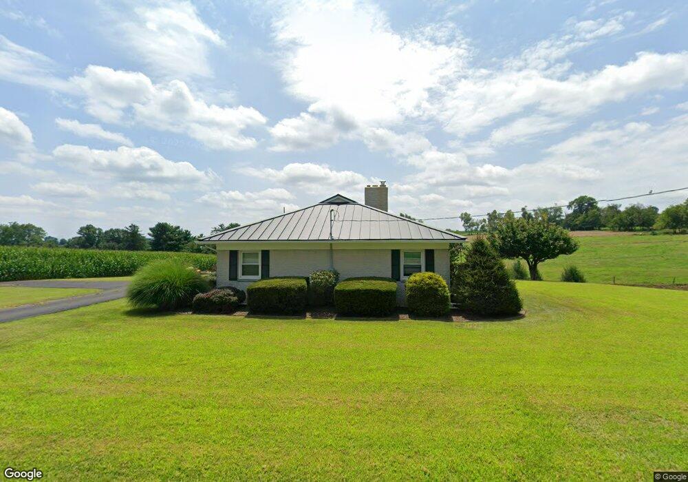
4570 Boyd Rd Brogue, PA 17309
Estimated Value: $300,575 - $340,000
3
Beds
1
Bath
1,848
Sq Ft
$176/Sq Ft
Est. Value
About This Home
This home is located at 4570 Boyd Rd, Brogue, PA 17309 and is currently estimated at $324,894, approximately $175 per square foot. 4570 Boyd Rd is a home located in York County with nearby schools including Clearview Elementary School, Red Lion Area Junior High School, and Red Lion Area Senior High School.
Ownership History
Date
Name
Owned For
Owner Type
Purchase Details
Closed on
Aug 15, 2008
Sold by
Robinson Evelyn B and Gohn Kimberly B
Bought by
Blank Stephen A and Blank Jessie L
Current Estimated Value
Home Financials for this Owner
Home Financials are based on the most recent Mortgage that was taken out on this home.
Original Mortgage
$135,000
Outstanding Balance
$88,908
Interest Rate
6.4%
Mortgage Type
Purchase Money Mortgage
Estimated Equity
$235,986
Purchase Details
Closed on
Jan 8, 1966
Bought by
Robinson Stanley M and Robinson Evelyn B
Create a Home Valuation Report for This Property
The Home Valuation Report is an in-depth analysis detailing your home's value as well as a comparison with similar homes in the area
Home Values in the Area
Average Home Value in this Area
Purchase History
| Date | Buyer | Sale Price | Title Company |
|---|---|---|---|
| Blank Stephen A | $196,000 | None Available | |
| Robinson Stanley M | $400 | -- |
Source: Public Records
Mortgage History
| Date | Status | Borrower | Loan Amount |
|---|---|---|---|
| Open | Blank Stephen A | $135,000 |
Source: Public Records
Tax History Compared to Growth
Tax History
| Year | Tax Paid | Tax Assessment Tax Assessment Total Assessment is a certain percentage of the fair market value that is determined by local assessors to be the total taxable value of land and additions on the property. | Land | Improvement |
|---|---|---|---|---|
| 2025 | $4,702 | $152,860 | $37,340 | $115,520 |
| 2024 | $4,552 | $152,860 | $37,340 | $115,520 |
| 2023 | $4,552 | $152,860 | $37,340 | $115,520 |
| 2022 | $4,552 | $152,860 | $37,340 | $115,520 |
| 2021 | $4,399 | $152,860 | $37,340 | $115,520 |
| 2020 | $4,399 | $152,860 | $37,340 | $115,520 |
| 2019 | $4,384 | $152,860 | $37,340 | $115,520 |
| 2018 | $4,338 | $152,860 | $37,340 | $115,520 |
| 2017 | $4,338 | $152,860 | $37,340 | $115,520 |
| 2016 | $0 | $152,860 | $37,340 | $115,520 |
| 2015 | -- | $152,860 | $37,340 | $115,520 |
| 2014 | -- | $143,900 | $37,340 | $106,560 |
Source: Public Records
Map
Nearby Homes
- 11119 Smith Hollow Rd
- 4360 Battlehill Rd
- 798 Goram Rd
- 10620 Enfield Rd
- 10640 Enfield Rd
- 10400 Enfield Rd
- 4877 Battlehill Rd
- 2659 Furnace Rd
- 3532 L 6 River Rd
- 3641 River Rd
- 9981 Douglas Rd
- 2758 Furnace Rd
- 9980 Douglas Rd
- 5987 River Rd
- 2606 Blymire Rd
- 58 Buck Run Rd
- 474 Bridge Valley Rd
- 621 River Hill Rd
- 367 Bridge Valley Rd
- 1406 Richmond Rd
- 4575 Boyd Rd
- 4565 Boyd Rd
- 1816 Furnace Rd
- 4665 Boyd Rd
- 4645 Boyd Rd
- 1784 Furnace Rd
- 10300 Lockport Rd
- 1997 Furnace Rd
- 1764 Furnace Rd
- 4800 Boyd Rd
- 1760 Furnace Rd
- 2005 Furnace Rd
- 2023 Furnace Rd
- 1744 Furnace Rd
- 2011 Furnace Rd
- 10539 Gum Tree Rd
- 10631 Gum Tree Rd
- 2034 Furnace Rd
- 10759 Pickel Rd
- 4885 Boyd Rd