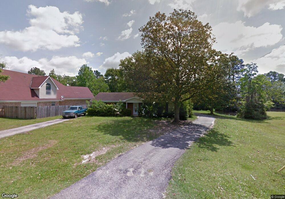
4571 Cypress Cir Mobile, AL 36619
Cypress Shores NeighborhoodEstimated Value: $217,000 - $251,000
3
Beds
2
Baths
1,590
Sq Ft
$148/Sq Ft
Est. Value
About This Home
This home is located at 4571 Cypress Cir, Mobile, AL 36619 and is currently estimated at $235,779, approximately $148 per square foot. 4571 Cypress Cir is a home located in Mobile County with nearby schools including Mary W Burroughs Elementary School, Katherine H Hankins Middle School, and Theodore High School.
Ownership History
Date
Name
Owned For
Owner Type
Purchase Details
Closed on
Sep 18, 2023
Sold by
Raybon Stella
Bought by
Pruett Keith
Current Estimated Value
Home Financials for this Owner
Home Financials are based on the most recent Mortgage that was taken out on this home.
Original Mortgage
$153,655
Outstanding Balance
$150,138
Interest Rate
7.23%
Mortgage Type
FHA
Estimated Equity
$85,641
Purchase Details
Closed on
Feb 10, 2014
Sold by
Pierce Maury P and Pierce Theresa A
Bought by
Raybon J W J and Raybon Stella
Purchase Details
Closed on
Mar 15, 2011
Sold by
Raybon J W J and Raybon Stella W
Bought by
Pierce Maury P and Pierce Theresa A
Purchase Details
Closed on
Jul 11, 2007
Sold by
Andress Ashley M and Andress Amanda F
Bought by
Raybon J W J and Raybon Stella W
Create a Home Valuation Report for This Property
The Home Valuation Report is an in-depth analysis detailing your home's value as well as a comparison with similar homes in the area
Home Values in the Area
Average Home Value in this Area
Purchase History
| Date | Buyer | Sale Price | Title Company |
|---|---|---|---|
| Pruett Keith | $200,000 | None Listed On Document | |
| Raybon J W J | $115,000 | None Available | |
| Pierce Maury P | $12,000 | None Available | |
| Raybon J W J | -- | None Available |
Source: Public Records
Mortgage History
| Date | Status | Borrower | Loan Amount |
|---|---|---|---|
| Open | Pruett Keith | $153,655 |
Source: Public Records
Tax History
| Year | Tax Paid | Tax Assessment Tax Assessment Total Assessment is a certain percentage of the fair market value that is determined by local assessors to be the total taxable value of land and additions on the property. | Land | Improvement |
|---|---|---|---|---|
| 2025 | $1,256 | $20,670 | $5,000 | $15,670 |
| 2024 | $1,256 | $19,950 | $5,000 | $14,950 |
| 2023 | $2,544 | $37,300 | $15,600 | $21,700 |
| 2022 | $2,351 | $37,020 | $15,600 | $21,420 |
| 2021 | $2,308 | $36,340 | $15,600 | $20,740 |
| 2020 | $2,276 | $35,840 | $15,600 | $20,240 |
| 2019 | $2,201 | $34,660 | $15,600 | $19,060 |
| 2018 | $2,176 | $34,260 | $0 | $0 |
| 2017 | $2,221 | $34,980 | $0 | $0 |
| 2016 | $1,883 | $29,660 | $0 | $0 |
| 2013 | $1,872 | $29,260 | $0 | $0 |
Source: Public Records
Map
Nearby Homes
- 4087 Canal Cir E
- 4219 Canal Dr
- 3923 Patricia Dr
- 3914 Blue Gill Cir
- 4301 Sawyer Ave
- 3865 Cypress Shores Dr N
- 4604 Cypress Park Dr
- 0 Audubon Dr Unit 7716268
- 5001 Audubon Dr
- 0 Downey Dr Unit 7684534
- 0 Cypress Business Park Dr Unit 30 372505
- 0 Cypress Business Park Dr Unit 7548657
- 0 Cypress Business Park Dr Unit 7506649
- 4323 Downey Dr
- 3847 Riviere Du Chien Rd
- 0 Higgins Rd Unit 153 371518
- 0 Higgins Rd Unit 7497709
- 0 Higgins Rd Unit 5 384060
- 0 Higgins Rd Unit 7634227
- 3531 Spanish Aly
- 4565 Cypress Shores Dr
- 4575 Cypress Shores Dr
- 26 Cypress Cir Unit 26
- 29 Cypress Cir Unit 29
- 30 Cypress Cir Unit 30
- 24 Cypress Cir Unit 24
- 23 Cypress Cir Unit 23
- 4563 Cypress Shores Dr
- 4581 Cypress Cir
- 4555 Cypress Shores Dr
- 4585 Cypress Cir
- 4550 Cypress Shores Dr
- 4540 Brentwood Dr
- 4225 Emmett Dr
- 4576 Cypress Shores Dr
- 4576 Cypress Shores Dr Unit 9
- 4600 Canal Cir W
- 4541 Cypress Shores Dr
- 4587 Cypress Cir
- 4620 Canal Cir W
Your Personal Tour Guide
Ask me questions while you tour the home.