Estimated Value: $140,386 - $160,000
2
Beds
1
Bath
1,085
Sq Ft
$142/Sq Ft
Est. Value
About This Home
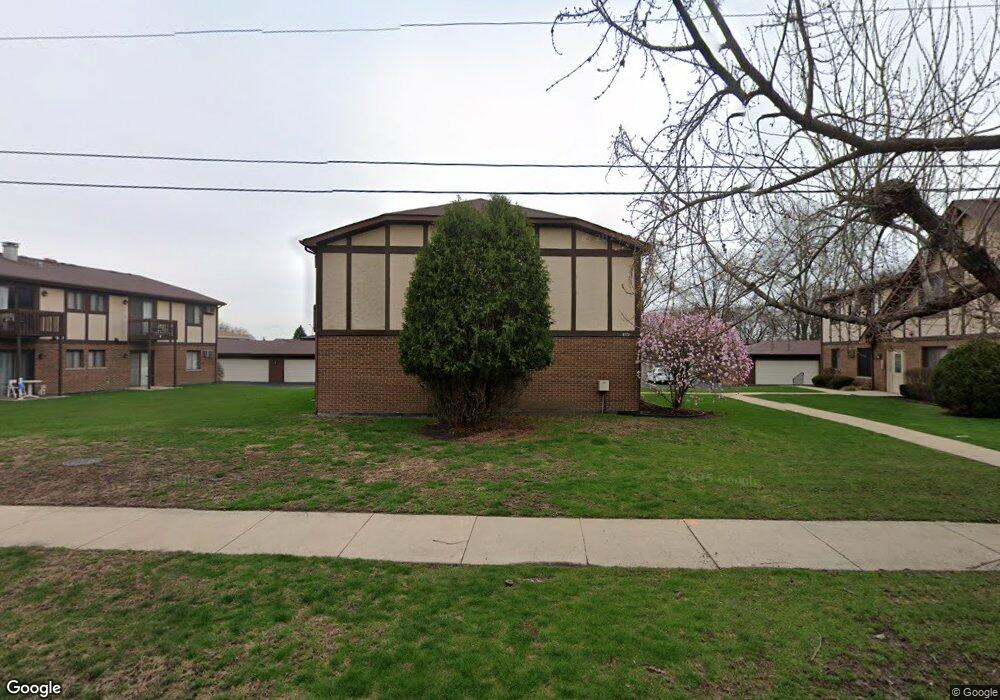
This home is located at 4572 W 131st St Unit 4572, Alsip, IL 60803 and is currently estimated at $154,347, approximately $142 per square foot. 4572 W 131st St Unit 4572 is a home located in Cook County with nearby schools including Nathan Hale Primary School, Nathan Hale Intermediate School, and Nathan Hale Middle School.
Ownership History
Date
Name
Owned For
Owner Type
Purchase Details
Closed on
Nov 12, 2003
Sold by
Walsh Michael E and Walsh Ruthann
Bought by
Snyder Todd B
Current Estimated Value
Home Financials for this Owner
Home Financials are based on the most recent Mortgage that was taken out on this home.
Original Mortgage
$82,400
Interest Rate
5.94%
Mortgage Type
Unknown
Purchase Details
Closed on
Apr 7, 1995
Sold by
Conwell Thomas C
Bought by
Walsh Michael E and Walsh Ruthann
Home Financials for this Owner
Home Financials are based on the most recent Mortgage that was taken out on this home.
Original Mortgage
$67,950
Interest Rate
8.79%
Create a Home Valuation Report for This Property
The Home Valuation Report is an in-depth analysis detailing your home's value as well as a comparison with similar homes in the area
Home Values in the Area
Average Home Value in this Area
Purchase History
| Date | Buyer | Sale Price | Title Company |
|---|---|---|---|
| Snyder Todd B | $103,000 | Ctic | |
| Walsh Michael E | $103,250 | First American Title |
Source: Public Records
Mortgage History
| Date | Status | Borrower | Loan Amount |
|---|---|---|---|
| Previous Owner | Snyder Todd B | $82,400 | |
| Previous Owner | Walsh Michael E | $67,950 |
Source: Public Records
Tax History Compared to Growth
Tax History
| Year | Tax Paid | Tax Assessment Tax Assessment Total Assessment is a certain percentage of the fair market value that is determined by local assessors to be the total taxable value of land and additions on the property. | Land | Improvement |
|---|---|---|---|---|
| 2024 | $2,277 | $9,652 | $1,784 | $7,868 |
| 2023 | $1,288 | $9,652 | $1,784 | $7,868 |
| 2022 | $1,288 | $6,381 | $2,108 | $4,273 |
| 2021 | $1,262 | $6,380 | $2,108 | $4,272 |
| 2020 | $1,325 | $6,380 | $2,108 | $4,272 |
| 2019 | $630 | $4,941 | $1,945 | $2,996 |
| 2018 | $604 | $4,941 | $1,945 | $2,996 |
| 2017 | $641 | $4,941 | $1,945 | $2,996 |
| 2016 | $1,103 | $5,146 | $1,621 | $3,525 |
| 2015 | $1,030 | $5,146 | $1,621 | $3,525 |
| 2014 | $294 | $5,146 | $1,621 | $3,525 |
| 2013 | $2,292 | $8,941 | $1,621 | $7,320 |
Source: Public Records
Map
Nearby Homes
- 13053 S Mcdaniels Ct
- 12738 S Kenneth Ave Unit E
- 12736 S Kenneth Ave Unit 1A
- 12730 S Mcdaniels St
- 4406 W 127th Place
- 4343 W Emerald Way St
- 4336 W Emerald Way St
- 14350 S Pulaski Rd
- 4309 W Park Lane Dr Unit 2B
- 12549 S Tripp Ave
- 12507 S Tripp Ave
- 4120 W 136th St
- 3425 W 135th St
- 4216 W 135th St
- 12417 S Orchard St
- 4920 134th Ct Unit 205
- 4920 134th Ct Unit 206
- 13300 W Circle Drive Pkwy Unit G222
- 4930 134th Ct Unit 312
- 4955 134th Place Unit 2A
- 4572 W 131st St Unit 4572
- 4572 W 131st St Unit 4572
- 4572 W 131st St Unit 4572
- 4572 W 131st St Unit 2S
- 4568 W 131st St Unit 4568
- 4568 W 131st St Unit 4568
- 4568 W 131st St Unit 4568
- 4568 W 131st St Unit 4568
- 4568 W 131st St Unit 1N
- 4568 W 131st St Unit 2S
- 4576 W 131st St Unit 2N
- 4576 W 131st St Unit 4576
- 4576 W 131st St Unit 4576
- 4576 W 131st St Unit 4576
- 4576 W 131st St Unit 4576
- 4405 W 129th St
- 4409 W 129th St
- 4564 W 131st St Unit 4564
- 4564 W 131st St Unit 4564
- 4564 W 131st St Unit 4564