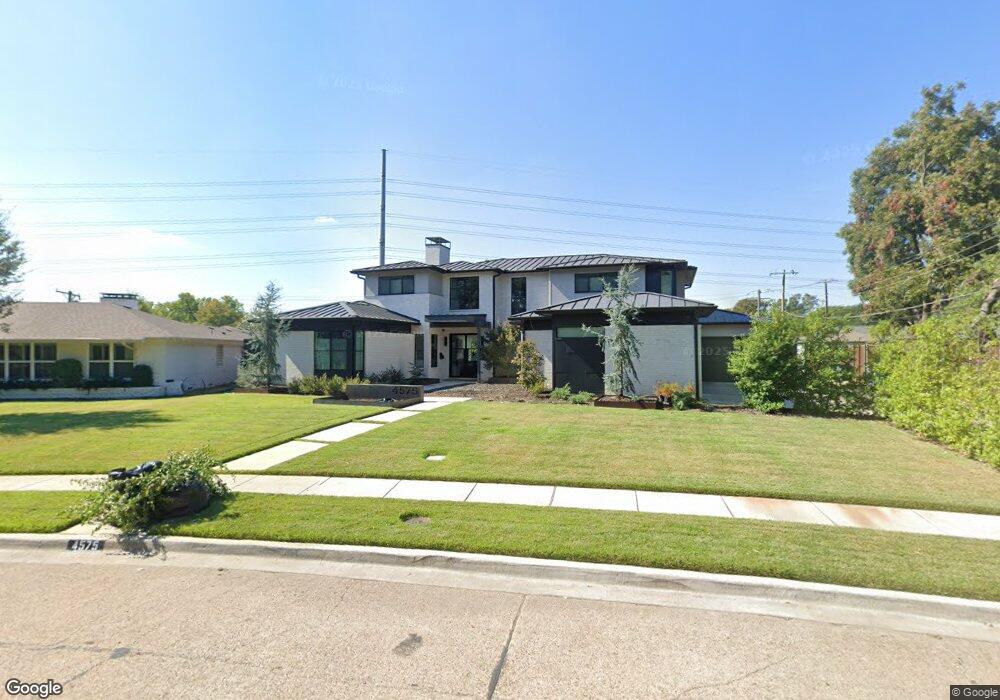
4575 Ashford Dr Dallas, TX 75214
Northeast Dallas NeighborhoodEstimated Value: $741,000 - $2,063,000
5
Beds
5
Baths
3,975
Sq Ft
$402/Sq Ft
Est. Value
About This Home
This home is located at 4575 Ashford Dr, Dallas, TX 75214 and is currently estimated at $1,599,480, approximately $402 per square foot. 4575 Ashford Dr is a home located in Dallas County with nearby schools including Lakewood Elementary School, J L Long Middle School, and Woodrow Wilson High School.
Ownership History
Date
Name
Owned For
Owner Type
Purchase Details
Closed on
Jun 9, 2004
Sold by
Morgan Jaime A
Bought by
Irish James L and Irish Jennifer C
Current Estimated Value
Home Financials for this Owner
Home Financials are based on the most recent Mortgage that was taken out on this home.
Original Mortgage
$120,000
Interest Rate
6.12%
Mortgage Type
Purchase Money Mortgage
Purchase Details
Closed on
Oct 1, 2003
Sold by
Brown Jan Jordan and Jordan Gary Ross
Bought by
Morgan Jaime A
Home Financials for this Owner
Home Financials are based on the most recent Mortgage that was taken out on this home.
Original Mortgage
$216,300
Interest Rate
6.25%
Mortgage Type
VA
Create a Home Valuation Report for This Property
The Home Valuation Report is an in-depth analysis detailing your home's value as well as a comparison with similar homes in the area
Home Values in the Area
Average Home Value in this Area
Purchase History
| Date | Buyer | Sale Price | Title Company |
|---|---|---|---|
| Irish James L | -- | Atc | |
| Morgan Jaime A | -- | -- |
Source: Public Records
Mortgage History
| Date | Status | Borrower | Loan Amount |
|---|---|---|---|
| Closed | Irish James L | $120,000 | |
| Previous Owner | Morgan Jaime A | $216,300 |
Source: Public Records
Tax History Compared to Growth
Tax History
| Year | Tax Paid | Tax Assessment Tax Assessment Total Assessment is a certain percentage of the fair market value that is determined by local assessors to be the total taxable value of land and additions on the property. | Land | Improvement |
|---|---|---|---|---|
| 2025 | $38,666 | $1,857,510 | $667,600 | $1,189,910 |
| 2024 | $38,666 | $1,730,010 | $300,000 | $1,430,010 |
| 2023 | $38,666 | $1,680,150 | $300,000 | $1,380,150 |
| 2022 | $28,307 | $1,132,090 | $300,000 | $832,090 |
| 2021 | $11,295 | $428,160 | $200,000 | $228,160 |
| 2020 | $11,615 | $428,160 | $200,000 | $228,160 |
| 2019 | $11,507 | $404,430 | $200,000 | $204,430 |
| 2018 | $10,997 | $404,430 | $200,000 | $204,430 |
| 2017 | $9,574 | $352,060 | $200,000 | $152,060 |
| 2016 | $9,574 | $352,060 | $200,000 | $152,060 |
| 2015 | $6,327 | $288,070 | $100,000 | $188,070 |
| 2014 | $6,327 | $280,700 | $100,000 | $180,700 |
Source: Public Records
Map
Nearby Homes
- 6537 Patrick Dr
- 6446 Lange Cir
- 6459 Trammel Dr
- 6529 Trammel Dr
- 6527 Axton Cir
- 6415 Axton Ln
- 6711 Vada Dr
- 6474 Sudbury Dr
- 4323 Ashford Dr
- 6720 Braeburn Dr
- 6802 Vada Dr
- 6746 Braeburn Dr
- 6644 Santa Anita Dr
- 6529 Saint Moritz Ave
- 6431 Dunstan Ln
- 6269 Saratoga Cir
- 6660 Santa Anita Dr
- 6305 Annapolis Ln
- 6665 Santa Anita Dr
- 6314 Woodcrest Ln
- 4569 Ashford Dr
- 6522 Patrick Dr
- 6516 Patrick Dr
- 4563 Ashford Dr
- 6506 Patrick Dr
- 6503 Prince St
- 6530 Patrick Dr
- 4557 Ashford Dr
- 6509 Prince St
- 4551 Ashford Dr
- 6521 Patrick Dr
- 6511 Patrick Dr
- 6456 Patrick Dr
- 6515 Prince St
- 6527 Patrick Dr
- 6508 Prince St
- 6540 Patrick Dr
- 6507 Patrick Dr
- 6531 Patrick Dr
- 4545 Ashford Dr