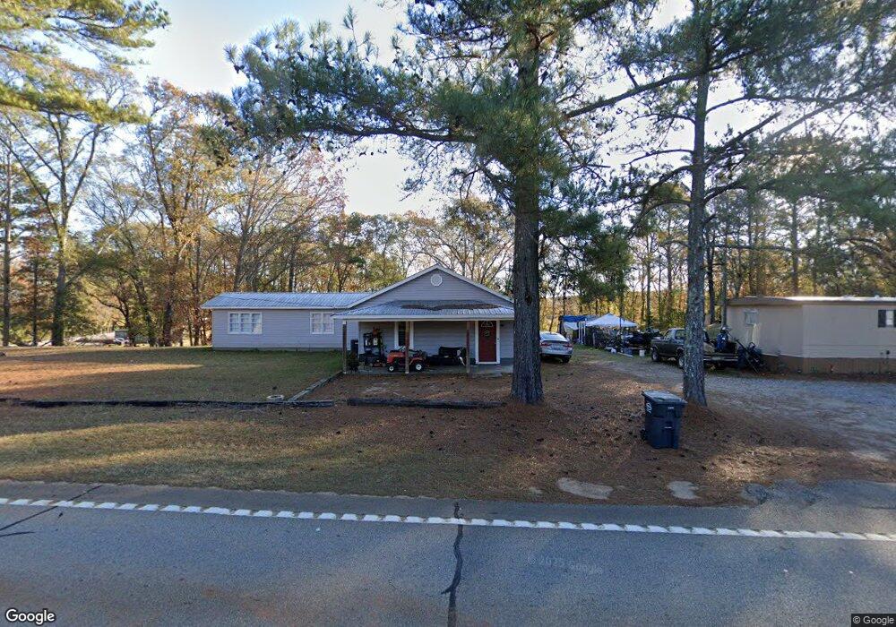
4575 Whitesville Rd Lagrange, GA 30240
Estimated Value: $334,000 - $524,072
3
Beds
3
Baths
2,214
Sq Ft
$206/Sq Ft
Est. Value
About This Home
This home is located at 4575 Whitesville Rd, Lagrange, GA 30240 and is currently estimated at $457,018, approximately $206 per square foot. 4575 Whitesville Rd is a home located in Troup County with nearby schools including Whitesville Road Elementary School, Rosemont Elementary School, and Berta Weathersbee Elementary School.
Ownership History
Date
Name
Owned For
Owner Type
Purchase Details
Closed on
Apr 27, 2004
Sold by
Wells Fargo Bank Na
Bought by
Stuart Lamar
Current Estimated Value
Purchase Details
Closed on
Nov 17, 1999
Sold by
Hazel Stuart
Bought by
Wells Fargo Bank Na
Purchase Details
Closed on
Nov 16, 1999
Sold by
Wade Stuart
Bought by
Hazel Stuart
Purchase Details
Closed on
Feb 1, 1985
Sold by
Wade Lamar Stuart
Bought by
Wade Stuart
Purchase Details
Closed on
Dec 28, 1976
Sold by
Wade Stuart
Bought by
Wade Lamar Stuart
Purchase Details
Closed on
Nov 7, 1972
Bought by
Wade Stuart
Create a Home Valuation Report for This Property
The Home Valuation Report is an in-depth analysis detailing your home's value as well as a comparison with similar homes in the area
Home Values in the Area
Average Home Value in this Area
Purchase History
| Date | Buyer | Sale Price | Title Company |
|---|---|---|---|
| Stuart Lamar | -- | -- | |
| Wells Fargo Bank Na | -- | -- | |
| Hazel Stuart | -- | -- | |
| Wade Stuart | -- | -- | |
| Wade Lamar Stuart | -- | -- | |
| Wade Stuart | -- | -- |
Source: Public Records
Tax History Compared to Growth
Tax History
| Year | Tax Paid | Tax Assessment Tax Assessment Total Assessment is a certain percentage of the fair market value that is determined by local assessors to be the total taxable value of land and additions on the property. | Land | Improvement |
|---|---|---|---|---|
| 2024 | $3,330 | $147,036 | $34,120 | $112,916 |
| 2023 | $2,996 | $134,972 | $34,120 | $100,852 |
| 2022 | $2,937 | $133,372 | $34,120 | $99,252 |
| 2021 | $2,896 | $118,160 | $30,480 | $87,680 |
| 2020 | $2,892 | $118,160 | $30,480 | $87,680 |
| 2019 | $2,648 | $110,240 | $30,480 | $79,760 |
| 2018 | $2,425 | $103,000 | $30,480 | $72,520 |
| 2017 | $2,335 | $103,000 | $30,480 | $72,520 |
| 2016 | $2,361 | $104,007 | $30,494 | $73,513 |
| 2015 | -- | $103,093 | $30,494 | $72,599 |
| 2014 | -- | $89,298 | $30,494 | $58,804 |
| 2013 | -- | $89,298 | $30,494 | $58,804 |
Source: Public Records
Map
Nearby Homes
- 3913 Whitesville Rd
- 1605 Bartley Rd
- 2067 Bartley Rd
- 0 Tomme Rd Unit 10614697
- 311 Tomme Rd
- 2557 Bartley Rd
- 11.59+/- AC Hunt Rd
- 2790 Bartley Rd
- 2964 Whitesville Rd
- 203 Harris Walk Unit 21
- 206 Harris Walk Unit 81
- 201 Harris Walk Unit 20
- 205 Harris Walk
- 207 Harris Walk
- 203 Harris Walk
- 201 Harris Walk
- 208 Harris Walk
- 206 Harris Walk
- 202 Harris Walk
- 204 Harris Walk
- 4539 Whitesville Rd
- 4599 Whitesville Rd
- 4625 Whitesville Rd
- 4513 Whitesville Rd
- 4645 Whitesville Rd
- 4485 Whitesville Rd
- 4683 Whitesville Rd
- 35 Ac - Tract 1 Whitesville Rd
- 4578 Whitesville Rd
- 58 Ac - Tract 2 Whitesville Rd
- 67 Ac - Tract 3 Whitesville Rd
- 52 Ac - Tract 4 Whitesville Rd
- 4371 Whitesville Rd
- 4795 Whitesville Rd
- 4281 Whitesville Rd
- 4855 Whitesville Rd
- 0 Whitesville Rd State 219 Unit 7235262
- 4873 Whitesville Rd
- 4232 Whitesville Rd
- 4899 Whitesville Rd