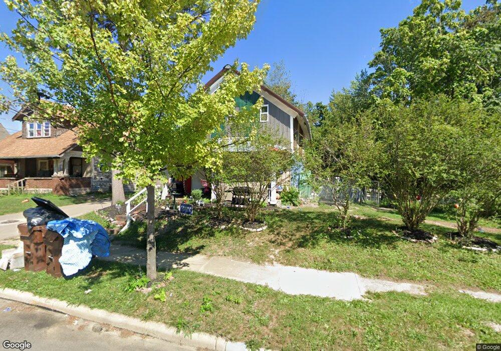
458 N Mulberry St Mansfield, OH 44902
Estimated Value: $70,692 - $79,000
3
Beds
1
Bath
1,155
Sq Ft
$66/Sq Ft
Est. Value
About This Home
This home is located at 458 N Mulberry St, Mansfield, OH 44902 and is currently estimated at $75,673, approximately $65 per square foot. 458 N Mulberry St is a home located in Richland County with nearby schools including Goal Digital Academy, St. Peter's Elementary/Montessori School, and St. Peter's High School/Junior High.
Ownership History
Date
Name
Owned For
Owner Type
Purchase Details
Closed on
Apr 18, 2022
Sold by
David Schunatz
Bought by
Schunatz David and Schunatz Lucinda A
Current Estimated Value
Purchase Details
Closed on
Nov 20, 2019
Sold by
Spognardi William N and Treasurer Of Richland County O
Bought by
Schunatz David
Purchase Details
Closed on
Sep 29, 2005
Sold by
Avery John E and Avery Florine
Bought by
Spognardi William N
Home Financials for this Owner
Home Financials are based on the most recent Mortgage that was taken out on this home.
Original Mortgage
$100,000
Interest Rate
5.93%
Mortgage Type
Purchase Money Mortgage
Purchase Details
Closed on
May 15, 2002
Sold by
Commercial Savings Bank
Bought by
Avery John E and Avery Florine
Home Financials for this Owner
Home Financials are based on the most recent Mortgage that was taken out on this home.
Original Mortgage
$222,142
Interest Rate
7.16%
Mortgage Type
New Conventional
Purchase Details
Closed on
Apr 3, 2002
Sold by
Shrf Billy Phelps Pr
Bought by
The Commercial Savings Bank
Home Financials for this Owner
Home Financials are based on the most recent Mortgage that was taken out on this home.
Original Mortgage
$222,142
Interest Rate
7.16%
Mortgage Type
New Conventional
Purchase Details
Closed on
Feb 3, 1999
Sold by
Balliett Group Inc
Bought by
Phelps Bill and Phelps Olive
Purchase Details
Closed on
Aug 24, 1998
Sold by
Taylor David
Bought by
Kunkel Donald R
Purchase Details
Closed on
Oct 27, 1997
Sold by
Holt Lena
Bought by
Taylor David
Purchase Details
Closed on
May 3, 1996
Sold by
Addai Erica
Bought by
Taylor David
Purchase Details
Closed on
Jun 1, 1985
Create a Home Valuation Report for This Property
The Home Valuation Report is an in-depth analysis detailing your home's value as well as a comparison with similar homes in the area
Home Values in the Area
Average Home Value in this Area
Purchase History
| Date | Buyer | Sale Price | Title Company |
|---|---|---|---|
| Schunatz David | $1,000 | Franco Robert A | |
| Schunatz David | $1,000 | Franco Robert A | |
| Schunatz David | -- | None Available | |
| Spognardi William N | $100,000 | A C S Title | |
| Avery John E | $40,000 | -- | |
| The Commercial Savings Bank | $8,000 | -- | |
| Phelps Bill | $140,000 | -- | |
| Kunkel Donald R | $20,000 | -- | |
| Taylor David | $7,800 | -- | |
| Taylor David | $7,000 | -- | |
| -- | $3,300 | -- |
Source: Public Records
Mortgage History
| Date | Status | Borrower | Loan Amount |
|---|---|---|---|
| Previous Owner | Spognardi William N | $100,000 | |
| Previous Owner | Avery John E | $222,142 |
Source: Public Records
Tax History Compared to Growth
Tax History
| Year | Tax Paid | Tax Assessment Tax Assessment Total Assessment is a certain percentage of the fair market value that is determined by local assessors to be the total taxable value of land and additions on the property. | Land | Improvement |
|---|---|---|---|---|
| 2024 | $91 | $1,910 | $1,510 | $400 |
| 2023 | $91 | $1,910 | $1,510 | $400 |
| 2022 | $95 | $1,660 | $1,370 | $290 |
| 2021 | $96 | $1,660 | $1,370 | $290 |
| 2020 | $98 | $1,660 | $1,370 | $290 |
| 2019 | $314 | $1,660 | $1,370 | $290 |
| 2018 | $107 | $1,660 | $1,370 | $290 |
| 2017 | $159 | $3,370 | $2,040 | $1,330 |
| 2016 | $107 | $1,660 | $640 | $1,020 |
| 2015 | $102 | $1,660 | $640 | $1,020 |
| 2014 | $101 | $1,660 | $640 | $1,020 |
| 2012 | $82 | $1,750 | $680 | $1,070 |
Source: Public Records
Map
Nearby Homes
- 452 Daisy St
- 156 Buckingham Ave Unit 158
- 526 Bowman St
- 371 Bell St
- 283 Bulkley Ave
- 0 Voegele Ave Unit Lot 6048, 6049, 6
- 743 Bowman St
- 426 Mcpherson St
- 169 W 5th St
- 346 Newman St
- 219 W 5th St
- 458 Wayne St
- 362-364 W 6th St
- 282 W 5th St
- 512 Burns St
- 311 Auburn St
- 0 Highway 30
- 82 N Adams St
- 406 Sherman Place
- 328 2nd Ave
- 462 N Mulberry St
- 466 N Mulberry St
- 468 N Mulberry St
- 445 Daisy St
- 439 Daisy St
- 0 N Mulberry St
- 470 N Mulberry St
- 455 Daisy St
- 451 Daisy St
- 472 N Mulberry St
- 463 N Mulberry St
- 467 N Mulberry St
- 107 Harker St
- 463 Daisy St
- 459 Daisy St
- 138 Buckingham Ave
- 475 N Mulberry St
- 84 Orchard St
- 439 N Mulberry St
- 479 N Mulberry St