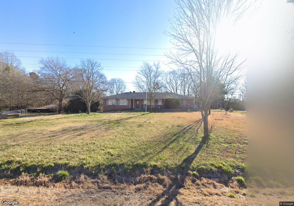
4580 Highway 145 Carnesville, GA 30521
Estimated Value: $266,902 - $378,000
3
Beds
2
Baths
1,655
Sq Ft
$190/Sq Ft
Est. Value
About This Home
This home is located at 4580 Highway 145, Carnesville, GA 30521 and is currently estimated at $313,967, approximately $189 per square foot. 4580 Highway 145 is a home located in Franklin County with nearby schools including Franklin County High School.
Ownership History
Date
Name
Owned For
Owner Type
Purchase Details
Closed on
May 8, 2025
Sold by
Morris Kaela D
Bought by
Burns Kaela D and Burns Ladarius C
Current Estimated Value
Purchase Details
Closed on
Oct 22, 2013
Sold by
Farmer Chad
Bought by
Coles Shelley L
Purchase Details
Closed on
Jul 12, 2013
Sold by
Morris Kaela D
Bought by
Farmer Chad
Purchase Details
Closed on
Apr 1, 2013
Sold by
Morris Kaela D
Bought by
Callahan Michael R
Purchase Details
Closed on
May 18, 2012
Sold by
Morris David Todd
Bought by
Morris Kaela D
Purchase Details
Closed on
May 3, 2004
Sold by
Terry Seth C
Bought by
Morris David Todd
Purchase Details
Closed on
Mar 31, 1998
Bought by
Terry Seth C
Create a Home Valuation Report for This Property
The Home Valuation Report is an in-depth analysis detailing your home's value as well as a comparison with similar homes in the area
Purchase History
| Date | Buyer | Sale Price | Title Company |
|---|---|---|---|
| Burns Kaela D | -- | -- | |
| Coles Shelley L | $8,000 | -- | |
| Farmer Chad | -- | -- | |
| Callahan Michael R | $5,000 | -- | |
| Morris Kaela D | -- | -- | |
| Morris David Todd | $265,000 | -- | |
| Terry Seth C | $150,000 | -- |
Source: Public Records
Tax History
| Year | Tax Paid | Tax Assessment Tax Assessment Total Assessment is a certain percentage of the fair market value that is determined by local assessors to be the total taxable value of land and additions on the property. | Land | Improvement |
|---|---|---|---|---|
| 2025 | $1,818 | $80,681 | $26,979 | $53,702 |
| 2024 | $1,599 | $69,156 | $17,042 | $52,114 |
| 2023 | $1,574 | $63,023 | $15,493 | $47,530 |
| 2022 | $1,388 | $55,808 | $12,434 | $43,374 |
| 2021 | $1,090 | $41,625 | $12,434 | $29,191 |
| 2020 | $853 | $32,689 | $12,434 | $20,255 |
| 2019 | $824 | $32,689 | $12,434 | $20,255 |
| 2018 | $794 | $29,561 | $11,856 | $17,705 |
| 2017 | $826 | $29,561 | $11,856 | $17,705 |
| 2016 | $807 | $27,645 | $11,856 | $15,789 |
| 2015 | -- | $27,644 | $11,856 | $15,789 |
| 2014 | -- | $27,645 | $11,856 | $15,789 |
| 2013 | -- | $48,339 | $17,734 | $30,605 |
Source: Public Records
Map
Nearby Homes
- 5177 Sandy Cross Rd
- 2985 Jackson Bridge Rd
- 33 Andrews Rd
- 555 Hubbard Rd
- 365 Carroll Church Rd
- 2556 Turkey Creek Rd
- 597 Meadow Brook Ln
- 1291 Brays Lake Rd
- 0 New Franklin Church Rd
- 6.98 ACRES New Franklin Church Rd
- 6602 New Franklin Church Rd
- 0 Turkey Creek Rd Unit 10671197
- 0 Turkey Creek Rd Unit 7709794
- 1898 Sandy Cross Rd
- 735 Bowersville Rd
- 9750 Lavonia Rd
- 1350 Noah Crow Rd
- 7 Crest View Cir
- 1320 Burroughs Rd
- 110 Adaline Ct
- 4671 Highway 145
- 4360 Highway 145
- 4344 Highway 145
- 4855 Highway 145
- 5035 Highway 145
- 5035 Highway 145
- 4399 Highway 145
- 4284 Highway 145
- 4850 Highway 145
- 4148 Highway 145
- 4301 Highway 145
- 4270 Highway 145
- 220 Stone Rd
- 4935 Georgia 145
- 4206 Georgia 145
- 4206 Highway 145
- 4211 Georgia 145
- 4211 Highway 145
- 4176 Highway 145
- 4176 Georgia 145