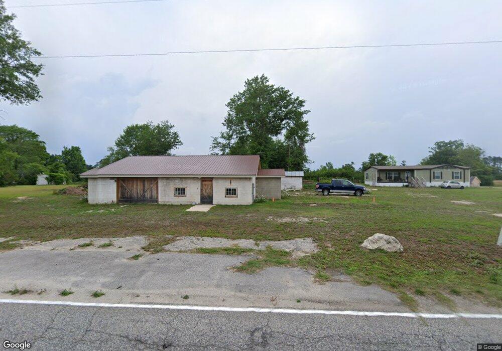
4580 Indian Branch Rd Hartsville, SC 29550
Estimated Value: $84,470 - $201,000
3
Beds
2
Baths
1,160
Sq Ft
$114/Sq Ft
Est. Value
About This Home
This home is located at 4580 Indian Branch Rd, Hartsville, SC 29550 and is currently estimated at $131,868, approximately $113 per square foot. 4580 Indian Branch Rd is a home located in Darlington County with nearby schools including Darlington County Virtual Academy, Hartsville Middle School, and Hartsville High School.
Ownership History
Date
Name
Owned For
Owner Type
Purchase Details
Closed on
Apr 21, 2022
Sold by
Southern Oak Investments Llc
Bought by
Bennett Roger J and Bennett Cora Mae
Current Estimated Value
Purchase Details
Closed on
Feb 24, 2022
Sold by
Lewis Jerry C
Bought by
Southern Oak Investments Soi Llc
Purchase Details
Closed on
Jan 11, 2022
Sold by
Chavis Hobart K
Bought by
Lewis Jerry C
Create a Home Valuation Report for This Property
The Home Valuation Report is an in-depth analysis detailing your home's value as well as a comparison with similar homes in the area
Home Values in the Area
Average Home Value in this Area
Purchase History
| Date | Buyer | Sale Price | Title Company |
|---|---|---|---|
| Bennett Roger J | $23,900 | Copeland Little Law Llc | |
| Southern Oak Investments Soi Llc | $15,000 | Copeland-Little Law Llc | |
| Southern Oak Investments Soi Llc | $15,000 | None Listed On Document | |
| Lewis Jerry C | $1,300 | None Listed On Document |
Source: Public Records
Tax History Compared to Growth
Tax History
| Year | Tax Paid | Tax Assessment Tax Assessment Total Assessment is a certain percentage of the fair market value that is determined by local assessors to be the total taxable value of land and additions on the property. | Land | Improvement |
|---|---|---|---|---|
| 2024 | $113 | $2,300 | $300 | $2,000 |
| 2023 | $574 | $2,300 | $300 | $2,000 |
| 2022 | $574 | $3,450 | $0 | $0 |
| 2021 | $574 | $3,450 | $0 | $0 |
| 2020 | $1,121 | $3,450 | $0 | $0 |
| 2019 | $336 | $2,290 | $0 | $0 |
| 2018 | $322 | $2,150 | $300 | $1,850 |
| 2017 | $299 | $2,150 | $300 | $1,850 |
| 2016 | $259 | $2,150 | $300 | $1,850 |
| 2014 | $304 | $2,150 | $300 | $1,850 |
| 2013 | $234 | $2,150 | $300 | $1,850 |
Source: Public Records
Map
Nearby Homes
- TBD Cherokee Lady St
- 3512 Oates Hwy
- 928 W Lydia Hwy
- 0 Spencer St Unit 20254176
- 2440 Wesley Chapel Rd
- 5273 Indian Branch Rd
- 5279 Indian Branch Rd
- 1345 Fisherman Rd
- 2352 Northcutt Rd
- 2326 Northcutt Rd
- 0 Snow Hill Rd
- 2318 Northcutt Rd
- 2314 Northcutt Rd
- 2308 Northcutt Rd
- 108 San Lin Ave
- 2073 Gum Cir
- 000 Manantial Rd
- 12 Acres Manantial Rd
- TBD Dovetail Rd Unit Lot 4
- TBD Gallowaytown Rd
- 4568 Indian Branch Rd
- 3064 Cherokee Lady St
- 3048 Cherokee Lady St
- 3040 Cherokee Lady St
- 4708 Indian Branch Rd
- 3000 Cherokee Lady St
- 3000 Cherokee Lady St
- 3017 Oates Hwy
- 3061 Oates Hwy
- 100 Mayford Rd
- 3064 Oates Hwy
- 3064 Oates Hwy
- 3002 Oates Hwy
- 3072 Oates Hwy
- 3145 Oates Hwy
- 3149 Oates Hwy
- 4736 Indian Branch Rd
- 2908 Cherokee Lady St Unit 16842
- 4417 Indian Branch Rd
- 501 Mayford Rd