Estimated Value: $140,000 - $150,000
2
Beds
1
Bath
1,085
Sq Ft
$134/Sq Ft
Est. Value
About This Home
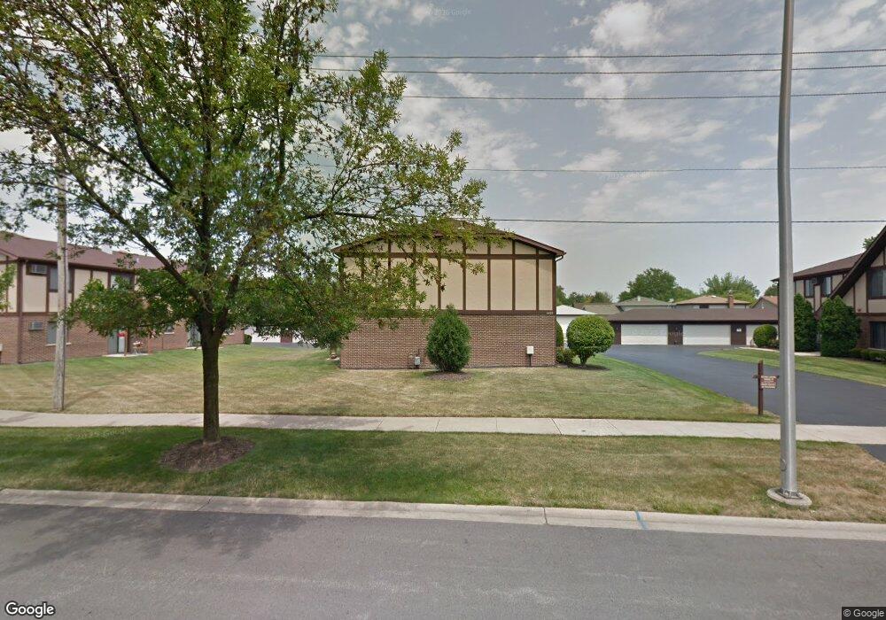
This home is located at 4580 W 131st St Unit 4580, Alsip, IL 60803 and is currently estimated at $145,261, approximately $133 per square foot. 4580 W 131st St Unit 4580 is a home located in Cook County with nearby schools including Nathan Hale Primary School, Nathan Hale Intermediate School, and Nathan Hale Middle School.
Ownership History
Date
Name
Owned For
Owner Type
Purchase Details
Closed on
Aug 14, 2016
Sold by
Duran Suzanne and Duran David V
Bought by
Duran Elizabeth A and Duran David V
Current Estimated Value
Purchase Details
Closed on
Sep 10, 2013
Sold by
Federal National Mortgage Association
Bought by
Duran Suzanne and Duran David V
Purchase Details
Closed on
Jun 21, 2013
Sold by
Cantele Joseph
Bought by
Federal National Mortgage Association
Purchase Details
Closed on
May 13, 2007
Sold by
Abelseth Victor A and Abelseth Christine A
Bought by
Cantele Joseph
Home Financials for this Owner
Home Financials are based on the most recent Mortgage that was taken out on this home.
Original Mortgage
$117,400
Interest Rate
6.21%
Mortgage Type
Unknown
Purchase Details
Closed on
Apr 4, 1996
Sold by
Farrell Michael E and Farrell Carolyn
Bought by
Abelseth Victor A and Abelseth Christine A
Create a Home Valuation Report for This Property
The Home Valuation Report is an in-depth analysis detailing your home's value as well as a comparison with similar homes in the area
Home Values in the Area
Average Home Value in this Area
Purchase History
| Date | Buyer | Sale Price | Title Company |
|---|---|---|---|
| Duran Elizabeth A | -- | None Available | |
| Duran Suzanne | -- | First American Title Insuran | |
| Federal National Mortgage Association | -- | None Available | |
| Cantele Joseph | $118,000 | Pntn | |
| Abelseth Victor A | $80,000 | Attorneys Natl Title Network |
Source: Public Records
Mortgage History
| Date | Status | Borrower | Loan Amount |
|---|---|---|---|
| Previous Owner | Cantele Joseph | $117,400 |
Source: Public Records
Tax History
| Year | Tax Paid | Tax Assessment Tax Assessment Total Assessment is a certain percentage of the fair market value that is determined by local assessors to be the total taxable value of land and additions on the property. | Land | Improvement |
|---|---|---|---|---|
| 2025 | $1,989 | $9,516 | $1,759 | $7,757 |
| 2024 | $1,989 | $9,516 | $1,759 | $7,757 |
| 2023 | $951 | $9,516 | $1,759 | $7,757 |
| 2022 | $951 | $6,291 | $2,078 | $4,213 |
| 2021 | $949 | $6,290 | $2,078 | $4,212 |
| 2020 | $1,038 | $6,290 | $2,078 | $4,212 |
| 2019 | $315 | $4,872 | $1,918 | $2,954 |
| 2018 | $301 | $4,872 | $1,918 | $2,954 |
| 2017 | $1,993 | $4,872 | $1,918 | $2,954 |
| 2016 | $2,113 | $5,073 | $1,598 | $3,475 |
| 2015 | $2,071 | $5,073 | $1,598 | $3,475 |
| 2014 | $2,011 | $5,073 | $1,598 | $3,475 |
| 2013 | $3,202 | $8,815 | $1,598 | $7,217 |
Source: Public Records
Map
Nearby Homes
- 4654 W 131st St Unit 1S
- 12818 S Blossom Dr
- 12769 S Loveland St
- 12738 S Kenneth Ave Unit E
- 4406 W 127th Place
- 4326 W Emerald Way St
- 4343 W Emerald Way St
- 4211 135th St
- 12741 S La Crosse Ave Unit 2B
- 4940 Circle Ct Unit 604
- 5024 Circle Ct Unit 1010
- 3425 W 135th St
- 4216 W 135th St
- 12409 S 44th Ct
- 13300 W Circle Drive Pkwy Unit G222
- 4955 134th Place Unit 3B
- 4955 134th Place Unit 2D
- 4501 W 123rd Place
- 13616 Royal Ct Unit 207
- 13651 S Crawford Ave
- 4580 W 131st St Unit 2N
- 4580 W 131st St Unit 4580
- 4580 W 131st St Unit 4580
- 4580 W 131st St Unit 4580
- 4580 W 131st St Unit 1S
- 4580 W 131st St Unit 1N
- 4584 W 131st St Unit 4584
- 4584 W 131st St Unit 4584
- 4584 W 131st St Unit 4584
- 4584 W 131st St Unit 4584
- 4584 W 131st St Unit 2N
- 4584 W 131st St Unit 1N
- 4576 W 131st St Unit 2N
- 4576 W 131st St Unit 4576
- 4576 W 131st St Unit 4576
- 4576 W 131st St Unit 4576
- 4576 W 131st St Unit 4576
- 4421 W 129th St
- 4417 W 129th St
- 4425 W 129th St