Estimated Value: $130,000 - $153,000
2
Beds
1
Bath
1,085
Sq Ft
$127/Sq Ft
Est. Value
About This Home
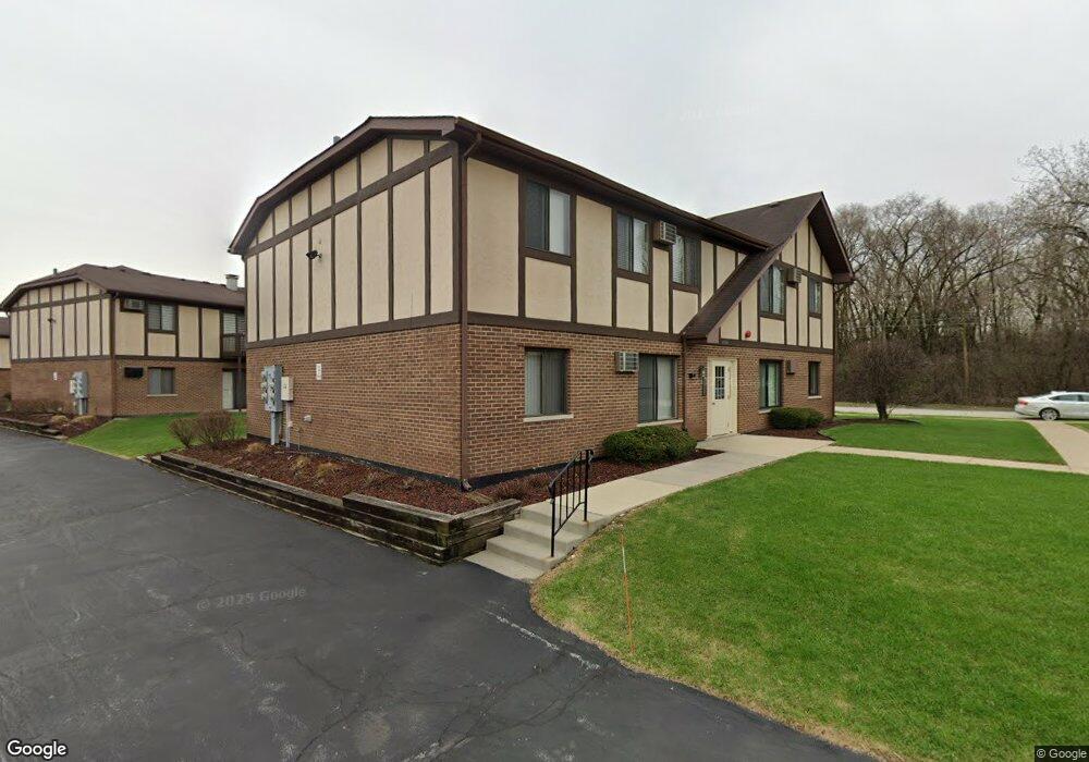
This home is located at 4584 W 131st St Unit 4584, Alsip, IL 60803 and is currently estimated at $137,698, approximately $126 per square foot. 4584 W 131st St Unit 4584 is a home located in Cook County with nearby schools including Nathan Hale Primary School, Nathan Hale Intermediate School, and Nathan Hale Middle School.
Ownership History
Date
Name
Owned For
Owner Type
Purchase Details
Closed on
Nov 18, 2021
Sold by
Reilly Tina
Bought by
Trella Sommer
Current Estimated Value
Purchase Details
Closed on
Mar 31, 2021
Sold by
Reilly Reid
Bought by
Rielly Tina
Purchase Details
Closed on
Apr 30, 2014
Sold by
Reece
Bought by
Reilly Reid
Purchase Details
Closed on
Jul 29, 2005
Sold by
Sliwa Debra L
Bought by
Reece Robert M
Home Financials for this Owner
Home Financials are based on the most recent Mortgage that was taken out on this home.
Original Mortgage
$111,550
Interest Rate
5.82%
Mortgage Type
FHA
Create a Home Valuation Report for This Property
The Home Valuation Report is an in-depth analysis detailing your home's value as well as a comparison with similar homes in the area
Home Values in the Area
Average Home Value in this Area
Purchase History
| Date | Buyer | Sale Price | Title Company |
|---|---|---|---|
| Trella Sommer | $94,000 | Citywide Title Corporation | |
| Rielly Tina | -- | Old Republic Natl Ttl Ins Co | |
| Reilly Reid | $30,000 | None Available | |
| Reece Robert M | $115,000 | First American Title |
Source: Public Records
Mortgage History
| Date | Status | Borrower | Loan Amount |
|---|---|---|---|
| Previous Owner | Reece Robert M | $111,550 |
Source: Public Records
Tax History Compared to Growth
Tax History
| Year | Tax Paid | Tax Assessment Tax Assessment Total Assessment is a certain percentage of the fair market value that is determined by local assessors to be the total taxable value of land and additions on the property. | Land | Improvement |
|---|---|---|---|---|
| 2024 | $2,277 | $9,652 | $1,784 | $7,868 |
| 2023 | $2,776 | $9,652 | $1,784 | $7,868 |
| 2022 | $2,776 | $6,381 | $2,108 | $4,273 |
| 2021 | $2,641 | $6,380 | $2,108 | $4,272 |
| 2020 | $2,579 | $6,380 | $2,108 | $4,272 |
| 2019 | $2,059 | $4,941 | $1,945 | $2,996 |
| 2018 | $1,983 | $4,941 | $1,945 | $2,996 |
| 2017 | $2,021 | $4,941 | $1,945 | $2,996 |
| 2016 | $2,143 | $5,146 | $1,621 | $3,525 |
| 2015 | $1,030 | $5,146 | $1,621 | $3,525 |
| 2014 | $1,022 | $5,146 | $1,621 | $3,525 |
| 2013 | $2,292 | $8,941 | $1,621 | $7,320 |
Source: Public Records
Map
Nearby Homes
- 13053 S Mcdaniels Ct
- 12730 S Mcdaniels St
- 12738 S Kenneth Ave Unit E
- 12736 S Kenneth Ave Unit 1A
- 4406 W 127th Place
- 4343 W Emerald Way St
- 4336 W Emerald Way St
- 14350 S Pulaski Rd
- 4309 W Park Lane Dr Unit 2B
- 12549 S Tripp Ave
- 12507 S Tripp Ave
- 4120 W 136th St
- 4920 134th Ct Unit 205
- 4920 134th Ct Unit 206
- 3425 W 135th St
- 4216 W 135th St
- 12417 S Orchard St
- 13300 W Circle Drive Pkwy Unit G222
- 4930 134th Ct Unit 312
- 4955 134th Place Unit 2A
- 4584 W 131st St Unit 4584
- 4584 W 131st St Unit 4584
- 4584 W 131st St Unit 4584
- 4584 W 131st St Unit 2N
- 4584 W 131st St Unit 1N
- 4580 W 131st St Unit 2N
- 4580 W 131st St Unit 4580
- 4580 W 131st St Unit 4580
- 4580 W 131st St Unit 4580
- 4580 W 131st St Unit 4580
- 4580 W 131st St Unit 1S
- 4580 W 131st St Unit 1N
- 4588 W 131st St Unit N
- 4588 W 131st St Unit 4588
- 4588 W 131st St Unit 4588
- 4588 W 131st St Unit 4588
- 4588 W 131st St Unit 4588
- 4588 W 131st St Unit 1N
- 4588 W 131st St Unit 2N
- 4425 W 129th St