Estimated Value: $356,000 - $382,756
3
Beds
2
Baths
1,722
Sq Ft
$213/Sq Ft
Est. Value
About This Home
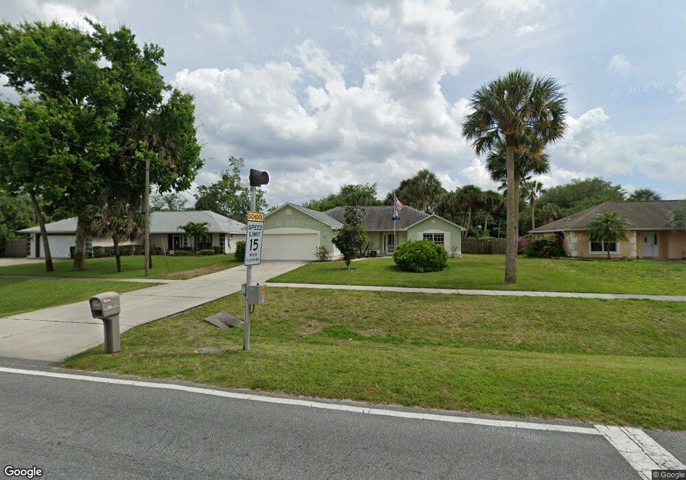
This home is located at 4585 Curtis Blvd, Cocoa, FL 32927 and is currently estimated at $366,439, approximately $212 per square foot. 4585 Curtis Blvd is a home located in Brevard County with nearby schools including Atlantis Elementary School, Space Coast Junior/Senior High School, and Sculptor Charter School.
Ownership History
Date
Name
Owned For
Owner Type
Purchase Details
Closed on
Sep 22, 2003
Sold by
Laschober Gerald
Bought by
Stahl Thomas R and Stahl Noreen R
Current Estimated Value
Home Financials for this Owner
Home Financials are based on the most recent Mortgage that was taken out on this home.
Original Mortgage
$136,800
Outstanding Balance
$58,008
Interest Rate
5%
Estimated Equity
$308,431
Purchase Details
Closed on
Jan 3, 2003
Sold by
Stewart Michael S
Bought by
Laschober Gerald
Home Financials for this Owner
Home Financials are based on the most recent Mortgage that was taken out on this home.
Original Mortgage
$370,800
Interest Rate
6.1%
Purchase Details
Closed on
Jan 13, 1999
Sold by
Deogracias Teresita P and Deogracias Cornelio B
Bought by
Deogracias Teresita P
Create a Home Valuation Report for This Property
The Home Valuation Report is an in-depth analysis detailing your home's value as well as a comparison with similar homes in the area
Home Values in the Area
Average Home Value in this Area
Purchase History
| Date | Buyer | Sale Price | Title Company |
|---|---|---|---|
| Stahl Thomas R | $144,000 | American Pioneer Title | |
| Laschober Gerald | $12,600 | -- | |
| Deogracias Teresita P | -- | -- |
Source: Public Records
Mortgage History
| Date | Status | Borrower | Loan Amount |
|---|---|---|---|
| Open | Stahl Thomas R | $136,800 | |
| Previous Owner | Laschober Gerald | $370,800 |
Source: Public Records
Tax History Compared to Growth
Tax History
| Year | Tax Paid | Tax Assessment Tax Assessment Total Assessment is a certain percentage of the fair market value that is determined by local assessors to be the total taxable value of land and additions on the property. | Land | Improvement |
|---|---|---|---|---|
| 2025 | $2,026 | $158,430 | -- | -- |
| 2024 | $1,366 | $153,970 | -- | -- |
| 2023 | $1,366 | $101,290 | $0 | $0 |
| 2022 | $1,271 | $98,340 | $0 | $0 |
| 2021 | $1,264 | $95,480 | $0 | $0 |
| 2020 | $1,200 | $94,170 | $0 | $0 |
| 2019 | $1,133 | $92,060 | $0 | $0 |
| 2018 | $1,123 | $90,350 | $0 | $0 |
| 2017 | $1,112 | $88,500 | $0 | $0 |
| 2016 | $1,190 | $86,680 | $18,000 | $68,680 |
| 2015 | $1,203 | $86,080 | $15,000 | $71,080 |
| 2014 | $1,203 | $85,400 | $11,000 | $74,400 |
Source: Public Records
Map
Nearby Homes
- 7160 Carlowe Ave
- 7065 Bright Ave
- 7035 Jasmine Ave
- 4390 Everglades St
- 7081 Bayfront Rd
- 4760 Ivan St
- 7155 Ackerman Ave
- 6839 Ackerman Ave
- 4235 Lee Hall Place
- 4550 Flood St
- 7315 Darien Rd
- 4200 Lee Hall Place
- 7350 Barbara Rd
- 7070 Bismarck Rd
- 7450 Calmoso Ave
- 7245 Grissom Pkwy
- 4790 Greenhill St
- 7155 Export Ave
- 3970 Curtis Blvd
- 4688 Fairsun St
- 4575 Curtis Blvd
- 4595 Curtis Blvd
- 6974 Boston Rd
- 6982 Boston Rd
- 4605 Curtis Blvd
- 6966 Boston Rd
- 6990 Boston Rd
- 4590 Curtis Blvd
- 4570 Curtis Blvd
- 4625 Curtis Blvd Unit Port St John Unit 8
- 4625 Curtis Blvd
- 4550 Curtis Blvd
- 4600 Curtis Blvd
- 6989 Boston Rd
- 4535 Curtis Blvd
- 6965 Boston
- 0 Curtis Caliph Dr Unit 768020
- 6955 Caliph Ave
- 7015 Briggs Ave
- 4620 Curtis Blvd