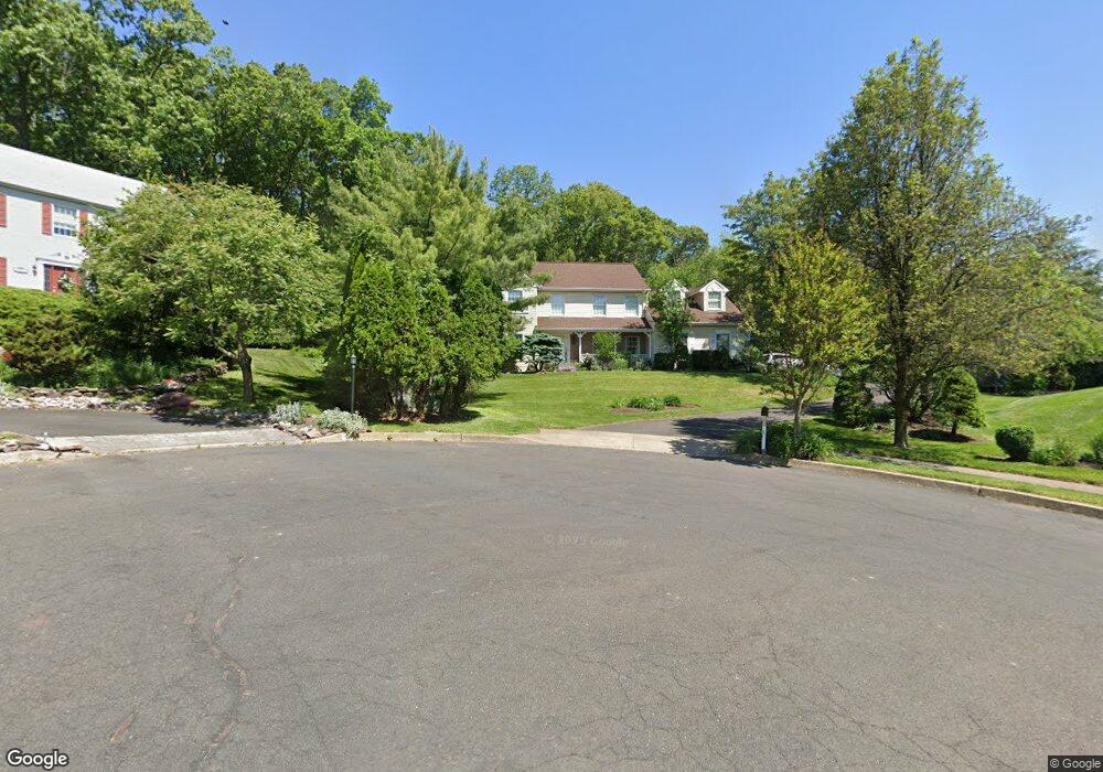
4585 Overlook Cir Doylestown, PA 18902
Estimated Value: $801,000 - $939,000
4
Beds
3
Baths
2,746
Sq Ft
$315/Sq Ft
Est. Value
About This Home
This home is located at 4585 Overlook Cir, Doylestown, PA 18902 and is currently estimated at $865,982, approximately $315 per square foot. 4585 Overlook Cir is a home located in Bucks County with nearby schools including Buckingham Elementary School, Holicong Middle School, and Central Bucks High School - East.
Ownership History
Date
Name
Owned For
Owner Type
Purchase Details
Closed on
Jan 10, 2011
Sold by
Saldon David M and Saldon Antoinette M
Bought by
Frye Kenneth and Frye Lynn
Current Estimated Value
Home Financials for this Owner
Home Financials are based on the most recent Mortgage that was taken out on this home.
Original Mortgage
$356,000
Outstanding Balance
$239,363
Interest Rate
4.88%
Mortgage Type
New Conventional
Estimated Equity
$626,619
Purchase Details
Closed on
Mar 30, 2001
Sold by
Saran G Michael and Saran Caroline I
Bought by
Saldon David M and Saldon Antoinette M
Home Financials for this Owner
Home Financials are based on the most recent Mortgage that was taken out on this home.
Original Mortgage
$275,000
Interest Rate
6.85%
Create a Home Valuation Report for This Property
The Home Valuation Report is an in-depth analysis detailing your home's value as well as a comparison with similar homes in the area
Home Values in the Area
Average Home Value in this Area
Purchase History
| Date | Buyer | Sale Price | Title Company |
|---|---|---|---|
| Frye Kenneth | $445,000 | None Available | |
| Saldon David M | $349,000 | First American Title Ins Co |
Source: Public Records
Mortgage History
| Date | Status | Borrower | Loan Amount |
|---|---|---|---|
| Open | Frye Kenneth | $356,000 | |
| Previous Owner | Saldon David M | $275,000 | |
| Closed | Saldon David M | $24,000 |
Source: Public Records
Tax History
| Year | Tax Paid | Tax Assessment Tax Assessment Total Assessment is a certain percentage of the fair market value that is determined by local assessors to be the total taxable value of land and additions on the property. | Land | Improvement |
|---|---|---|---|---|
| 2025 | $8,818 | $54,160 | $12,800 | $41,360 |
| 2024 | $8,818 | $54,160 | $12,800 | $41,360 |
| 2023 | $8,519 | $54,160 | $12,800 | $41,360 |
| 2022 | $8,417 | $54,160 | $12,800 | $41,360 |
| 2021 | $8,316 | $54,160 | $12,800 | $41,360 |
| 2020 | $8,316 | $54,160 | $12,800 | $41,360 |
| 2019 | $8,262 | $54,160 | $12,800 | $41,360 |
| 2018 | $8,262 | $54,160 | $12,800 | $41,360 |
| 2017 | $8,194 | $54,160 | $12,800 | $41,360 |
| 2016 | $8,276 | $54,160 | $12,800 | $41,360 |
| 2015 | -- | $54,160 | $12,800 | $41,360 |
| 2014 | -- | $54,160 | $12,800 | $41,360 |
Source: Public Records
Map
Nearby Homes
- 2798 Forge Place
- 2918 Snake Hill Rd
- 3039 Durham Rd
- 5025 Anderson Rd
- 3455 & 3479 Durham Rd
- 3889 Robin Rd
- 2980 Yorkshire Rd
- 4203 Greenspire Ln
- 3689 Hancock Ln
- 3775 Buckingham Dr
- 3795 Route 202
- 3468 Holicong Rd
- 5358 York Rd
- 3660 Buttonwood Dr
- 1908 Durham Rd
- 3960 S Mallard Ln
- 117 Windover Ln
- 4448 Lower Mountain Rd
- 6185 Mechanicsville Rd
- 2096 Holicong Rd
- 4590 Overlook Cir
- 2850 W Fox Chase Cir
- 4570 Overlook Cir
- 4565 Overlook Cir
- 2840 W Fox Chase Cir
- 4550 Overlook Cir
- 4545 Overlook Cir
- 2925 Burnt House Hill Rd
- 2903 Burnt House Hill Rd
- 2860 W Fox Chase Cir
- 2830 W Fox Chase Cir
- 4530 Overlook Cir
- 2855 W Fox Chase Cir
- 2877 Burnt House Hill Rd
- 4557 French Dr
- 4561 French Dr
- 4565 French Dr
- 4553 French Dr
- 4525 Overlook Cir
- 2835 W Fox Chase Cir
Your Personal Tour Guide
Ask me questions while you tour the home.