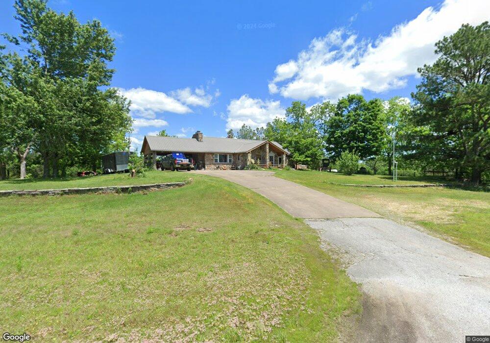
4585 S Highway 27 Marshall, AR 72650
Estimated Value: $242,524 - $364,000
Studio
2
Baths
2,112
Sq Ft
$137/Sq Ft
Est. Value
About This Home
This home is located at 4585 S Highway 27, Marshall, AR 72650 and is currently estimated at $289,381, approximately $137 per square foot. 4585 S Highway 27 is a home located in Searcy County with nearby schools including Marshall Elementary School, Leslie Elementary School, and Marshall High School.
Ownership History
Date
Name
Owned For
Owner Type
Purchase Details
Closed on
Feb 5, 2025
Sold by
Anderson Clarke C and Anderson Cecil C
Bought by
Cecil C Anderson And Donna R Anderson Revocab and Anderson
Current Estimated Value
Purchase Details
Closed on
Oct 11, 2022
Sold by
Anderson Clark C and Anderson Donna Rae
Bought by
Anderson Clark C and Anderson Donna Rae
Purchase Details
Closed on
Mar 19, 2012
Sold by
Hightower Beth
Bought by
Anderson Clarke C and Anderson
Purchase Details
Closed on
Mar 16, 2012
Bought by
Anderson Clarke C and Anderson Donna R
Purchase Details
Closed on
Apr 2, 2004
Bought by
Hightower Beth
Purchase Details
Closed on
Jul 15, 2003
Bought by
Mergler Marilyn and Mergler Layton,Patrici
Purchase Details
Closed on
Jan 4, 1996
Bought by
Mergler Marilyn and Mergler Layton,Patrici
Purchase Details
Closed on
Dec 28, 1995
Bought by
Mergler Marilyn and Mergler Layton,Patrici
Purchase Details
Closed on
Aug 1, 1973
Bought by
Treat
Create a Home Valuation Report for This Property
The Home Valuation Report is an in-depth analysis detailing your home's value as well as a comparison with similar homes in the area
Purchase History
| Date | Buyer | Sale Price | Title Company |
|---|---|---|---|
| Cecil C Anderson And Donna R Anderson Revocab | -- | None Listed On Document | |
| Cecil C Anderson And Donna R Anderson Revocab | -- | None Listed On Document | |
| Anderson Clark C | -- | None Listed On Document | |
| Anderson Clark C | -- | None Listed On Document | |
| Anderson Clarke C | -- | -- | |
| Anderson Clarke C | $120,000 | -- | |
| Hightower Beth | $80,000 | -- | |
| Mergler Marilyn | -- | -- | |
| Mergler Marilyn | -- | -- | |
| Mergler Marilyn | -- | -- | |
| Treat | -- | -- |
Source: Public Records
Tax History
| Year | Tax Paid | Tax Assessment Tax Assessment Total Assessment is a certain percentage of the fair market value that is determined by local assessors to be the total taxable value of land and additions on the property. | Land | Improvement |
|---|---|---|---|---|
| 2025 | $423 | $24,920 | $1,330 | $23,590 |
| 2024 | $495 | $24,920 | $1,330 | $23,590 |
| 2023 | $495 | $24,920 | $1,330 | $23,590 |
| 2022 | $545 | $24,920 | $1,330 | $23,590 |
| 2021 | $542 | $19,240 | $1,060 | $18,180 |
| 2020 | $542 | $19,240 | $1,060 | $18,180 |
| 2019 | $560 | $19,240 | $1,060 | $18,180 |
| 2018 | $585 | $19,240 | $1,060 | $18,180 |
| 2017 | $565 | $19,320 | $1,040 | $18,280 |
| 2016 | $547 | $19,320 | $1,040 | $18,280 |
| 2014 | $733 | $17,190 | $1,040 | $16,150 |
Source: Public Records
Map
Nearby Homes
- 150 Jack Frost Dr
- 00 End Line Rd
- 1141 Wafted Lane Tract 3
- 1141
- 1141 Wafted Lane Tract 4
- 1141 Wafted Lane Tract 1
- 1719 Arkansas 27
- 205 Westwood Dr
- 721 U S 65
- 2040 S Mountain Rd
- 112 Turney Dr
- 582 Canaan Rd
- 603 W Main St
- 200 Dogwood Blvd
- 400 Canaan Rd
- 0 Punkin Flat Rd Unit 25022106
- 0 Punkin Flat Rd Unit 23772165
- 117 S Spring St
- 303 W Campus St
- 111 S Spring St
- 00 Co Rd 99
- 4765 S Highway 27
- 1361 Point Peter Mountain Rd
- 4438 S Highway 27
- 00 E Hwy 14
- 4235 S Highway 27
- 4150 S Highway 27
- 1982 N Highway 333
- 3887 S Highway 27
- 4000 S Hwy 27
- 4000 S Highway 27
- 302 Big Foot Dr
- 5173 S Highway 27
- 5173 S Highway 27
- 5173 S Hwy 27
- 3842 S Highway 27
- 1650 N Highway 333
- 5247 S Highway 27
- 323 Big Foot Dr
- 323 Big Foot Dr
Your Personal Tour Guide
Ask me questions while you tour the home.