Estimated Value: $152,000 - $226,000
--
Bed
1
Bath
1,848
Sq Ft
$100/Sq Ft
Est. Value
About This Home
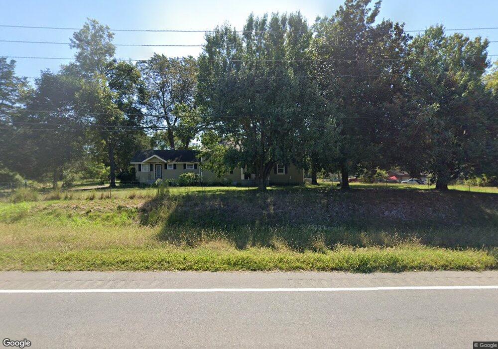
This home is located at 4589 Alabama Hwy SW, Rome, GA 30165 and is currently estimated at $184,790, approximately $99 per square foot. 4589 Alabama Hwy SW is a home located in Floyd County with nearby schools including Coosa Middle School and Coosa High School.
Ownership History
Date
Name
Owned For
Owner Type
Purchase Details
Closed on
Jul 14, 2023
Sold by
Lee Sandra
Bought by
Lee Sandra
Current Estimated Value
Purchase Details
Closed on
Apr 6, 2023
Sold by
Barrett Daniel P
Bought by
Barrett Daniel P and Lee Sandra
Purchase Details
Closed on
Jul 9, 2015
Sold by
Hall Curtis T
Bought by
Barrett Daniel Paul
Home Financials for this Owner
Home Financials are based on the most recent Mortgage that was taken out on this home.
Original Mortgage
$18,000
Interest Rate
4.08%
Mortgage Type
New Conventional
Purchase Details
Closed on
Apr 22, 2015
Sold by
P and R
Bought by
P and R
Purchase Details
Closed on
Dec 19, 2014
Sold by
Hall Frances Smith
Bought by
Hall Curtis T and Worley Deborah H
Purchase Details
Closed on
Sep 24, 1988
Sold by
Baptist Village Inc
Bought by
Hall Frances Smith
Purchase Details
Closed on
Mar 26, 1964
Sold by
Hall Jasper T
Bought by
Baptist Village Inc
Purchase Details
Closed on
Mar 1, 1964
Bought by
Hall Jasper T
Create a Home Valuation Report for This Property
The Home Valuation Report is an in-depth analysis detailing your home's value as well as a comparison with similar homes in the area
Home Values in the Area
Average Home Value in this Area
Purchase History
| Date | Buyer | Sale Price | Title Company |
|---|---|---|---|
| Lee Sandra | -- | -- | |
| Barrett Daniel P | -- | -- | |
| Barrett Daniel Paul | $38,000 | -- | |
| P | -- | -- | |
| Hall Curtis T | -- | -- | |
| Hall Frances Smith | -- | -- | |
| Baptist Village Inc | -- | -- | |
| Hall Jasper T | $4,000 | -- |
Source: Public Records
Mortgage History
| Date | Status | Borrower | Loan Amount |
|---|---|---|---|
| Previous Owner | Barrett Daniel Paul | $18,000 |
Source: Public Records
Tax History Compared to Growth
Tax History
| Year | Tax Paid | Tax Assessment Tax Assessment Total Assessment is a certain percentage of the fair market value that is determined by local assessors to be the total taxable value of land and additions on the property. | Land | Improvement |
|---|---|---|---|---|
| 2024 | $1,619 | $51,427 | $14,467 | $36,960 |
| 2023 | $1,251 | $48,656 | $13,152 | $35,504 |
| 2022 | $1,189 | $40,059 | $10,850 | $29,209 |
| 2021 | $1,052 | $34,863 | $9,875 | $24,988 |
| 2020 | $973 | $31,955 | $8,587 | $23,368 |
| 2019 | $912 | $30,353 | $8,587 | $21,766 |
| 2018 | $852 | $28,325 | $8,179 | $20,146 |
| 2017 | $807 | $26,755 | $7,573 | $19,182 |
| 2016 | $464 | $26,080 | $7,560 | $18,520 |
| 2015 | -- | $18,022 | $7,560 | $10,462 |
| 2014 | -- | $18,022 | $7,560 | $10,462 |
Source: Public Records
Map
Nearby Homes
- 4485 Alabama Hwy
- 8 Kayla Dr NW
- 4813 Alabama Hwy SW
- 10 Nest Dr NW
- 48 Atwood Dr NW
- 1 Ann Dr NW
- 43 Brownlow Dr NW
- 5 Red Fox Dr SW
- 775 Mays Bridge Rd SW
- 33 Cedar Ln NW
- 31 Cedar Ln NW
- 0 Alabama Hwy Unit 10590171
- 0 Alabama Hwy Unit 7635346
- 0 Alabama Hwy Unit 7494552
- 26 Red Fox Dr SW
- 293 N Avery Rd NW
- 86 N Avery Rd NW
- 45 Albert Ave NW
- 458 Kraftsman Rd SW
- 87 Northside Dr NW
- 4565 Alabama Hwy SW
- 4611 Alabama Hwy SW
- 4611 Alabama Hwy SW
- 4814 Alabama Hwy
- 4551 Alabama Hwy SW
- 3 Lake Park Dr NW
- 20 Fairhaven Dr NW
- 2 Lake Park Dr NW
- 18 Fairhaven Dr NW
- 4640 Alabama Hwy NW
- 16 Fairhaven Dr NW
- 26 Fairhaven Dr NW
- 14A Fairhaven Dr NW Unit B
- 23 Fairhaven Dr NW
- 14 Fairhaven Dr NW
- 21 Fairhaven Dr NW
- 28 Fairhaven Dr NW
- 4544 Alabama Hwy NW
- 4 Lake Park Dr NW
- 19 Fairhaven Dr NW