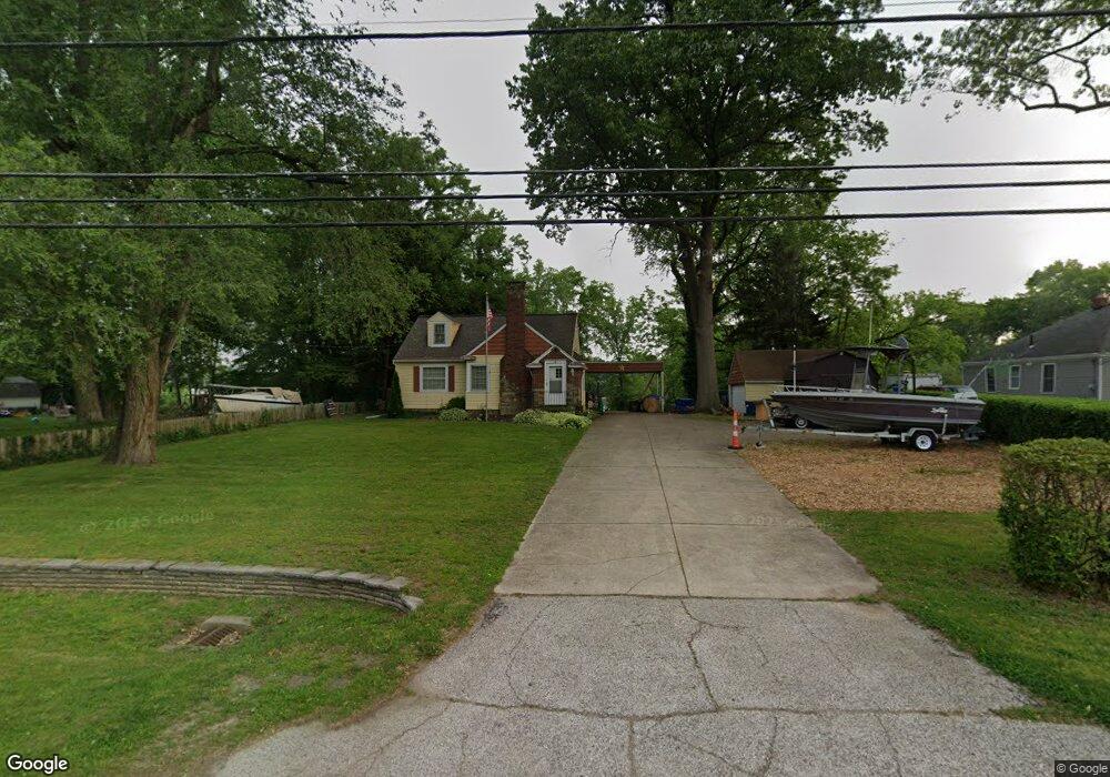
45890 N Ridge Rd Amherst, OH 44001
Estimated Value: $256,000 - $288,000
3
Beds
2
Baths
1,855
Sq Ft
$148/Sq Ft
Est. Value
About This Home
This home is located at 45890 N Ridge Rd, Amherst, OH 44001 and is currently estimated at $275,068, approximately $148 per square foot. 45890 N Ridge Rd is a home located in Lorain County with nearby schools including Powers Elementary School, Walter G. Nord Middle School, and Amherst Junior High School.
Ownership History
Date
Name
Owned For
Owner Type
Purchase Details
Closed on
Mar 15, 2008
Sold by
Anderson Lowell G and Anderson Andrea D
Bought by
Klanac Anna
Current Estimated Value
Home Financials for this Owner
Home Financials are based on the most recent Mortgage that was taken out on this home.
Original Mortgage
$147,584
Outstanding Balance
$91,943
Interest Rate
5.74%
Mortgage Type
FHA
Estimated Equity
$183,125
Purchase Details
Closed on
Nov 29, 2005
Sold by
Harris Mary and Harris James J
Bought by
Anderson Ii Lowell G and Anderson Andrea D
Home Financials for this Owner
Home Financials are based on the most recent Mortgage that was taken out on this home.
Original Mortgage
$86,000
Interest Rate
6.36%
Mortgage Type
Fannie Mae Freddie Mac
Create a Home Valuation Report for This Property
The Home Valuation Report is an in-depth analysis detailing your home's value as well as a comparison with similar homes in the area
Home Values in the Area
Average Home Value in this Area
Purchase History
| Date | Buyer | Sale Price | Title Company |
|---|---|---|---|
| Klanac Anna | $149,900 | Erieview Title Agency | |
| Anderson Ii Lowell G | $125,000 | Lorain County Title Co Inc |
Source: Public Records
Mortgage History
| Date | Status | Borrower | Loan Amount |
|---|---|---|---|
| Open | Klanac Anna | $147,584 | |
| Previous Owner | Anderson Ii Lowell G | $86,000 |
Source: Public Records
Tax History Compared to Growth
Tax History
| Year | Tax Paid | Tax Assessment Tax Assessment Total Assessment is a certain percentage of the fair market value that is determined by local assessors to be the total taxable value of land and additions on the property. | Land | Improvement |
|---|---|---|---|---|
| 2024 | $3,549 | $87,854 | $24,031 | $63,823 |
| 2023 | $3,131 | $65,303 | $17,987 | $47,317 |
| 2022 | $3,001 | $65,303 | $17,987 | $47,317 |
| 2021 | $3,009 | $65,303 | $17,987 | $47,317 |
| 2020 | $2,950 | $56,840 | $15,660 | $41,180 |
| 2019 | $2,891 | $56,840 | $15,660 | $41,180 |
| 2018 | $2,886 | $56,840 | $15,660 | $41,180 |
| 2017 | $2,866 | $52,640 | $13,770 | $38,870 |
| 2016 | $2,889 | $52,640 | $13,770 | $38,870 |
| 2015 | $2,873 | $52,640 | $13,770 | $38,870 |
| 2014 | $2,697 | $49,200 | $12,870 | $36,330 |
| 2013 | $2,706 | $49,200 | $12,870 | $36,330 |
Source: Public Records
Map
Nearby Homes
- 135 Ridgeland Dr
- 8 Riviera Ave
- 60 Flamingo Ave
- 41 Flamingo Ave
- 351 Rockridge Dr
- 117 Caesars Cir
- 127 Tropicana Ave
- 6394 Balsam Dr
- Pine w/ Full Basement Plan at Quarry Creek
- Poplar Plan at Quarry Creek
- 1273 Spruce Tree Ln
- 105 N Woodhill Dr
- 1140 Woodside Dr
- 168 Orchard Hill Dr
- 825 Cleveland Ave
- 726 Sunrise Dr
- 707 Greenlawn Dr
- 922 Sharondale Dr
- 891 Park Ave
- 574 Fieldstone Dr
- 45860 N Ridge Rd
- 45850 N Ridge Rd
- 45920 N Ridge Rd
- V/L North Ridge
- V/L N Ridge Rd
- 45840 N Ridge Rd
- 414 Rock Creek Run
- 45820 N Ridge Rd
- 418 Rock Creek Run
- 410 Rock Creek Run
- 422 Rock Creek Run
- 426 Rock Creek Run
- 430 Rock Creek Run
- 406 High Meadow Rd
- 199 N Leavitt Rd
- 45800 N Ridge Rd
- 432 Rock Creek Run
- 415 Rock Creek Run
- 425 Rock Creek Run
- 412 High Meadow Rd