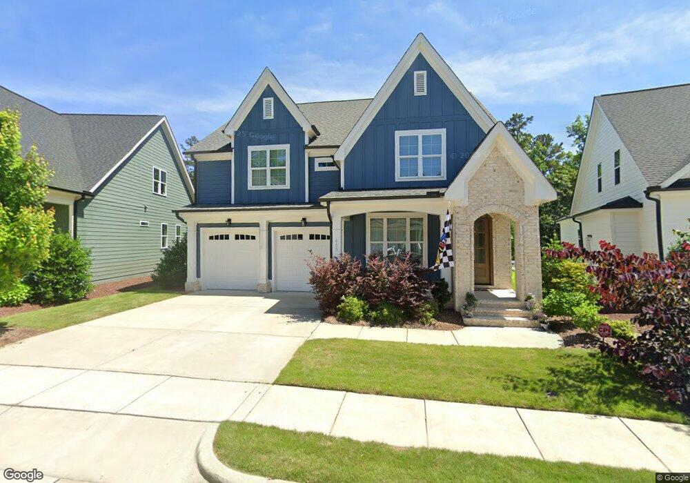
459 Boulder Point Dr Unit Lt1624 Chapel Hill, NC 27516
Estimated Value: $865,938 - $953,000
4
Beds
3
Baths
2,902
Sq Ft
$313/Sq Ft
Est. Value
About This Home
This home is located at 459 Boulder Point Dr Unit Lt1624, Chapel Hill, NC 27516 and is currently estimated at $909,235, approximately $313 per square foot. 459 Boulder Point Dr Unit Lt1624 is a home located in Chatham County with nearby schools including Margaret B. Pollard Middle School and Woods Charter.
Ownership History
Date
Name
Owned For
Owner Type
Purchase Details
Closed on
Feb 17, 2022
Sold by
Rocha and Kamila
Bought by
Rich James Logan and Rich Elyse Susan
Current Estimated Value
Home Financials for this Owner
Home Financials are based on the most recent Mortgage that was taken out on this home.
Original Mortgage
$765,000
Outstanding Balance
$706,215
Interest Rate
3.69%
Mortgage Type
New Conventional
Estimated Equity
$203,020
Purchase Details
Closed on
Oct 26, 2018
Sold by
Homes By Dickerson Inc
Bought by
Rocha Saul and Rocha Kamila
Home Financials for this Owner
Home Financials are based on the most recent Mortgage that was taken out on this home.
Original Mortgage
$473,557
Interest Rate
4.6%
Mortgage Type
New Conventional
Purchase Details
Closed on
May 9, 2018
Sold by
Nnp Briar Chapel Llc
Bought by
Homes By Dickerson Inc
Create a Home Valuation Report for This Property
The Home Valuation Report is an in-depth analysis detailing your home's value as well as a comparison with similar homes in the area
Home Values in the Area
Average Home Value in this Area
Purchase History
| Date | Buyer | Sale Price | Title Company |
|---|---|---|---|
| Rich James Logan | $1,650 | None Listed On Document | |
| Rocha Saul | $592,000 | None Available | |
| Homes By Dickerson Inc | $90,000 | None Available |
Source: Public Records
Mortgage History
| Date | Status | Borrower | Loan Amount |
|---|---|---|---|
| Open | Rich James Logan | $765,000 | |
| Previous Owner | Rocha Saul | $473,557 |
Source: Public Records
Tax History
| Year | Tax Paid | Tax Assessment Tax Assessment Total Assessment is a certain percentage of the fair market value that is determined by local assessors to be the total taxable value of land and additions on the property. | Land | Improvement |
|---|---|---|---|---|
| 2025 | $5,834 | $808,653 | $116,028 | $692,625 |
| 2024 | $5,834 | $476,313 | $110,754 | $365,559 |
| 2023 | $4,200 | $476,313 | $110,754 | $365,559 |
| 2022 | $3,855 | $476,313 | $110,754 | $365,559 |
| 2021 | $0 | $476,313 | $110,754 | $365,559 |
| 2020 | $3,308 | $452,414 | $90,000 | $362,414 |
| 2019 | $3,645 | $452,414 | $90,000 | $362,414 |
| 2018 | $592 | $452,414 | $90,000 | $362,414 |
| 2017 | $0 | $45,000 | $45,000 | $0 |
Source: Public Records
Map
Nearby Homes
- 601 Boulder Point Dr
- 174 Bluffwood Ave
- 70 Bluffwood Ave
- 13 Boone St
- 105 Coventry Ln
- 90 Pulaski Trail
- 153 Abercorn Cir
- 140 Noble Reserve Way
- 45 Post Oak Rd
- 78 Scott Ridge Dr
- 572 Beacon Ridge Blvd
- 562 Beacon Ridge Blvd
- 339 Lila Dr
- 405 Lila Dr
- 85 Noble Reserve Way
- 441 Lila Dr
- 504 Beacon Ridge Blvd
- 473 Lila Dr
- 183 Post Oak Rd
- 346 Lila Dr
- 459 Boulder Point Dr
- 469 Boulder Point Dr Unit Lt1623
- 449 Boulder Point Dr Unit Lt1625
- 443 Boulder Point Dr Unit Lt1626
- 431 Boulder Point Dr
- 431 Boulder Point Dr Unit Lt1627
- 419 Boulder Point Dr
- 513 Boulder Point Dr Unit Lt1622
- 405 Boulder Point Dr
- 533 Boulder Point Dr Unit Lt1621
- 553 Boulder Point Dr Unit Lt1620
- 182 Logbridge Rd Unit Lt1828
- 189 Logbridge Rd
- 153 Logbridge Rd
- 138 Logbridge Rd
- 167 Logbridge Rd Unit Lt1909
- 189 Logbridge Rd Unit Lt1907
- 146 Logbridge Rd Unit Lt1824
- 156 Logbridge Rd Unit Lt1825
- 174 Logbridge Rd Unit Lt1827
Your Personal Tour Guide
Ask me questions while you tour the home.