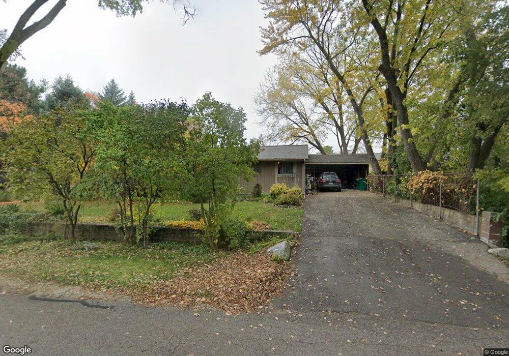
459 Dupont Ave Ypsilanti, MI 48197
Estimated Value: $291,000 - $355,000
3
Beds
3
Baths
2,212
Sq Ft
$147/Sq Ft
Est. Value
About This Home
This home is located at 459 Dupont Ave, Ypsilanti, MI 48197 and is currently estimated at $325,465, approximately $147 per square foot. 459 Dupont Ave is a home located in Washtenaw County with nearby schools including Estabrook Elementary School, Holmes Elementary School, and Erickson Elementary School.
Ownership History
Date
Name
Owned For
Owner Type
Purchase Details
Closed on
Jul 11, 2008
Sold by
Buker Dawn and Buker Dawn M
Bought by
Carruth Hayden K and Carruth Sylvia J
Current Estimated Value
Home Financials for this Owner
Home Financials are based on the most recent Mortgage that was taken out on this home.
Original Mortgage
$164,912
Outstanding Balance
$106,551
Interest Rate
6.1%
Mortgage Type
FHA
Estimated Equity
$218,914
Create a Home Valuation Report for This Property
The Home Valuation Report is an in-depth analysis detailing your home's value as well as a comparison with similar homes in the area
Home Values in the Area
Average Home Value in this Area
Purchase History
| Date | Buyer | Sale Price | Title Company |
|---|---|---|---|
| Carruth Hayden K | $167,500 | None Available |
Source: Public Records
Mortgage History
| Date | Status | Borrower | Loan Amount |
|---|---|---|---|
| Open | Carruth Hayden K | $164,912 |
Source: Public Records
Tax History Compared to Growth
Tax History
| Year | Tax Paid | Tax Assessment Tax Assessment Total Assessment is a certain percentage of the fair market value that is determined by local assessors to be the total taxable value of land and additions on the property. | Land | Improvement |
|---|---|---|---|---|
| 2025 | -- | $179,100 | $0 | $0 |
| 2024 | -- | $165,700 | $0 | $0 |
| 2023 | -- | $140,700 | $0 | $0 |
| 2022 | $0 | $121,800 | $0 | $0 |
| 2021 | $2,121 | $113,200 | $0 | $0 |
| 2020 | $3,448 | $107,700 | $0 | $0 |
| 2019 | $1,329 | $98,900 | $98,900 | $0 |
| 2018 | $0 | $93,900 | $0 | $0 |
| 2017 | $3,017 | $89,200 | $0 | $0 |
| 2016 | $1,881 | $63,398 | $0 | $0 |
| 2015 | $2,796 | $63,209 | $0 | $0 |
| 2014 | $2,796 | $61,235 | $0 | $0 |
| 2013 | -- | $61,235 | $0 | $0 |
Source: Public Records
Map
Nearby Homes
- 550 Brookside St
- 2600 Collegewood St
- 2564 Collegewood St
- 259 Elmhurst Ave
- 2434 Harding Ave
- 2432 Harding Ave
- 224 N Hewitt Rd
- 2002 Midvale Ave
- 2514 Carlton Dr
- 1481 E Chateau Vert St
- 3819 Beech Dr
- 2017 Harding Ave
- 2418 Draper Ave
- 1817 Burns Ave
- 1636 Washtenaw Ave
- 1621 Whittier Rd
- 3995 Helen Ave
- 2180 Ellsworth Rd
- 1493 Ainsley St
- 4139 Persimmon Dr
- 3110 Southlawn St
- 477 Dupont Ave
- 1 Southlawn
- 458 Dupont Ave
- 464 Dupont Ave
- 454 Dupont Ave
- 483 Dupont Ave
- 476 Dupont Ave
- 3127 Southlawn St
- 2811 Golfside Rd
- 3109 Southlawn St
- 495 Dupont Ave
- 3075 Southlawn St
- 2955 Golfside Rd
- 3041 Southlawn St
- 503 Dupont Ave
- 488 Dupont Ave
- 461 Rice Ave
- 3016 Southlawn St
- 465 Rice Ave