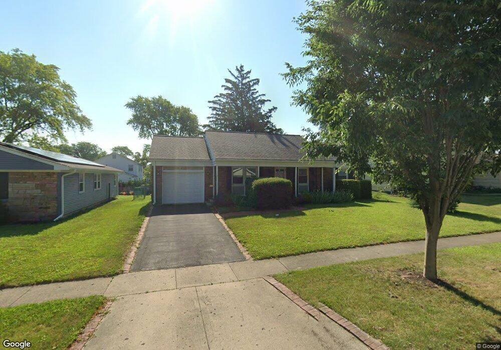
459 Forestway Dr Buffalo Grove, IL 60089
South Buffalo Grove NeighborhoodEstimated Value: $379,614 - $448,000
3
Beds
1
Bath
1,284
Sq Ft
$326/Sq Ft
Est. Value
About This Home
This home is located at 459 Forestway Dr, Buffalo Grove, IL 60089 and is currently estimated at $418,404, approximately $325 per square foot. 459 Forestway Dr is a home located in Cook County with nearby schools including Henry W Longfellow Elementary School, Cooper Middle School, and Buffalo Grove High School.
Ownership History
Date
Name
Owned For
Owner Type
Purchase Details
Closed on
Apr 16, 2004
Sold by
Rosen Robert J
Bought by
West Eric T
Current Estimated Value
Home Financials for this Owner
Home Financials are based on the most recent Mortgage that was taken out on this home.
Original Mortgage
$214,800
Outstanding Balance
$95,483
Interest Rate
4.87%
Mortgage Type
New Conventional
Estimated Equity
$322,921
Purchase Details
Closed on
Jan 14, 1997
Sold by
Treleaven Michael W and Treleaven Patrice N
Bought by
Rosen Robert J
Home Financials for this Owner
Home Financials are based on the most recent Mortgage that was taken out on this home.
Original Mortgage
$90,000
Interest Rate
7.54%
Mortgage Type
Balloon
Create a Home Valuation Report for This Property
The Home Valuation Report is an in-depth analysis detailing your home's value as well as a comparison with similar homes in the area
Home Values in the Area
Average Home Value in this Area
Purchase History
| Date | Buyer | Sale Price | Title Company |
|---|---|---|---|
| West Eric T | $268,500 | Ticor Title Insurance | |
| Rosen Robert J | $160,000 | Attorneys Natl Title Network |
Source: Public Records
Mortgage History
| Date | Status | Borrower | Loan Amount |
|---|---|---|---|
| Open | West Eric T | $214,800 | |
| Previous Owner | Rosen Robert J | $90,000 |
Source: Public Records
Tax History Compared to Growth
Tax History
| Year | Tax Paid | Tax Assessment Tax Assessment Total Assessment is a certain percentage of the fair market value that is determined by local assessors to be the total taxable value of land and additions on the property. | Land | Improvement |
|---|---|---|---|---|
| 2024 | $7,581 | $27,000 | $6,930 | $20,070 |
| 2023 | $7,261 | $27,000 | $6,930 | $20,070 |
| 2022 | $7,261 | $27,000 | $6,930 | $20,070 |
| 2021 | $7,977 | $25,910 | $4,427 | $21,483 |
| 2020 | $7,841 | $25,910 | $4,427 | $21,483 |
| 2019 | $7,832 | $28,726 | $4,427 | $24,299 |
| 2018 | $5,873 | $20,490 | $3,850 | $16,640 |
| 2017 | $5,786 | $20,490 | $3,850 | $16,640 |
| 2016 | $5,651 | $20,490 | $3,850 | $16,640 |
| 2015 | $5,587 | $19,070 | $3,272 | $15,798 |
| 2014 | $5,513 | $19,070 | $3,272 | $15,798 |
| 2013 | $5,078 | $19,070 | $3,272 | $15,798 |
Source: Public Records
Map
Nearby Homes
- 921 Bernard Dr
- 859 Beechwood Rd
- 571 Estate Dr
- 535 Estate Dr
- 720 Weidner Rd Unit 302
- 705 Grove Dr Unit 101
- 820 Weidner Rd Unit 4013
- 820 Weidner Rd Unit 409
- 669 White Pine Rd
- 715 W Whiting Ln
- 751 W Happfield Dr Unit 30
- 715 W Happfield Dr
- 812 W Whiting Ln
- 811 W Nichols Rd
- 665 Thornwood Dr
- 310 Rosewood Ave
- 18 E Heritage Ct
- 3451 N Carriageway Dr Unit 503
- 1115 Miller Ln Unit 104
- 3227 N Heritage Ln
- 467 Forestway Dr
- 441 Forestway Dr
- 462 Longwood Dr
- 426 Regent Dr
- 481 Forestway Dr
- 462 Forestway Dr
- 450 Forestway Dr
- 474 Forestway Dr
- 436 Forestway Dr Unit 2
- 480 Longwood Dr
- 497 Forestway Dr
- 423 Regent Dr
- 484 Forestway Dr
- 422 Forestway Dr
- 425 Regent Dr
- 419 Regent Dr
- 469 Longwood Dr
- 509 Forestway Dr
- 427 Regent Dr
- 488 Longwood Dr