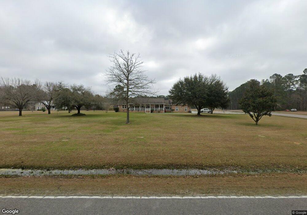
459 Lazy Hill Rd Moncks Corner, SC 29461
Estimated Value: $440,000 - $724,516
3
Beds
3
Baths
1,887
Sq Ft
$310/Sq Ft
Est. Value
About This Home
This home is located at 459 Lazy Hill Rd, Moncks Corner, SC 29461 and is currently estimated at $585,879, approximately $310 per square foot. 459 Lazy Hill Rd is a home located in Berkeley County with nearby schools including Whitesville Elementary School, Berkeley Middle School, and Berkeley High School.
Ownership History
Date
Name
Owned For
Owner Type
Purchase Details
Closed on
Jan 27, 2011
Sold by
Tpf & Ldc Llc
Bought by
Owens Jr James Thedford and Thompkins Casey
Current Estimated Value
Home Financials for this Owner
Home Financials are based on the most recent Mortgage that was taken out on this home.
Original Mortgage
$33,000
Interest Rate
4.79%
Mortgage Type
Seller Take Back
Create a Home Valuation Report for This Property
The Home Valuation Report is an in-depth analysis detailing your home's value as well as a comparison with similar homes in the area
Home Values in the Area
Average Home Value in this Area
Purchase History
| Date | Buyer | Sale Price | Title Company |
|---|---|---|---|
| Owens Jr James Thedford | $33,000 | -- |
Source: Public Records
Mortgage History
| Date | Status | Borrower | Loan Amount |
|---|---|---|---|
| Closed | Owens Jr James Thedford | $33,000 |
Source: Public Records
Tax History Compared to Growth
Tax History
| Year | Tax Paid | Tax Assessment Tax Assessment Total Assessment is a certain percentage of the fair market value that is determined by local assessors to be the total taxable value of land and additions on the property. | Land | Improvement |
|---|---|---|---|---|
| 2025 | $1,602 | $430,109 | $156,485 | $273,624 |
| 2024 | $1,540 | $17,204 | $6,259 | $10,945 |
| 2023 | $1,540 | $17,204 | $6,259 | $10,945 |
| 2022 | $1,358 | $13,267 | $4,188 | $9,079 |
| 2021 | $1,393 | $13,270 | $4,188 | $9,079 |
| 2020 | $1,412 | $13,267 | $4,188 | $9,079 |
| 2019 | $1,605 | $13,267 | $4,188 | $9,079 |
| 2018 | $1,474 | $11,536 | $3,112 | $8,424 |
| 2017 | $1,395 | $11,536 | $3,112 | $8,424 |
| 2016 | $1,430 | $11,530 | $3,110 | $8,420 |
| 2015 | $1,312 | $11,530 | $3,110 | $8,420 |
| 2014 | $1,293 | $11,530 | $3,110 | $8,420 |
| 2013 | -- | $11,530 | $3,110 | $8,420 |
Source: Public Records
Map
Nearby Homes
- 607 Lazy Hill Rd
- 240 Groomsville Rd
- Emerson Plan at High Point at Foxbank
- 508 Eagleview Dr
- 420 Eagleview Dr
- 312 Red Leaf Blvd
- 117 Forest Springs Rd
- 221 Old Grove Ave
- 519 Eagleview Dr
- 327 Hillman Trail Dr
- 661 Black Pine Rd
- 293 Red Leaf Blvd
- 659 Black Pine Rd
- 655 Black Pine Rd
- 627 Black Pine Rd
- 332 Southern Sugar Ave
- 575 Pendleton Dr
- 141 Ancestry Ln
- 193 Cypress Forest Dr
- 342 Silverleaf Ln
- 449 Lazy Hill Rd
- 103 New Oak Ln
- 501 Lazy Hill Rd
- 122 Deer Track Ln
- 116 New Oak Ln
- 111 New Oak Ln
- 0 New Oak Ln Unit 9284139
- 0 New Oak Ln Unit 9305196
- 0 New Oak Ln Unit 9174943
- 0 New Oak Ln Unit 9284140
- 0 New Oak Ln Unit 9305197
- 0 New Oak Ln Unit 9174944
- 0 New Oak Ln Unit 9509022
- 0 New Oak Ln Unit 9600712
- 0 New Oak Ln Unit 9174923
- 0 New Oak Ln Unit 9174922
- 0 New Oak Ln Unit 9701583
- 0 New Oak Ln Unit 9415425
- 0 New Oak Ln Unit 9415426
- 0 New Oak Ln Unit 9058602