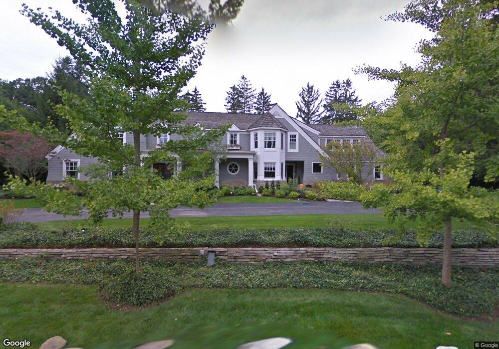
459 Martell Dr Bloomfield Hills, MI 48304
Estimated Value: $3,960,276 - $5,349,000
4
Beds
6
Baths
8,451
Sq Ft
$554/Sq Ft
Est. Value
About This Home
This home is located at 459 Martell Dr, Bloomfield Hills, MI 48304 and is currently estimated at $4,678,092, approximately $553 per square foot. 459 Martell Dr is a home located in Oakland County with nearby schools including Way Elementary School, South Hills Middle School, and Bloomfield Hills High School.
Ownership History
Date
Name
Owned For
Owner Type
Purchase Details
Closed on
Aug 15, 2005
Sold by
Sherwood Patrick J and Sherwood Jill M
Bought by
The Orchard Lake Property Trust
Current Estimated Value
Purchase Details
Closed on
Aug 15, 2001
Sold by
Snell Sheridan F
Bought by
Sherwood Patrick J
Home Financials for this Owner
Home Financials are based on the most recent Mortgage that was taken out on this home.
Original Mortgage
$2,480,000
Interest Rate
6.69%
Purchase Details
Closed on
Jan 10, 1997
Sold by
O'Connell Robert T
Bought by
Snell Sheridan F
Home Financials for this Owner
Home Financials are based on the most recent Mortgage that was taken out on this home.
Original Mortgage
$800,000
Interest Rate
7.66%
Create a Home Valuation Report for This Property
The Home Valuation Report is an in-depth analysis detailing your home's value as well as a comparison with similar homes in the area
Home Values in the Area
Average Home Value in this Area
Purchase History
| Date | Buyer | Sale Price | Title Company |
|---|---|---|---|
| The Orchard Lake Property Trust | -- | Cambridge Title Company Llc | |
| Sherwood Patrick J | -- | -- | |
| Snell Sheridan F | -- | -- |
Source: Public Records
Mortgage History
| Date | Status | Borrower | Loan Amount |
|---|---|---|---|
| Previous Owner | Sherwood Patrick J | $2,480,000 | |
| Previous Owner | Snell Sheridan F | $800,000 |
Source: Public Records
Tax History Compared to Growth
Tax History
| Year | Tax Paid | Tax Assessment Tax Assessment Total Assessment is a certain percentage of the fair market value that is determined by local assessors to be the total taxable value of land and additions on the property. | Land | Improvement |
|---|---|---|---|---|
| 2024 | $40,640 | $1,875,310 | $0 | $0 |
| 2023 | $38,741 | $1,729,080 | $0 | $0 |
| 2022 | $49,611 | $1,708,360 | $0 | $0 |
| 2021 | $47,195 | $1,701,130 | $0 | $0 |
| 2020 | $34,484 | $1,650,840 | $0 | $0 |
| 2019 | $43,935 | $1,640,360 | $0 | $0 |
| 2018 | $42,956 | $1,482,410 | $0 | $0 |
| 2017 | $42,282 | $1,375,820 | $0 | $0 |
| 2016 | $41,841 | $1,271,820 | $0 | $0 |
| 2015 | -- | $1,180,970 | $0 | $0 |
| 2014 | -- | $1,042,550 | $0 | $0 |
| 2011 | -- | $916,240 | $0 | $0 |
Source: Public Records
Map
Nearby Homes
- 270 Martell Dr
- 596 Rudgate Rd
- 692 Bennington Dr
- 341 Keswick Rd
- 931 Vaughan Rd
- 1348 Charrington Rd
- 362 Keswick Rd
- 60 Kingsley Manor Dr
- 275 Barden Rd
- 1287 Charrington Rd
- 3673 York Ct
- 4650 Lahser Rd
- 33 Boulder Ln Unit 2
- 1260 Lyonhurst St
- 130 Denbar Rd
- 110 Denbar Rd
- 1120 Lyonhurst St
- 229 Barden Rd
- 1012 Stratford Ln Unit 64
- 170 Kirkwood Ct
- 460 Martell Dr
- 491 Martell Dr
- 490 Martell Dr
- 445 Lone Pine Rd
- 411 Martell Dr
- 362 Lone Pine Ct
- 412 Lone Pine Ct
- 35 Beresford Ct
- 456 Lone Pine Ct
- 393 Martell Dr
- 42 Beresford Ct
- 420 Martell Dr
- 475 Goodhue Rd
- 475 Goodhue Rd
- 465 Lone Pine Ct
- 400 Martell Dr
- 401 Lone Pine Ct
- 371 Martell Dr
- 21 Beresford Ct
- 298 Lone Pine Ct