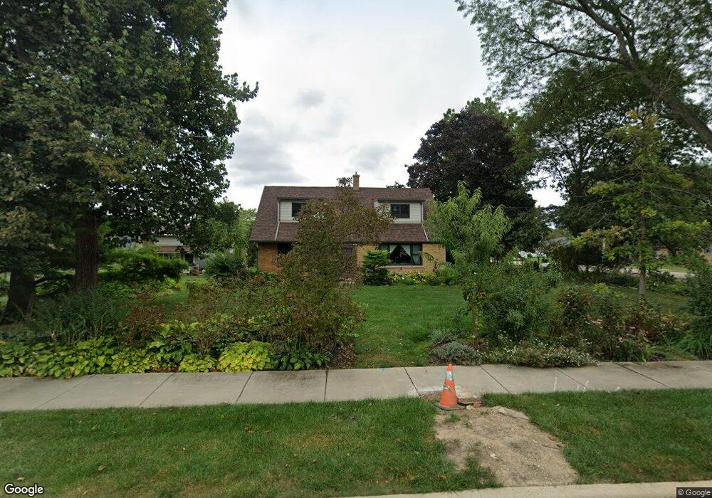
459 N 1st St Gurnee, IL 60031
Estimated Value: $316,000 - $339,600
4
Beds
2
Baths
1,725
Sq Ft
$190/Sq Ft
Est. Value
About This Home
This home is located at 459 N 1st St, Gurnee, IL 60031 and is currently estimated at $326,900, approximately $189 per square foot. 459 N 1st St is a home located in Lake County with nearby schools including Spaulding Elementary School, Viking Middle School, and Warren Township High School.
Ownership History
Date
Name
Owned For
Owner Type
Purchase Details
Closed on
Nov 1, 2000
Sold by
Belec Victor and Trust #1
Bought by
Callen Kevin P and Callen Kathryn J
Current Estimated Value
Home Financials for this Owner
Home Financials are based on the most recent Mortgage that was taken out on this home.
Original Mortgage
$135,920
Outstanding Balance
$50,012
Interest Rate
7.86%
Estimated Equity
$276,888
Create a Home Valuation Report for This Property
The Home Valuation Report is an in-depth analysis detailing your home's value as well as a comparison with similar homes in the area
Home Values in the Area
Average Home Value in this Area
Purchase History
| Date | Buyer | Sale Price | Title Company |
|---|---|---|---|
| Callen Kevin P | $170,000 | First American Title |
Source: Public Records
Mortgage History
| Date | Status | Borrower | Loan Amount |
|---|---|---|---|
| Open | Callen Kevin P | $135,920 |
Source: Public Records
Tax History Compared to Growth
Tax History
| Year | Tax Paid | Tax Assessment Tax Assessment Total Assessment is a certain percentage of the fair market value that is determined by local assessors to be the total taxable value of land and additions on the property. | Land | Improvement |
|---|---|---|---|---|
| 2024 | $7,721 | $91,514 | $15,878 | $75,636 |
| 2023 | $6,585 | $84,963 | $14,741 | $70,222 |
| 2022 | $6,585 | $72,357 | $15,751 | $56,606 |
| 2021 | $5,547 | $64,910 | $14,130 | $50,780 |
| 2020 | $5,373 | $63,315 | $13,783 | $49,532 |
| 2019 | $5,237 | $60,720 | $13,383 | $47,337 |
| 2018 | $4,899 | $56,704 | $13,658 | $43,046 |
| 2017 | $4,846 | $55,080 | $13,267 | $41,813 |
| 2016 | $4,695 | $52,627 | $12,676 | $39,951 |
| 2015 | $4,554 | $49,912 | $12,022 | $37,890 |
| 2014 | $4,691 | $52,758 | $11,843 | $40,915 |
| 2012 | $4,452 | $53,162 | $11,934 | $41,228 |
Source: Public Records
Map
Nearby Homes
- 4176 Blackstone Ave
- 4074 Blackstone Ave
- 287 Jennifer Ct Unit 12
- 3951 Blackstone Ave
- 3947 Blackstone Ave
- 4471 Brighton Ct Unit 7
- 287 Kensington Ct Unit 4
- 93 Berkshire Ct Unit D
- 4124 Russell Ave
- 578 Pine Grove Ave
- 389 Pine Grove Ave
- 964 Magnolia Ave
- 450 Tanglewood Dr
- 468 Tanglewood Dr
- 424 Greenview Dr
- 951 Belle Plaine Ave
- 963 Belle Plaine Ave
- 00 Northwood Ave
- 0 Northwoods Ave Unit MRD11938775
- 334 Concord Square
- 4172 Dorchester Ave
- 485 N 1st St
- 4167 Woodlawn Ave
- 466 N 1st St
- 4160 Dorchester Ave
- 484 N 1st St
- 437 N 1st St
- 4155 Woodlawn Ave
- 440 N 1st St
- 4150 Dorchester Ave
- 4183 Dorchester Ave
- 4151 Woodlawn Ave
- 4221 Dorchester Ave
- 515 N 1st St
- 4155 Dorchester Ave
- 415 N 1st St
- 4170 Woodlawn Ave
- 4176 Kenwood Ave
- 4138 Dorchester Ave
- 4227 Woodlawn Ave