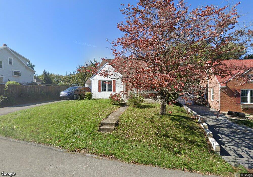
459 Pangborn Blvd Hagerstown, MD 21742
East End NeighborhoodEstimated Value: $219,000 - $264,000
--
Bed
1
Bath
1,248
Sq Ft
$194/Sq Ft
Est. Value
About This Home
This home is located at 459 Pangborn Blvd, Hagerstown, MD 21742 and is currently estimated at $241,935, approximately $193 per square foot. 459 Pangborn Blvd is a home located in Washington County with nearby schools including Pangborn Elementary School, Northern Middle School, and North Hagerstown High School.
Ownership History
Date
Name
Owned For
Owner Type
Purchase Details
Closed on
Jun 26, 2006
Sold by
Marshall David W
Bought by
Mohamed Aitichou
Current Estimated Value
Purchase Details
Closed on
May 26, 2006
Sold by
Marshall David W
Bought by
Mohamed Aitichou
Purchase Details
Closed on
Jun 5, 1989
Sold by
Hesse Lois P
Bought by
Marshall David W
Create a Home Valuation Report for This Property
The Home Valuation Report is an in-depth analysis detailing your home's value as well as a comparison with similar homes in the area
Home Values in the Area
Average Home Value in this Area
Purchase History
| Date | Buyer | Sale Price | Title Company |
|---|---|---|---|
| Mohamed Aitichou | $180,000 | -- | |
| Mohamed Aitichou | $180,000 | -- | |
| Marshall David W | $73,000 | -- |
Source: Public Records
Mortgage History
| Date | Status | Borrower | Loan Amount |
|---|---|---|---|
| Closed | Mohamed Aitichou | -- |
Source: Public Records
Tax History Compared to Growth
Tax History
| Year | Tax Paid | Tax Assessment Tax Assessment Total Assessment is a certain percentage of the fair market value that is determined by local assessors to be the total taxable value of land and additions on the property. | Land | Improvement |
|---|---|---|---|---|
| 2025 | $1,441 | $162,767 | $0 | $0 |
| 2024 | $1,441 | $139,200 | $42,500 | $96,700 |
| 2023 | $1,382 | $133,433 | $0 | $0 |
| 2022 | $1,322 | $127,667 | $0 | $0 |
| 2021 | $1,284 | $121,900 | $42,500 | $79,400 |
| 2020 | $1,284 | $121,667 | $0 | $0 |
| 2019 | $1,287 | $121,433 | $0 | $0 |
| 2018 | $1,285 | $121,200 | $42,500 | $78,700 |
| 2017 | $1,248 | $117,767 | $0 | $0 |
| 2016 | -- | $114,333 | $0 | $0 |
| 2015 | $1,431 | $110,900 | $0 | $0 |
| 2014 | $1,431 | $110,900 | $0 | $0 |
Source: Public Records
Map
Nearby Homes
- 69 Sunbrook Ln Unit 11
- 1221 1221 Security Rd
- 137 Sunbrook Ln Unit 182
- 213 Sunbrook Ln Unit 69
- 942 Monet Dr
- 732 Jefferson Blvd
- 761 Jefferson Blvd
- 854 View St
- 818 View St
- 907 View St
- 562 Jefferson St
- 226 Brynwood St
- 212 Brynwood St
- 528 Jefferson St
- 808 Mulberry Ave
- 344 Dayspring Ln
- 823 Mulberry Ave
- 563 Liberty St
- 805 Mulberry Ave
- 1055 View St
- 465 Pangborn Blvd
- 471 Pangborn & 473 Blvd
- 447 Pangborn Blvd
- 441 Pangborn Blvd
- 820 Park Rd
- 435 Pangborn Blvd
- 839 Security Rd
- 845 Security Rd
- 841 Security Rd
- 816 Park Rd
- 475 Pangborn Blvd
- 466 Pangborn Blvd
- 464 Pangborn Blvd
- 470 Pangborn Blvd
- 460 Pangborn Blvd
- 472 Pangborn Blvd
- 833 Security Rd
- 474 Pangborn Blvd
- 454 Pangborn Blvd
- 814 Park Rd