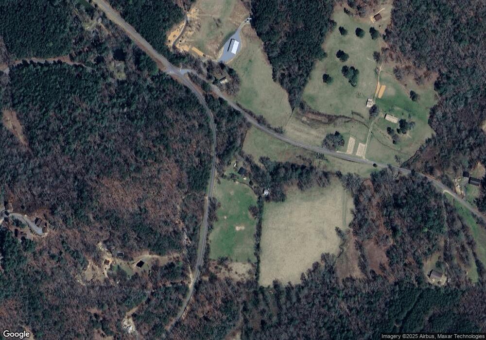
459 Ritchie Creek Rd Blue Ridge, GA 30513
Estimated Value: $485,297 - $532,000
--
Bed
2
Baths
1,344
Sq Ft
$377/Sq Ft
Est. Value
About This Home
This home is located at 459 Ritchie Creek Rd, Blue Ridge, GA 30513 and is currently estimated at $506,574, approximately $376 per square foot. 459 Ritchie Creek Rd is a home located in Fannin County with nearby schools including Fannin County High School.
Ownership History
Date
Name
Owned For
Owner Type
Purchase Details
Closed on
Jun 12, 2025
Sold by
Meldrum Jonathan J
Bought by
Reeves John R and Taranto Lauren
Current Estimated Value
Home Financials for this Owner
Home Financials are based on the most recent Mortgage that was taken out on this home.
Original Mortgage
$449,100
Outstanding Balance
$447,947
Interest Rate
6.81%
Mortgage Type
New Conventional
Estimated Equity
$58,627
Purchase Details
Closed on
Mar 20, 2023
Sold by
Fried Janet A
Bought by
Meldrum Jonathan J
Home Financials for this Owner
Home Financials are based on the most recent Mortgage that was taken out on this home.
Original Mortgage
$332,500
Interest Rate
6.32%
Mortgage Type
New Conventional
Purchase Details
Closed on
Jan 25, 2017
Sold by
Fried Janet
Bought by
Fried Janet A and Fried Mark R
Purchase Details
Closed on
May 28, 2009
Sold by
Wilson Dwayne H
Bought by
Fried Janet and Fried Mark
Create a Home Valuation Report for This Property
The Home Valuation Report is an in-depth analysis detailing your home's value as well as a comparison with similar homes in the area
Home Values in the Area
Average Home Value in this Area
Purchase History
| Date | Buyer | Sale Price | Title Company |
|---|---|---|---|
| Reeves John R | $499,000 | -- | |
| Meldrum Jonathan J | $350,000 | -- | |
| Fried Janet A | -- | -- | |
| Fried Janet | $100,000 | -- |
Source: Public Records
Mortgage History
| Date | Status | Borrower | Loan Amount |
|---|---|---|---|
| Open | Reeves John R | $449,100 | |
| Previous Owner | Meldrum Jonathan J | $332,500 |
Source: Public Records
Tax History Compared to Growth
Tax History
| Year | Tax Paid | Tax Assessment Tax Assessment Total Assessment is a certain percentage of the fair market value that is determined by local assessors to be the total taxable value of land and additions on the property. | Land | Improvement |
|---|---|---|---|---|
| 2024 | $836 | $91,244 | $6,924 | $84,320 |
| 2023 | $865 | $84,826 | $6,924 | $77,902 |
| 2022 | $874 | $85,730 | $6,924 | $78,806 |
| 2021 | $422 | $41,288 | $4,980 | $36,308 |
| 2020 | $431 | $41,288 | $4,980 | $36,308 |
| 2019 | $439 | $41,288 | $4,980 | $36,308 |
| 2018 | $460 | $40,835 | $4,527 | $36,308 |
| 2017 | $729 | $41,216 | $4,527 | $36,689 |
| 2016 | $453 | $37,144 | $4,557 | $32,587 |
| 2015 | $665 | $37,495 | $4,557 | $32,938 |
| 2014 | $745 | $42,386 | $5,792 | $36,594 |
| 2013 | -- | $35,032 | $5,791 | $29,241 |
Source: Public Records
Map
Nearby Homes
- 136 Oasis Dr
- 2704 Lebanon Rd
- 0 Cottonwood Ln
- 879 Mill Stone Mountain Ln
- 98 Saddle Back Trail
- 55 Deer Watch Ln
- 416 Mill Stone Mountain Ln
- 226 Pinetree Dr
- 150 Cadence Way
- 399 Pack Creek Rd
- 445 Twin Creeks Unit 13
- 445 Twin Creeks
- 7590 Mobile Rd
- 25 Rocky Dam Rd
- 215 Twin Creeks
- 56 Devils Den Overlook
- 400 Cloudland Trace
- 474 Buck Creek Trail
- 459 Ritchie Creek Rd
- 107 Cool Creek Trail
- LT 1B Majestic View
- 0 Colwell Rd Unit 120128
- 3.6 Colwell Rd
- 0 Colwell Rd Unit 185272
- 0 Colwell Rd Unit 132398
- 0 Colwell Rd
- 78.88 Colwell Rd
- 0 Colwell Rd Unit 20094266
- 0 Colwell Rd Unit 321855
- 0 Colwell Rd Unit 315875
- 0 Colwell Rd Unit 20037882
- 0 Colwell Rd Unit 7096918
- 0 Colwell Rd Unit 8555880
- 0 Colwell Rd Unit 8228522
- 0 Colwell Rd Unit 8226628
- 0 Colwell Rd Unit 7623603
- 1718 Colwell Rd
- 516 Ritchie Creek Rd
