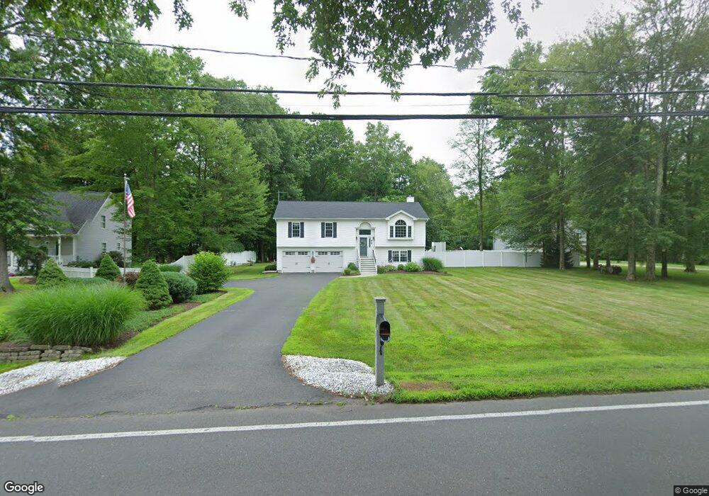
459 Thrall Ave Suffield, CT 06078
Estimated Value: $397,000 - $457,000
3
Beds
2
Baths
1,339
Sq Ft
$311/Sq Ft
Est. Value
About This Home
This home is located at 459 Thrall Ave, Suffield, CT 06078 and is currently estimated at $416,952, approximately $311 per square foot. 459 Thrall Ave is a home located in Hartford County with nearby schools including A. Ward Spaulding School, Mcalister Intermediate School, and Suffield Middle School.
Ownership History
Date
Name
Owned For
Owner Type
Purchase Details
Closed on
May 9, 1997
Sold by
Falcor Homes
Bought by
Lavoie Richard and Lavoie Cheryl
Current Estimated Value
Home Financials for this Owner
Home Financials are based on the most recent Mortgage that was taken out on this home.
Original Mortgage
$136,700
Interest Rate
7.88%
Mortgage Type
Unknown
Create a Home Valuation Report for This Property
The Home Valuation Report is an in-depth analysis detailing your home's value as well as a comparison with similar homes in the area
Home Values in the Area
Average Home Value in this Area
Purchase History
| Date | Buyer | Sale Price | Title Company |
|---|---|---|---|
| Lavoie Richard | $143,900 | -- |
Source: Public Records
Mortgage History
| Date | Status | Borrower | Loan Amount |
|---|---|---|---|
| Open | Lavoie Richard | $219,750 | |
| Closed | Lavoie Richard | $192,000 | |
| Closed | Lavoie Richard | $160,000 | |
| Closed | Lavoie Richard | $136,700 |
Source: Public Records
Tax History
| Year | Tax Paid | Tax Assessment Tax Assessment Total Assessment is a certain percentage of the fair market value that is determined by local assessors to be the total taxable value of land and additions on the property. | Land | Improvement |
|---|---|---|---|---|
| 2025 | $5,816 | $248,430 | $60,480 | $187,950 |
| 2024 | $5,622 | $248,430 | $60,480 | $187,950 |
| 2023 | $5,141 | $179,690 | $60,760 | $118,930 |
| 2022 | $5,141 | $179,690 | $60,760 | $118,930 |
| 2021 | $5,146 | $179,690 | $60,760 | $118,930 |
| 2020 | $5,146 | $179,690 | $60,760 | $118,930 |
| 2019 | $5,161 | $179,690 | $60,760 | $118,930 |
| 2018 | $5,221 | $178,080 | $57,960 | $120,120 |
| 2017 | $5,145 | $178,080 | $57,960 | $120,120 |
| 2016 | $5,022 | $178,080 | $57,960 | $120,120 |
| 2015 | $4,947 | $178,080 | $57,960 | $120,120 |
| 2014 | $4,830 | $178,080 | $57,960 | $120,120 |
Source: Public Records
Map
Nearby Homes
- 424 Bridge St
- 713 Thrall Ave
- 779 Bridge St
- 61 Brandywine Ln
- 392 Boston Neck Rd
- 186 S Main St
- 15 High St
- 39 Marbern Dr
- 0 Stone St S Unit 24039713
- 105 1st St
- 0 Suffield St Unit 24093452
- 0 Suffield St Unit 24057050
- 98 1st St
- 1 E Elaine Dr
- 3 Pebblestone Cir Unit 3
- 840 Branch Rd
- 278 Thompsonville Rd
- 610 East St S
- 660 East St S
- 147 W Grayling Ln
- 441 Thrall Ave
- 475 Thrall Ave
- 481 Thrall Ave
- 427 Thrall Ave
- 500 Loomis Rd
- 430 Thrall Ave
- 476 Thrall Ave
- 424 Bridge St Unit Lower Unit
- 470 Bridge St
- 484 Bridge St
- 425 Thrall Ave
- Lot A Bridge St
- 424 Thrall Ave
- 478 Thrall Ave
- 535 Thrall Ave
- 500 Thrall Ave
- 510 Bridge St
- 480 Thrall Ave
- 1 Dylan Dr
- 530 Bridge St
Your Personal Tour Guide
Ask me questions while you tour the home.