Estimated Value: $223,000 - $258,000
3
Beds
2
Baths
1,200
Sq Ft
$203/Sq Ft
Est. Value
About This Home
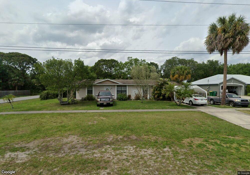
This home is located at 4590 Curtis Blvd, Cocoa, FL 32927 and is currently estimated at $243,719, approximately $203 per square foot. 4590 Curtis Blvd is a home located in Brevard County with nearby schools including Atlantis Elementary School, Space Coast Junior/Senior High School, and Sculptor Charter School.
Ownership History
Date
Name
Owned For
Owner Type
Purchase Details
Closed on
Oct 24, 2001
Sold by
Ellis Diane R
Bought by
Hunt Donna E and Hunt Timothy E
Current Estimated Value
Home Financials for this Owner
Home Financials are based on the most recent Mortgage that was taken out on this home.
Original Mortgage
$61,800
Outstanding Balance
$23,926
Interest Rate
6.74%
Estimated Equity
$219,794
Purchase Details
Closed on
Mar 9, 1999
Sold by
Messineo Patricia and Winters Eileen M
Bought by
Ellis Diane R
Home Financials for this Owner
Home Financials are based on the most recent Mortgage that was taken out on this home.
Original Mortgage
$35,763
Interest Rate
6.74%
Create a Home Valuation Report for This Property
The Home Valuation Report is an in-depth analysis detailing your home's value as well as a comparison with similar homes in the area
Home Values in the Area
Average Home Value in this Area
Purchase History
| Date | Buyer | Sale Price | Title Company |
|---|---|---|---|
| Hunt Donna E | $77,300 | -- | |
| Ellis Diane R | $43,500 | -- |
Source: Public Records
Mortgage History
| Date | Status | Borrower | Loan Amount |
|---|---|---|---|
| Open | Hunt Donna E | $61,800 | |
| Previous Owner | Ellis Diane R | $35,763 |
Source: Public Records
Tax History
| Year | Tax Paid | Tax Assessment Tax Assessment Total Assessment is a certain percentage of the fair market value that is determined by local assessors to be the total taxable value of land and additions on the property. | Land | Improvement |
|---|---|---|---|---|
| 2025 | $968 | $65,580 | -- | -- |
| 2024 | $950 | $63,740 | -- | -- |
| 2023 | $950 | $61,890 | $0 | $0 |
| 2022 | $903 | $60,090 | $0 | $0 |
| 2021 | $903 | $58,340 | $0 | $0 |
| 2020 | $858 | $57,540 | $0 | $0 |
| 2019 | $805 | $56,250 | $0 | $0 |
| 2018 | $805 | $55,210 | $0 | $0 |
| 2017 | $805 | $54,080 | $0 | $0 |
| 2016 | $810 | $52,970 | $18,000 | $34,970 |
| 2015 | $815 | $52,610 | $15,000 | $37,610 |
| 2014 | $819 | $52,200 | $11,000 | $41,200 |
Source: Public Records
Map
Nearby Homes
- 4625 Curtis Blvd
- 7160 Carlowe Ave
- 6990 Camden Ave
- 7065 Bright Ave
- 6947 Carlowe Ave
- 7081 Bayfront Rd
- 6820 Caliph Ave
- 7155 Ackerman Ave
- 4760 Ivan St
- 4285 Glover St
- 4550 Flood St
- 4824 Curtis Blvd
- 4395 Comfort St
- 7450 Calmoso Ave
- 7350 Bartow Ave
- 7070 Bismarck Rd
- 7245 Grissom Pkwy
- 7456 Camio Ave
- 0000 Unknown St
- 7155 Export Ave
- 4570 Curtis Blvd
- 4600 Curtis Blvd
- 4590 Cinema St
- 4550 Curtis Blvd
- 7110 Briggs Ave
- 4595 Curtis Blvd
- 4585 Curtis Blvd
- 4600 Cinema St
- 4620 Curtis Blvd
- 4625 Cinema St
- 4605 Curtis Blvd
- 4575 Curtis Blvd
- 7120 Briggs Ave
- 4625 Curtis Blvd Unit Port St John Unit 8
- 4640 Curtis Blvd
- 6974 Boston Rd
- 7130 Briggs Ave
- 6966 Boston Rd
- 6982 Boston Rd
- 0 Curtis Caliph Dr Unit 768020
Your Personal Tour Guide
Ask me questions while you tour the home.