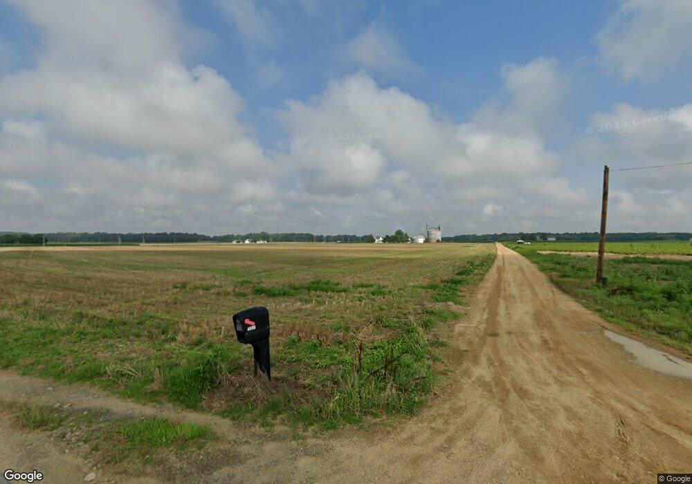
4590 Newton Rd Preston, MD 21655
Estimated Value: $276,357 - $403,000
--
Bed
1
Bath
1,560
Sq Ft
$211/Sq Ft
Est. Value
About This Home
This home is located at 4590 Newton Rd, Preston, MD 21655 and is currently estimated at $329,339, approximately $211 per square foot. 4590 Newton Rd is a home located in Caroline County with nearby schools including Preston Elementary School, Colonel Richardson Middle School, and Colonel Richardson High School.
Ownership History
Date
Name
Owned For
Owner Type
Purchase Details
Closed on
Nov 12, 2012
Sold by
Blankenship Allison T and Taylor Allison L
Bought by
Blankenship Allison T and Blankenship Michael S
Current Estimated Value
Home Financials for this Owner
Home Financials are based on the most recent Mortgage that was taken out on this home.
Original Mortgage
$173,000
Outstanding Balance
$119,716
Interest Rate
3.42%
Mortgage Type
New Conventional
Estimated Equity
$209,623
Purchase Details
Closed on
Apr 25, 2008
Sold by
Taylor Calvin W and Taylor Debora M
Bought by
Taylor Calvin W and Taylor Debora M
Home Financials for this Owner
Home Financials are based on the most recent Mortgage that was taken out on this home.
Original Mortgage
$190,000
Interest Rate
5.93%
Mortgage Type
Purchase Money Mortgage
Create a Home Valuation Report for This Property
The Home Valuation Report is an in-depth analysis detailing your home's value as well as a comparison with similar homes in the area
Home Values in the Area
Average Home Value in this Area
Purchase History
| Date | Buyer | Sale Price | Title Company |
|---|---|---|---|
| Blankenship Allison T | -- | None Available | |
| Taylor Calvin W | $200,000 | -- | |
| Taylor Calvin W | $200,000 | -- |
Source: Public Records
Mortgage History
| Date | Status | Borrower | Loan Amount |
|---|---|---|---|
| Open | Blankenship Allison T | $173,000 | |
| Closed | Taylor Calvin W | $190,000 |
Source: Public Records
Tax History Compared to Growth
Tax History
| Year | Tax Paid | Tax Assessment Tax Assessment Total Assessment is a certain percentage of the fair market value that is determined by local assessors to be the total taxable value of land and additions on the property. | Land | Improvement |
|---|---|---|---|---|
| 2025 | $2,175 | $223,600 | $0 | $0 |
| 2024 | $2,175 | $208,000 | $0 | $0 |
| 2023 | $2,068 | $192,400 | $65,800 | $126,600 |
| 2022 | $1,970 | $180,933 | $0 | $0 |
| 2021 | $1,785 | $169,467 | $0 | $0 |
| 2020 | $1,785 | $158,000 | $65,800 | $92,200 |
| 2019 | $1,723 | $152,267 | $0 | $0 |
| 2018 | $1,660 | $146,533 | $0 | $0 |
| 2017 | $1,598 | $140,800 | $0 | $0 |
| 2016 | -- | $136,400 | $0 | $0 |
| 2015 | $1,524 | $132,000 | $0 | $0 |
| 2014 | $1,524 | $127,600 | $0 | $0 |
Source: Public Records
Map
Nearby Homes
- 22490 Ash Blvd
- 22991 Westview Dr
- Lot 1 Dover Bridge Rd
- 23547 Jonestown Ln
- 22403 Marsh Creek Rd
- lot 6 Harmony Woods Dr
- 106 Lednum Ave
- 148 Main St
- 113 Lednum Ave
- 22109 Tanyard Rd
- 162 Main St
- 158 Wright St
- 113 Chambers St
- 212 Main St
- 22408 Hog Creek Rd
- Parcel 210 Dover Bridge Rd
- 21682 Dover Bridge Rd
- 0 Gadow Rd
- 4631 Everlea Ct
- 6101 Bethlehem Rd
- Newton Rd
- 311 Hughlett St
- 22816 Dover Bridge Rd
- 2 Willow Oak Way
- 4 Willow Oak Way
- 4734 Newton Rd
- 0 Todds Wharf Rd Unit 1008161596
- 0 Todds Wharf Rd Unit 1008063032
- 0 Todds Wharf Rd Unit 1007887908
- 0 Todds Wharf Rd Unit CM10109311
- 0 Todds Wharf Rd Unit MDCM2003364
- 0 Todds Wharf Rd Unit MDCM2001100
- 0 Todds Wharf Rd Unit MDCM2001096
- 0 Todds Wharf Rd Unit 1004225373
- 22677 Dover Bridge Rd
- 22652 Dover Bridge Rd
- 4768 Poplar Neck Rd
- 22650 Tanyard Rd
- 22636 Dover Bridge Rd
- 22653 Tanyard Rd
