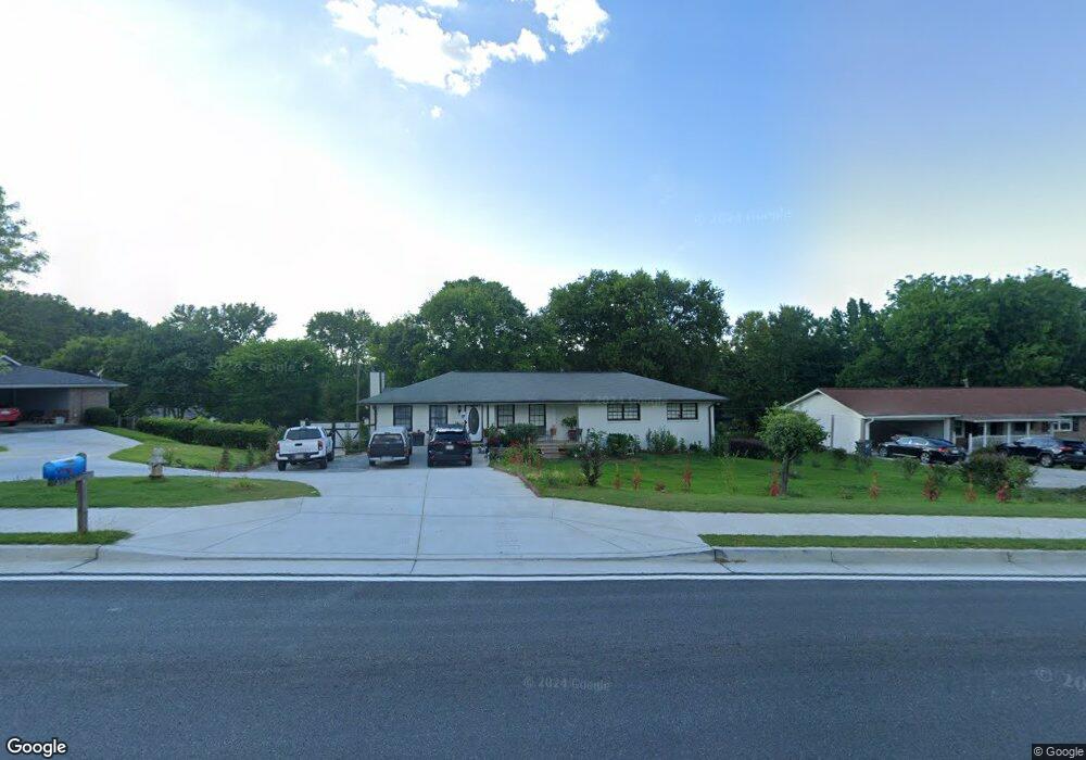
4593 Burns Rd NW Unit 4 Lilburn, GA 30047
Estimated Value: $331,000 - $377,000
3
Beds
2
Baths
1,741
Sq Ft
$203/Sq Ft
Est. Value
About This Home
This home is located at 4593 Burns Rd NW Unit 4, Lilburn, GA 30047 and is currently estimated at $353,347, approximately $202 per square foot. 4593 Burns Rd NW Unit 4 is a home located in Gwinnett County with nearby schools including Hopkins Elementary School, Berkmar Middle School, and Berkmar High School.
Ownership History
Date
Name
Owned For
Owner Type
Purchase Details
Closed on
Apr 23, 2018
Sold by
Jordan Julian L
Bought by
Mazariegos Karen B and Prado Vilma
Current Estimated Value
Home Financials for this Owner
Home Financials are based on the most recent Mortgage that was taken out on this home.
Original Mortgage
$171,830
Outstanding Balance
$149,732
Interest Rate
5.12%
Mortgage Type
FHA
Estimated Equity
$203,615
Create a Home Valuation Report for This Property
The Home Valuation Report is an in-depth analysis detailing your home's value as well as a comparison with similar homes in the area
Home Values in the Area
Average Home Value in this Area
Purchase History
| Date | Buyer | Sale Price | Title Company |
|---|---|---|---|
| Mazariegos Karen B | $175,000 | -- | |
| Mazariegos Karen B | $175,000 | -- |
Source: Public Records
Mortgage History
| Date | Status | Borrower | Loan Amount |
|---|---|---|---|
| Open | Mazariegos Karen B | $171,830 |
Source: Public Records
Tax History Compared to Growth
Tax History
| Year | Tax Paid | Tax Assessment Tax Assessment Total Assessment is a certain percentage of the fair market value that is determined by local assessors to be the total taxable value of land and additions on the property. | Land | Improvement |
|---|---|---|---|---|
| 2025 | $5,707 | $152,720 | $21,120 | $131,600 |
| 2024 | $5,444 | $143,600 | $21,120 | $122,480 |
| 2023 | $5,444 | $112,960 | $21,600 | $91,360 |
| 2022 | $4,318 | $112,960 | $21,600 | $91,360 |
| 2021 | $3,186 | $79,840 | $14,160 | $65,680 |
| 2020 | $3,203 | $79,840 | $14,160 | $65,680 |
| 2019 | $2,747 | $70,000 | $14,160 | $55,840 |
| 2018 | $2,395 | $66,120 | $12,400 | $53,720 |
| 2016 | $1,931 | $52,240 | $9,600 | $42,640 |
| 2015 | $1,651 | $43,760 | $8,000 | $35,760 |
| 2014 | $1,418 | $37,040 | $7,200 | $29,840 |
Source: Public Records
Map
Nearby Homes
- 1360 Dickens Rd NW
- 849 Cadet Ct NW
- 4495 Casco Ln NW
- 4474 Casco Ln NW
- 783 Silvercreek Ct NW
- 4596 Mossy Ln NW Unit 1
- 1014 Brockdell Ct
- 4716 Mossy Ln NW Unit 1
- 1020 Park Forest Dr NW
- 1060 Heatherwood Ct
- 4608 Warners Trail Unit 3
- 4446 Arcadia Dr
- 1035 Beaver Ruin Rd
- 1411 Indian Way NW
- 1052 Rabun Dr NW Unit 2
- 1451 Indian Way NW
- 1097 Rock Creek Ln
- 4652 Parklake Ct
- 1066 Rock Creek Ln
- 1037 Dover Way
- 4593 Burns Rd NW
- 4583 Burns Rd NW
- 4609 Burns Rd NW
- 1440 Dickens Rd NW
- 4584 Dickens Terrace NW Unit 3
- 4574 Dickens Terrace NW Unit 3
- 4594 Dickens Terrace NW
- 4594 Burns Rd NW
- 4584 Burns Rd NW Unit 2
- 4604 Burns Rd NW Unit 1
- 1430 Dickens Rd NW Unit 3
- 803 Burns Cir NW
- 823 Burns Cir NW
- 4582 Burns Rd NW
- 4614 Burns Rd NW
- 811 Burns Cir NW Unit DRIVE
- 811 Burns Cir NW
- 4564 Dickens Terrace NW Unit 3
- 4564 Dickens Terrace NW
- 801 Burns Cir NW Unit DRIVE