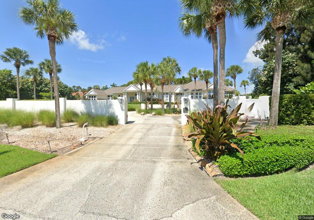
4595 S Tropical Trail Merritt Island, FL 32952
Estimated Value: $1,802,000 - $2,411,000
5
Beds
5
Baths
4,343
Sq Ft
$473/Sq Ft
Est. Value
About This Home
This home is located at 4595 S Tropical Trail, Merritt Island, FL 32952 and is currently estimated at $2,055,374, approximately $473 per square foot. 4595 S Tropical Trail is a home located in Brevard County with nearby schools including Tropical Elementary School, Thomas Jefferson Middle School, and Merritt Island High School.
Ownership History
Date
Name
Owned For
Owner Type
Purchase Details
Closed on
Oct 27, 1998
Sold by
Suntrust Bk Cntl Fl N A
Bought by
Barin David K and Barin Wendyt F
Current Estimated Value
Home Financials for this Owner
Home Financials are based on the most recent Mortgage that was taken out on this home.
Original Mortgage
$118,764
Outstanding Balance
$26,060
Interest Rate
6.65%
Estimated Equity
$2,029,314
Create a Home Valuation Report for This Property
The Home Valuation Report is an in-depth analysis detailing your home's value as well as a comparison with similar homes in the area
Home Values in the Area
Average Home Value in this Area
Purchase History
| Date | Buyer | Sale Price | Title Company |
|---|---|---|---|
| Barin David K | $129,900 | -- |
Source: Public Records
Mortgage History
| Date | Status | Borrower | Loan Amount |
|---|---|---|---|
| Open | Barin David K | $118,764 |
Source: Public Records
Tax History Compared to Growth
Tax History
| Year | Tax Paid | Tax Assessment Tax Assessment Total Assessment is a certain percentage of the fair market value that is determined by local assessors to be the total taxable value of land and additions on the property. | Land | Improvement |
|---|---|---|---|---|
| 2025 | $14,800 | $1,248,560 | -- | -- |
| 2024 | $14,760 | $1,213,380 | -- | -- |
| 2023 | $14,760 | $1,178,040 | $0 | $0 |
| 2022 | $13,826 | $1,143,730 | $0 | $0 |
| 2021 | $14,706 | $1,110,420 | $0 | $0 |
| 2020 | $14,775 | $1,095,090 | $0 | $0 |
| 2019 | $14,838 | $1,070,470 | $0 | $0 |
| 2018 | $14,961 | $1,050,520 | $0 | $0 |
| 2017 | $15,259 | $1,028,920 | $0 | $0 |
| 2016 | $15,637 | $1,007,760 | $275,120 | $732,640 |
| 2015 | $16,213 | $1,000,760 | $275,120 | $725,640 |
| 2014 | $16,374 | $992,820 | $275,120 | $717,700 |
Source: Public Records
Map
Nearby Homes
- 4395 Crooked Mile Rd
- 4320 Crooked Mile Rd
- 4760 Honeyridge Ln
- 4245 Hillview Cir
- 4250 Blossom Cir
- 4385 Stillwaters Dr
- 735 Pilot Ln Unit 314
- 735 Pilot Ln Unit 812
- 735 Pilot Ln Unit 408
- 735 Pilot Ln Unit 603
- 735 Pilot Ln Unit 614
- 735 Pilot Ln Unit 611
- 735 Pilot Ln Unit 908
- 735 Pilot Ln Unit 606
- 735 Pilot Ln Unit 1004
- 735 Pilot Ln Unit 510
- 735 Pilot Ln Unit 814
- 5140 Del Sol Dr
- 4297 Crooked Mile Rd
- 190 Stewart Dr
- 4545 S Tropical Trail
- 4635 S Tropical Trail
- 110 Honeymoon Hill Ln
- 4645 S Tropical Trail
- 120 Honeymoon Hill Ln
- 120 Honeymoon Hill Ln
- 4425 Crooked Mile Rd
- 4565 S Tropical Trail
- 100 Camel Ln
- 130 Macaw Ln
- 4415 Crooked Mile Rd
- 135 Macaw Ln
- 4385 S Tropical Trail
- 4380 Viewcrest Dr
- 160 Macaw Ln
- 125 Macaw Ln
- 4411 Crooked Mile Rd
- 4375 Viewcrest Dr
- 4365 S Tropical Trail
- 4360 Viewcrest Dr