Estimated Value: $372,519 - $472,000
6
Beds
3
Baths
2,220
Sq Ft
$190/Sq Ft
Est. Value
About This Home
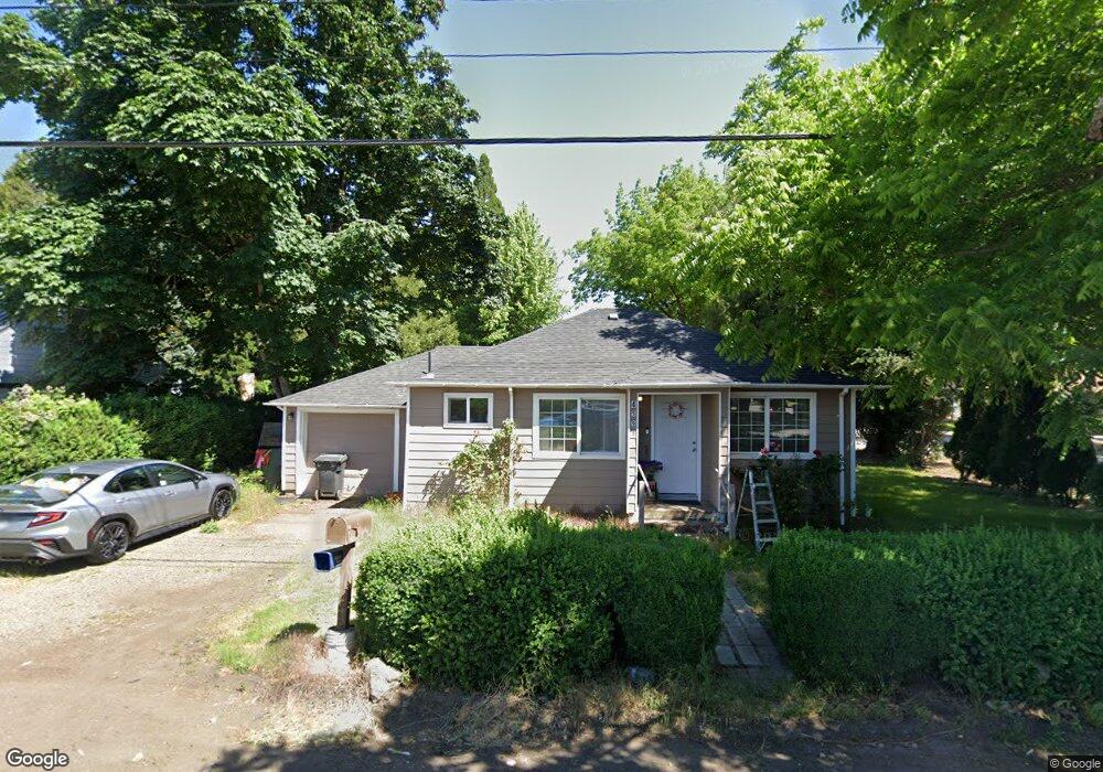
This home is located at 4595 State St, Salem, OR 97301 and is currently estimated at $421,630, approximately $189 per square foot. 4595 State St is a home located in Marion County with nearby schools including Eyre Elementary School, Houck Middle School, and South Salem High School.
Ownership History
Date
Name
Owned For
Owner Type
Purchase Details
Closed on
Sep 16, 2024
Sold by
Hoy Lawrence and Hoy David
Bought by
Hoys Investments Limited
Current Estimated Value
Purchase Details
Closed on
Dec 28, 2018
Sold by
Hoy David and Hoy Larry
Bought by
Hoy Lawrence R and Hoy David
Home Financials for this Owner
Home Financials are based on the most recent Mortgage that was taken out on this home.
Original Mortgage
$226,800
Interest Rate
7.62%
Mortgage Type
Adjustable Rate Mortgage/ARM
Purchase Details
Closed on
Aug 22, 2001
Sold by
Cockrell James E
Bought by
Hoy David and Hoy Larry
Home Financials for this Owner
Home Financials are based on the most recent Mortgage that was taken out on this home.
Original Mortgage
$98,000
Interest Rate
7.21%
Mortgage Type
Seller Take Back
Create a Home Valuation Report for This Property
The Home Valuation Report is an in-depth analysis detailing your home's value as well as a comparison with similar homes in the area
Home Values in the Area
Average Home Value in this Area
Purchase History
| Date | Buyer | Sale Price | Title Company |
|---|---|---|---|
| Hoys Investments Limited | -- | None Listed On Document | |
| Hoy Lawrence R | -- | Ticor Title Co | |
| Hoy David | $140,000 | Key Title Company |
Source: Public Records
Mortgage History
| Date | Status | Borrower | Loan Amount |
|---|---|---|---|
| Previous Owner | Hoy Lawrence R | $226,800 | |
| Previous Owner | Hoy David | $98,000 |
Source: Public Records
Tax History
| Year | Tax Paid | Tax Assessment Tax Assessment Total Assessment is a certain percentage of the fair market value that is determined by local assessors to be the total taxable value of land and additions on the property. | Land | Improvement |
|---|---|---|---|---|
| 2025 | $3,252 | $195,340 | -- | -- |
| 2024 | $3,252 | $189,660 | -- | -- |
| 2023 | $3,080 | $184,140 | $0 | $0 |
| 2022 | $3,024 | $178,780 | $0 | $0 |
| 2021 | $2,997 | $173,580 | $0 | $0 |
| 2020 | $2,825 | $168,530 | $0 | $0 |
| 2019 | $2,846 | $163,630 | $0 | $0 |
| 2018 | $2,883 | $0 | $0 | $0 |
| 2017 | $2,256 | $0 | $0 | $0 |
| 2016 | $2,154 | $0 | $0 | $0 |
| 2015 | $2,101 | $0 | $0 | $0 |
| 2014 | $1,929 | $0 | $0 | $0 |
Source: Public Records
Map
Nearby Homes
- 133 Broadmore Ave NE
- 142 45th Ave NE
- 427 Lost Lake St NE
- 194 Broadmore Ave NE
- 127 Clearwater Ave NE
- 270 Brink Ct SE
- 148 Clearwater Ave NE
- 280 Brink Ct SE
- 283 Broadmore Ave NE
- 0000 Kenwood Ave NE
- 4676 Amber St NE
- 4849 State St
- 312 47th Ave SE
- 4766 Amber St NE
- 4771 Westlawn Ct SE
- 4823 Cougar Ct SE
- 4730 Auburn Rd NE Unit 10
- 4730 Auburn Rd NE Unit 20 Rd NE
- 4730 Auburn Rd NE Unit 158
- 4730 Auburn Rd NE Unit 123 Rd
- 4575 State St
- 4611 State St Unit 4675
- 105 46th Ave SE
- 105 46th Ave SE Unit 109
- 4564 State St Unit 4568
- 105 46th (- 109) Ave
- 4564 State (- 4568) St
- 125 Kenwood St NE
- 4564 State (-4568) St SE
- 4544 State St Unit 4648
- 4535 State St
- 106 46th Ave SE Unit 110
- 126 Draper St NE
- 106 46th Ave SE
- 106 SE 46th (Plus 30 More) Ave
- 130 Kenwood St NE
- 125 46th (#127 #129) Ave SE
- 125 46th Ave SE
- 135 Kenwood St NE
- 125 46th Ave SE Unit 129