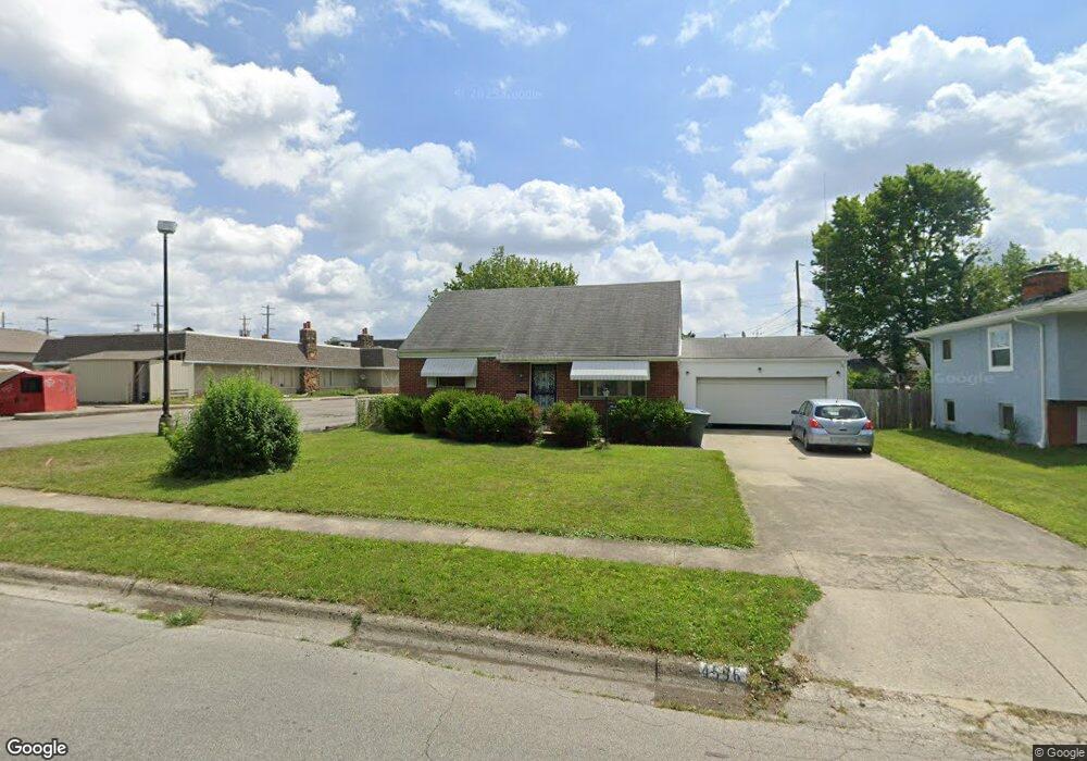
4596 Emslie Dr Columbus, OH 43224
Maize-Morse NeighborhoodEstimated Value: $231,183 - $291,000
4
Beds
2
Baths
1,243
Sq Ft
$209/Sq Ft
Est. Value
About This Home
This home is located at 4596 Emslie Dr, Columbus, OH 43224 and is currently estimated at $259,796, approximately $209 per square foot. 4596 Emslie Dr is a home located in Franklin County with nearby schools including Maize Road Elementary School, Medina Middle School, and Mifflin High School.
Ownership History
Date
Name
Owned For
Owner Type
Purchase Details
Closed on
Oct 16, 2009
Sold by
Smith Dorothy S
Bought by
Kauffman Jon and Kauffman Megan
Current Estimated Value
Home Financials for this Owner
Home Financials are based on the most recent Mortgage that was taken out on this home.
Original Mortgage
$79,670
Outstanding Balance
$51,360
Interest Rate
5.15%
Mortgage Type
FHA
Estimated Equity
$208,436
Purchase Details
Closed on
Mar 17, 1993
Bought by
Smith Dorothy S
Create a Home Valuation Report for This Property
The Home Valuation Report is an in-depth analysis detailing your home's value as well as a comparison with similar homes in the area
Home Values in the Area
Average Home Value in this Area
Purchase History
| Date | Buyer | Sale Price | Title Company |
|---|---|---|---|
| Kauffman Jon | -- | Attorney | |
| Smith Dorothy S | -- | -- |
Source: Public Records
Mortgage History
| Date | Status | Borrower | Loan Amount |
|---|---|---|---|
| Open | Kauffman Jon | $79,670 |
Source: Public Records
Tax History
| Year | Tax Paid | Tax Assessment Tax Assessment Total Assessment is a certain percentage of the fair market value that is determined by local assessors to be the total taxable value of land and additions on the property. | Land | Improvement |
|---|---|---|---|---|
| 2025 | $3,341 | $74,450 | $20,060 | $54,390 |
| 2024 | $3,341 | $74,450 | $20,060 | $54,390 |
| 2023 | $3,299 | $74,445 | $20,055 | $54,390 |
| 2022 | $2,553 | $49,220 | $9,210 | $40,010 |
| 2021 | $2,557 | $49,220 | $9,210 | $40,010 |
| 2020 | $2,561 | $49,220 | $9,210 | $40,010 |
| 2019 | $2,393 | $39,450 | $7,350 | $32,100 |
| 2018 | $2,314 | $39,450 | $7,350 | $32,100 |
| 2017 | $2,392 | $39,450 | $7,350 | $32,100 |
| 2016 | $2,468 | $37,250 | $6,970 | $30,280 |
| 2015 | $2,240 | $37,250 | $6,970 | $30,280 |
| 2014 | $2,245 | $37,250 | $6,970 | $30,280 |
| 2013 | $1,165 | $39,165 | $7,315 | $31,850 |
Source: Public Records
Map
Nearby Homes
- 1144 Reed Circle Dr
- 1116 Tulsa Dr
- 4450 N 4th St
- 4615 Glenmawr Ave
- 4605 Glenmawr Ave
- 4320 Sandy Lane Rd
- 1130 Carbone Dr
- 4795 Colonel Perry Dr
- 899 Meadowview Dr
- 827 Inwood Place
- 4143 Karl Rd Unit 215
- 4143 Karl Rd Unit 314
- 4145 Karl Rd Unit 223
- 1485 Norma Rd
- 4923 Karl Rd Unit 4925
- 4231 Glenmawr Ave Unit 233
- 601 Morse Rd
- 5004 Julie Place
- 5010 Julie Place
- 3967 Karl Rd Unit 224
Your Personal Tour Guide
Ask me questions while you tour the home.