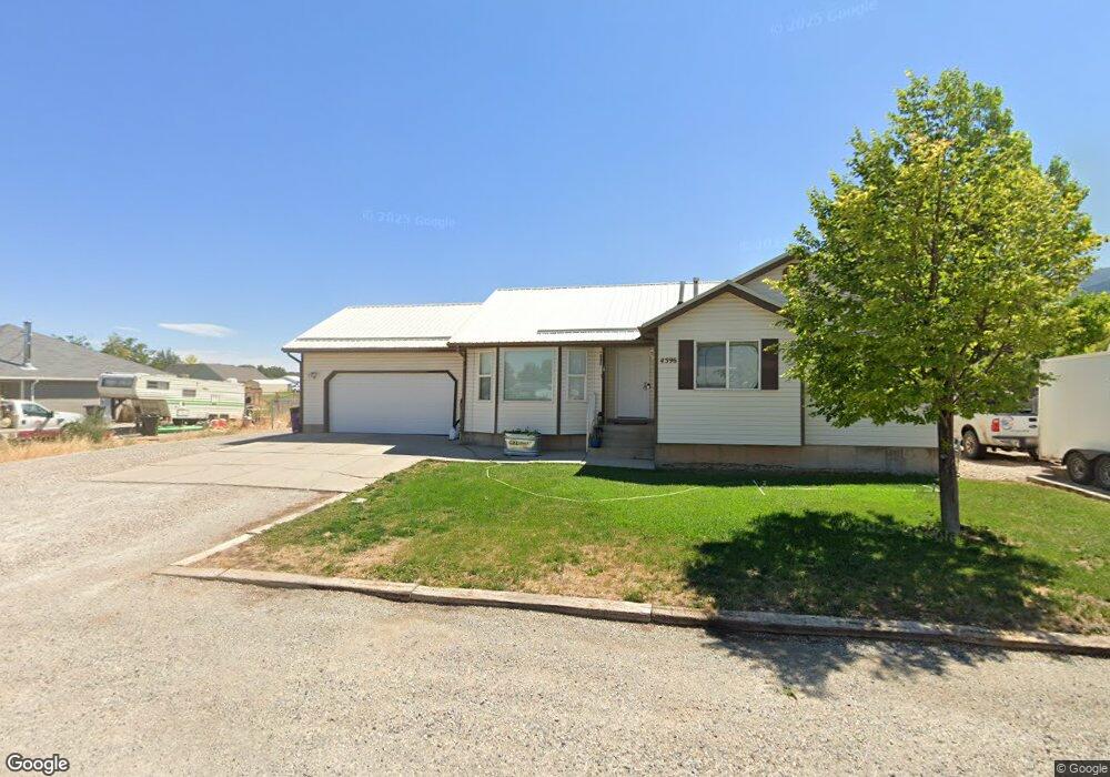
4596 N 1120 E Cedar City, UT 84721
Estimated Value: $324,000 - $374,000
Studio
--
Bath
1,250
Sq Ft
$275/Sq Ft
Est. Value
About This Home
This home is located at 4596 N 1120 E, Cedar City, UT 84721 and is currently estimated at $343,507, approximately $274 per square foot. 4596 N 1120 E is a home located in Iron County with nearby schools including Enoch School, Cedar Middle School, and Cedar City High School.
Ownership History
Date
Name
Owned For
Owner Type
Purchase Details
Closed on
May 31, 2022
Sold by
Corby Robinson
Bought by
Corby And Olivia Robinson Family Trust
Current Estimated Value
Purchase Details
Closed on
Oct 16, 2006
Sold by
Hoyt Kent and Hoyt Martha
Bought by
Hoyt Kent D and Hoyt Martha L
Purchase Details
Closed on
Feb 16, 2006
Sold by
Olmsted Darrell and Olmsted Julie
Bought by
Hoyt Kent and Hoyt Martha
Purchase Details
Closed on
Nov 1, 2005
Sold by
Slack Christine R
Bought by
Olmstead Darrell and Olmstead Julie
Home Financials for this Owner
Home Financials are based on the most recent Mortgage that was taken out on this home.
Original Mortgage
$35,000
Interest Rate
5.3%
Mortgage Type
Stand Alone Second
Purchase Details
Closed on
Sep 16, 2005
Sold by
Slack Henry O
Bought by
Slack Christine R
Home Financials for this Owner
Home Financials are based on the most recent Mortgage that was taken out on this home.
Original Mortgage
$35,000
Interest Rate
5.3%
Mortgage Type
Stand Alone Second
Create a Home Valuation Report for This Property
The Home Valuation Report is an in-depth analysis detailing your home's value as well as a comparison with similar homes in the area
Home Values in the Area
Average Home Value in this Area
Purchase History
| Date | Buyer | Sale Price | Title Company |
|---|---|---|---|
| Corby And Olivia Robinson Family Trust | -- | Westwood Law | |
| Hoyt Kent D | -- | -- | |
| Hoyt Kent | -- | -- | |
| Olmstead Darrell | -- | -- | |
| Slack Christine R | -- | -- |
Source: Public Records
Mortgage History
| Date | Status | Borrower | Loan Amount |
|---|---|---|---|
| Previous Owner | Olmstead Darrell | $35,000 |
Source: Public Records
Tax History
| Year | Tax Paid | Tax Assessment Tax Assessment Total Assessment is a certain percentage of the fair market value that is determined by local assessors to be the total taxable value of land and additions on the property. | Land | Improvement |
|---|---|---|---|---|
| 2025 | $1,281 | $175,490 | $45,650 | $129,840 |
| 2023 | $1,332 | $169,055 | $42,435 | $126,620 |
| 2022 | $1,330 | $155,520 | $40,415 | $115,105 |
| 2021 | $972 | $113,605 | $17,665 | $95,940 |
| 2020 | $1,079 | $110,845 | $17,665 | $93,180 |
| 2019 | $1,039 | $101,360 | $15,865 | $85,495 |
| 2018 | $1,047 | $99,220 | $15,865 | $83,355 |
| 2017 | $889 | $88,345 | $15,865 | $72,480 |
| 2016 | $823 | $76,150 | $11,345 | $64,805 |
| 2015 | $831 | $72,680 | $0 | $0 |
| 2014 | $766 | $63,065 | $0 | $0 |
Source: Public Records
Map
Nearby Homes
- 4636 N Marshal Trail
- 26.25 Acre E Midvalley Rd
- 1040 E Midvalley Rd
- 3.32 Acres E Midvalley Rd
- 1050 E Midvalley Rd Unit Approx.
- 3.32 E Midvalley Rd
- 5 Acre Ft 1963 Priority Date
- 60 acre ft Priority Date 1951
- 3 acre ft
- 4509 N Gold Dust Trail St
- 4785 Old Scout Trail
- 1116 E Southern Homestead Blvd
- 1271 E Southern Homestead Blvd
- 985 E Winchester Dr
- 1050 E Midvalley (Approx) Rd
- 4944 N 925 E Unit Lot 88
- 4062 N 970 E
- 4954 N Remington Rd
- 4956 N 925 E Unit Lot 87
- 4972 N 970 E
- 4596 N Oregon Trail
- 4578 N 1120 E
- 4591 N 1170 E
- 4593 N Oregon Trail
- 4573 N 1170 E
- 4562 N Oregon Trail
- 4606 Oregon Trail
- 4606 Oregon Trail Unit 2
- 4562 N 1120 E
- 4613 N 1170 E
- 4593 N 1120 E
- 4613 Quickdraw Ln
- 4605 Oregon Trail
- 4605 N 1120 E
- 4575 N 1120 E
- 4613 N Quickdraw Ln
- 4559 N 1170 E
- 4559 Quickdraw Ln
- 4636 N 1120 E
- 4544 N 1120 E
Your Personal Tour Guide
Ask me questions while you tour the home.