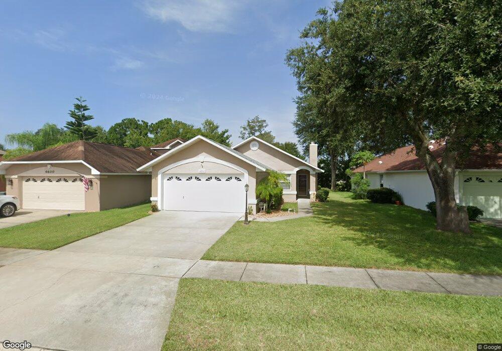
4598 Barnacle Dr Port Orange, FL 32127
South Port Orange NeighborhoodEstimated Value: $249,000 - $292,000
2
Beds
2
Baths
1,220
Sq Ft
$219/Sq Ft
Est. Value
About This Home
This home is located at 4598 Barnacle Dr, Port Orange, FL 32127 and is currently estimated at $267,215, approximately $219 per square foot. 4598 Barnacle Dr is a home located in Volusia County with nearby schools including Sugar Mill Elementary School, Silver Sands Middle School, and Spruce Creek High School.
Ownership History
Date
Name
Owned For
Owner Type
Purchase Details
Closed on
Jun 27, 2003
Sold by
Abbey Chad S and Abbey Michelle M
Bought by
Stoekel Nancy E
Current Estimated Value
Home Financials for this Owner
Home Financials are based on the most recent Mortgage that was taken out on this home.
Original Mortgage
$70,000
Outstanding Balance
$29,850
Interest Rate
5.3%
Estimated Equity
$237,365
Purchase Details
Closed on
Apr 27, 1998
Sold by
Thompson Barbara and Rinaldi Barbara
Bought by
Abbey Chad S and Abbey Michelle M
Home Financials for this Owner
Home Financials are based on the most recent Mortgage that was taken out on this home.
Original Mortgage
$79,560
Interest Rate
7.03%
Mortgage Type
VA
Purchase Details
Closed on
Oct 15, 1992
Bought by
Stoekel Nancy E
Purchase Details
Closed on
Jul 15, 1989
Bought by
Stoekel Nancy E
Create a Home Valuation Report for This Property
The Home Valuation Report is an in-depth analysis detailing your home's value as well as a comparison with similar homes in the area
Home Values in the Area
Average Home Value in this Area
Purchase History
| Date | Buyer | Sale Price | Title Company |
|---|---|---|---|
| Stoekel Nancy E | $124,000 | -- | |
| Abbey Chad S | $78,000 | -- | |
| Stoekel Nancy E | $68,000 | -- | |
| Stoekel Nancy E | $100 | -- |
Source: Public Records
Mortgage History
| Date | Status | Borrower | Loan Amount |
|---|---|---|---|
| Open | Stoekel Nancy E | $70,000 | |
| Previous Owner | Abbey Chad S | $79,560 |
Source: Public Records
Tax History Compared to Growth
Tax History
| Year | Tax Paid | Tax Assessment Tax Assessment Total Assessment is a certain percentage of the fair market value that is determined by local assessors to be the total taxable value of land and additions on the property. | Land | Improvement |
|---|---|---|---|---|
| 2025 | $1,051 | $100,523 | -- | -- |
| 2024 | $1,051 | $97,690 | -- | -- |
| 2023 | $1,051 | $94,845 | $0 | $0 |
| 2022 | $993 | $92,083 | $0 | $0 |
| 2021 | $997 | $89,401 | $0 | $0 |
| 2020 | $968 | $88,167 | $0 | $0 |
| 2019 | $930 | $86,185 | $0 | $0 |
| 2018 | $921 | $84,578 | $0 | $0 |
| 2017 | $913 | $82,838 | $0 | $0 |
| 2016 | $896 | $81,134 | $0 | $0 |
| 2015 | $917 | $80,570 | $0 | $0 |
| 2014 | $916 | $79,931 | $0 | $0 |
Source: Public Records
Map
Nearby Homes
- 4590 Miles Dr
- 4589 Alder Dr
- 4577 Miles Dr
- 830 Lakeland Dr
- 723 Raven Rock Ct
- 722 Raven Rock Ct
- 5402 Marshfield Dr
- 69 Tropical Ct
- 5411 Marshfield Dr
- 139 Royal Palm Cir
- 5442 Marshfield Dr
- 5416 Wilson Dr
- 13 Royal Palm Cir
- 5439 Marshfield Dr
- 4911 Spruce Creek Rd
- 712 Kristina Ct
- 823 Wooddusk Dr
- 15 Royal Palm Cir
- 772 Horseman Dr
- 5417 Wilson Dr
- 4600 Barnacle Dr
- 4596 Barnacle Dr
- 4602 Barnacle Dr
- 4594 Barnacle Dr
- 4597 Barnacle Dr
- 4592 Barnacle Dr
- 4599 Barnacle Dr
- 4606 Barnacle Dr
- 4595 Barnacle Dr
- 4593 Barnacle Dr
- 4591 Miles Dr
- 4589 Miles Dr
- 4591 Barnacle Dr
- 4593 Miles Dr
- 4610 Barnacle Dr
- 4605 Barnacle Dr
- 4589 Barnacle Dr
- 4588 Barnacle Dr
- 4612 Barnacle Dr
- 4607 Barnacle Dr